
Ohaton is a hamlet in central Alberta, Canada within Camrose County. Previously an incorporated municipality, Ohaton dissolved from village status on January 1, 1946.

Aldersyde is a hamlet in Alberta, Canada within the Municipal District of Foothills No. 31. Located between Highway 2 and Highway 2A south of Highway 7, the hamlet is approximately 8 kilometres (5.0 mi) southeast of Okotoks, 10 kilometres (6.2 mi) north of High River and 25 kilometres (16 mi) south of Calgary. A Canadian Pacific Railway line runs through the hamlet.

Yellowhead County is a municipal district in west central Alberta, Canada.

Lac La Biche County is a specialized municipality within Division No. 12 in northern Alberta, Canada. Its economy is based on the oil and gas industry, agriculture and tourism. Some sawmills are also present.

Cardston County is a municipal district in southern Alberta, Canada. It is located in Census Division 3 around the Town of Cardston.
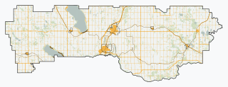
Lacombe County is a municipal district in central Alberta, Canada, located in Census Division No. 8 north of the City of Red Deer. Its municipal office is 4 km (2.5 mi) west of Highway 2 and the City of Lacombe, and 6 km (3.7 mi) east of the Summer Village of Gull Lake, at the intersection of Highway 12 and Spruceville Road.

The County of Newell is a municipal district in southern Alberta, Canada. Located in Census Division No. 2, its municipal office is located south of the City of Brooks.
Wandering River is a hamlet in Alberta, Canada within Athabasca County. It is located approximately 95 kilometres (59 mi) north of Athabasca and 200 kilometres (120 mi) south of Fort McMurray on Highway 63.
Breynat is a hamlet in northern Alberta in Athabasca County, located 1 kilometre (0.62 mi) west of Highway 63, 189 kilometres (117 mi) northeast of Edmonton.
Caslan is a hamlet in central Alberta in Athabasca County, located 21 kilometres (13 mi) south of Highway 55, 152 kilometres (94 mi) west of Cold Lake. The first baby in the area was born in 1921.
Meanook is a hamlet in northern Alberta in Athabasca County, located 3 kilometres (1.9 mi) east of Highway 2, 116 kilometres (72 mi) north of Edmonton.
Perryvale is a hamlet in northern Alberta in Athabasca County, located 2 kilometres (1.2 mi) east of Highway 2, 104 kilometres (65 mi) north of Edmonton.
