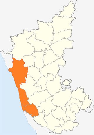
Karnataka is a state in the southwestern region of India. It was formed as Mysore State on 1 November 1956, with the passage of the States Reorganisation Act, and renamed Karnataka in 1973. The state is bordered by the Lakshadweep Sea to the west, Goa to the northwest, Maharashtra to the north, Telangana to the northeast, Andhra Pradesh to the east, Tamil Nadu to the southeast, and Kerala to the southwest. With 61,130,704 inhabitants at the 2011 census, Karnataka is the eighth-largest state by population, comprising 31 districts. With 15,257,000 residents, the state capital Bengaluru is the largest city of Karnataka.

The Tulu language is a Dravidian language whose speakers are concentrated in Dakshina Kannada and in the southern part of Udupi of Karnataka in south-western India and also in the northern parts of the Kasaragod district of Kerala. The native speakers of Tulu are referred to as Tuluva or Tulu people and the geographical area is unofficially called Tulu Nadu.

Kanara or Canara, also known as Karavali, is the historically significant stretch of land situated by the southwestern Konkan coast of India, alongside the Arabian Sea in the present-day Indian state of Karnataka. The subregion comprises three civil districts, namely: Uttara Kannada, Udupi, and Dakshina Kannada. Kasaragod was included prior to the States Reorganisation Act.

Dakshina Kannada district is located in the state of Karnataka in India, with its headquarters in the coastal city of Mangalore. The district covers an area nestled in between the Western Ghats to its east and the Arabian Sea to its west. Dakshina Kannada receives abundant rainfall during the Indian monsoon. It is bordered by Udupi district to the north, Chikmagalur district to the northeast, Hassan district to the east, Kodagu to the southeast and Kasaragod district of Kerala to the south. According to the 2011 census of India, Dakshina Kannada district had a population of 2,083,625. It is the only district in Karnataka state to have all modes of transport like road, rail, water and air due to the presence of a major hub, Mangalore. This financial district is also known as the Cradle of Indian banking.

Puttur (Pronunciation:) is a city in Dakshina Kannada district of Karnataka state in India. The Puttur Shree Mahalingeshwara Temple is located here.

Tigalari or Tulu script is a Southern Brahmic script which was used to write Tulu, Kannada, and Sanskrit languages. It was primarily used for writing Vedic texts in Sanskrit. It evolved from the Grantha script.

Kateel or Kateelu is a temple town in the Dakshina Kannada district of the Indian state of Karnataka. It is considered one of the holiest Hindu temple towns in India. It is situated on the banks of the river Nandini.
Talapady is a village near Mangaluru city in Ullal taluk of Dakshina Kannada district of Karnataka state in India. Talapady borders the states of Karnataka and Kerala. National Highway 66 passes through Talapady which is 14 km (9 mi) south of Mangalore city. The Karnataka-Kerala checkpost border is situated at Talapady. Another village Thalapady, Kasargod which is situated near Talapady in Manjeswar crossing Kerala border.

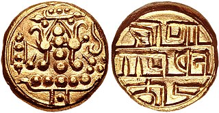
The Alupa dynasty was an Indian dynasty that ruled from 200 to 1444 A.D. in Southern India. The kingdom they ruled was known as Alvakheda Arusasira and its territory spanned the coastal districts of the modern Indian state known as Karnataka.
Devadiga also known as Moily, Sherigar is a Hindu Community or Caste. Devadigas were traditionally temple servants and musicians in Hindu temples. Devadigas are originally from the land stretching between Karwar in Uttara Kannada district of Karnataka and Kasaragod district of Kerala and some parts of Maharashtra in west-coast of India up to the Chandragiri River and Many People live in Shivamogga and Chikmagalur too. It is believed that their two divisions, namely Kannada Devadiga (Moily) and Tulu Devadiga (Moily); were endogamous in the past.
Muchur is a small village in the Dakshina Kannada district of Karnataka, India. It is very close to Kateel and Nellitheertha. There is a very ancient temple of Lord Sri Durga Parameshwari at this place.

Paduru Gururaja Bhat was a teacher, historian and archaeologist of Tulu Nadu and of Barkur, the ancient capital of the Tulu kingdom.
Kokradi (Kokrady) is an agricultural village in Dakshina Kannada of Karnataka State in India. Village population is predominantly engaged in arecanut farming. Administratively, it is under Andinje gram panchayat, Belthangadi Taluk, Dakshina Kannada. Kokradi is also used as a surname among the Billava, Chitrapur, Saraswat, and Brahmins from the village. Billava community constitutes the majority of the village population.
Amtady is a village in the southern state of Karnataka, India. It is located in the Bantwal taluk of Dakshina Kannada district in Karnataka.
Kanyana is a village in the southern state of Karnataka, India. It is located in the Bantwal Taluk of Dakshina Kannada district in Karnataka. The majority of the population are Hindus, Catholics and Muslims and the main languages spoken are Tulu, Kannada, Beary, Malayalam and Konkani.
Punacha is a village in the southern state of Karnataka, India. It is located in the Bantwal taluk of Dakshina Kannada district in Karnataka.
Tenkayedapadavu is a panchayat village in the southern state of Karnataka, India. Administratively, it is under Mangalore taluk of Dakshina Kannada district in Karnataka. It is located at a distance of 26 km from Mangalore city. There are two villages in the gram panchayat, Tenkayedapadavu and Badagayedapadavu. The village Tenka Yedapadav is the part of Yedapadavu, divided for easier administration of village. The Post name is "Shibrikere" which means "Shabari lake". In Yedapadav there are 2 temples, the Shri Rama Mandira and the Shri Adishakthi Durga Parameshwari Temple. There are also 2 primary and secondary level schools, and one Pre-University college named "Swami Vivekananda Pre-University college, Yedapadavu". Shri Krishna Janmastami & Ramanavami are two festivals that are held in the village, with the people taking to celebrate "Masaru Kuduke ustava" in a grand manner. Yedapadav is the middle village for Ganjimatt and Moodbidiri and also Kuppe Padavu.

Tulu Nadu State movement is aimed at increasing Tulu Nadu's influence and political power through the formation of separate Tulu Nadu state from Karnataka and Kerala. Tulu Nadu is a region on the south-western coast of India. It consists of the Dakshina Kannada and Udupi districts of Karnataka and Kasargod district up to the Chandragiri river in Kerala. The Chandragiri River has traditionally been considered a boundary between Tulu Nadu and Kerala from the fourth century AD onwards. The first call for a separate Tulu Nadu state was made just after the Quit India Movement in 1942 by Srinivas Updhyaya Paniyadi, a banker and a press owner from Udupi. Mangalore is the largest and the chief city of Tulu Nadu. Tulu activists have been demanding a separate Tulu Nadu state since the late 2000s, considering language and culture as the basis for their demand.
Karnataka is a state in the southern part of India. It was created on 1 November 1956, with the passing of the States Reorganisation Act. Karnataka is bordered by the Arabian Sea to the west, Goa to the north-west, Maharashtra to the north, Telangana and Andhra Pradesh to the east, Tamil Nadu to the south-east, and Kerala to the south-west. The state covers an area of 74,122 sq mi (191,976 km2), or 5.83% of the total geographical area of India. It comprises 30 districts. Kannada is the official language of Karnataka and as per the 2011 census is the mother tongue of 66.5% of the population. Various ethnic groups with origins in other parts of India have unique customs and use languages at home other than Kannada, adding to the cultural diversity of the state. Significant linguistic minorities in the state in 2011 included speakers of Urdu (10.8%), Telugu (5.8%), Tamil (3.5%), Marathi (3.4%), Hindi (3.2%), Tulu (2.6%), Konkani (1.3%) and Malayalam (1.3%).


