Kirari Suleman Nagar

Last updated

Kirari Nagar
Kirari Village
Location map India Delhi EN.svg
Red pog.svg
Kirari Nagar
Location in Delhi, India
Coordinates: 28°41′48″N77°03′52″E / 28.6968°N 77.0644°E / 28.6968; 77.0644
CountryIndia
State Delhi
District North West Delhi
Languages
  OfficialHindi, English
  Mother Tongue Haryanvi
Time zone UTC+5:30 (IST)
PIN
110086
Civic agencyNorth Delhi Municipal Corporation

Kirari village is an urban village originally settled by Jat kings of Bharatpur State.[ citation needed ] It lies in the North West Part of Delhi. The surrounding area and some parts of the village itself are now heavily urbanized and industrialized although town has grown a lot in a past few years but the culture and spirit of the village with which it was established still exists.

Contents

Waves of migrants from Bihar and UP came in 1999s to 2020. [1] A lot of migrants are now settled around the parts of the village they are hard working and prospering in almost every field including politics, the current MLA of Kirari is Rituraj Govind. [2]

History

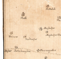
Kirari first officially appeared as (khiraree) on the map found in the musty room of the National Archives of India which shows Delhi in 1807, shortly after the arrival of the British in 1803. It highlights the hierarchy of settlements, from small to larger villages. [3]

On 15 August 1947, when India became independent, the Government of India formed the 'Matsya Union' by combining Alwar, Bharatpur, Dholpur and Karauli from the princely states of Rajputana and 'Rajasthan' by merging the remaining princely states. In June 1949, the four princely states of Matsya Union were also merged in Rajasthan.On behalf of the state of Bharatpur, the Matsyavajas Jat Dheeraj Mathur and Natha Mathur were appointed to conduct the court by making the ruler of five villages named Karala, Pansali, Punth Khurd, Kiradi, Hastasar near Delhi. The ruins of this office are still lying in Karaala. Settled in Kakana village (near Gohana) from this village itself.[ citation needed ]

Lateron Village Nithari was created from the Kirari.

Demography

As of 2012 India census, [5] Kirari Suleman Nagar has a population of 154633 (2001). Males constitute 55% of the population and females 45%. Kirari Suleman Nagar has an average literacy rate of 49%, less than the national average of 59.5%: male literacy is 51%, and female literacy is 38%. In Kirari Suleman Nagar, 20% of the population is under 6 years of age. This is a census town in North West district in the Indian state of Delhi. Kirari Suleman Nagar Approved Residency by Aam Aadmi Party in 2017.

Related Research Articles

<span class="mw-page-title-main">Rajasthan</span> State in Northwestern India

Rajasthan is a state in northwestern India. It covers 342,239 square kilometres (132,139 sq mi) or 10.4 per cent of India's total geographical area. It is the largest Indian state by area and the seventh largest by population. It is on India's northwestern side, where it comprises most of the wide and inhospitable Thar Desert and shares a border with the Pakistani provinces of Punjab to the northwest and Sindh to the west, along the Sutlej-Indus River valley. It is bordered by five other Indian states: Punjab to the north; Haryana and Uttar Pradesh to the northeast; Madhya Pradesh to the southeast; and Gujarat to the southwest. Its geographical location is 23°.3' to 30°.12' North latitude and 69°.30' to 78°.17' East longitude, with the Tropic of Cancer passing through its southernmost tip.

<span class="mw-page-title-main">Alwar</span> City in Rajasthan, India

Alwar is a city located in India's National Capital Region and the administrative headquarters of Alwar District in the state of Rajasthan. It is located 150 km south of Delhi and 150 km north of Jaipur.

<span class="mw-page-title-main">Suraj Mal</span> Maharaja of Bharatpur from 1755–1763

Suraj Mal was a Jat ruler of Bharatpur in present-day state of Rajasthan. Under him, the Jat rule covered the present-day districts of Agra, Aligarh, Bharatpur, Dholpur, Etawa, Hathras, Mainpuri, Meerut, Ghaziabad, Mathura, and Rohtak, Sonipat, Jhajjar, Nuh, Palwal, Faridabad, Kasganj, Mainpuri, Firozabad, Bulandshahr.

<span class="mw-page-title-main">Deeg</span> City in Rajasthan, India

Deeg is an ancient historical city in Deeg district of Rajasthan, India. It is carved out from its former district bharatpur on 7 August 2023. It is situated 32 kilometres (20 mi) north of Bharatpur and 98 kilometres (61 mi) northwest of Agra.

<span class="mw-page-title-main">Mewat</span> Historical and cultural region in northwestern India

Mewat is a historical and cultural region which encompasses parts of the modern-day states of Haryana, Rajasthan, and Uttar Pradesh in north-western India.

<span class="mw-page-title-main">Dholpur</span> City in Rajasthan, India

Dholpur is a city in the Dholpur district in Rajasthan state of India. It is situated on the left bank of the famous Chambal river. The city is the administrative headquarters of Dholpur District and was formerly seat of the Dholpur princely State of Jats.

<span class="mw-page-title-main">Sawai Madhopur district</span> District of Rajasthan in India

Sawai Madhopur district is a district of Rajasthan state in north-west India. Sawai Madhopur is the chief town and district headquarters. Sawai Madhopur district comes under Bharatpur division.

<span class="mw-page-title-main">Dholpur State</span> Historic Kingdom

Dhaulpur State or Dholpur State, historically known as the Kingdom of Dholpur, was a kingdom of eastern Rajasthan, India, which was founded in AD 1806 by a Jat ruler Rana Kirat Singh of Gohad. After 1818, the state was placed under the authority of British India's Jatwara. The Ranas ruled the state until the independence of India in 1947, when the kingdom was merged with the Union of India.

<span class="mw-page-title-main">Bharatpur district</span> District of Rajasthan in India

Bharatpur District is a district in Rajasthan state in western India. The city of Bharatpur is the District Headquarters, Division Headquarters and Headquarters of Bharatpur Police Range of Rajasthan Police. Bharatpur District is a part of National Capital Region of India Delhi.

<span class="mw-page-title-main">Behror</span> City in Rajasthan, India

Behror is a city in the Kotpulti-Behror district of Rajasthan of the Jaipur division. It serves as the administrative headquarters of the eponymous Behror Tehsil and shares headquarters for Kotputli-Behror district with Kotputli. It is equidistant from both sate capital Jaipur and national capital New Delhi. Located 120 km south-west of New Delhi and as a part of National Capital Region, it is regulated under National Capital Region Planning Board which is a federal authority for urban planning purposes in NCR. Along with Shahjahanpur and Neemrana it is grouped as SNB Complex (Shahjahanpur-Neemrana-Behror) of NCR- which includes 137 revenue villages, in which Behror municipality is the largest urban conglomeration. This region is also known as 'Ahirwal region' or simply as Raath and is an important industrial hub for the state of Rajasthan. Behror municipality spreads out in an area of 15 km2 is divided into four revenue villages namely Behror tarf Gangabishan, Behror tarf Doongrasi, Behror tarf Nainsukh, Behror tarf Balram.

<span class="mw-page-title-main">Dumraon</span> Town in Bihar, India

Dumraon is a town, near Buxar city and nagar parishad corresponding community development block in Buxar district in the Indian state of Bihar. Dumraon is one of Bihar's oldest municipalities and one of India's oldest princely states also known as Dumraon Raj. It is located 1.5 km south of National Highway (NH) 84, 20 kilometres (12 mi)north from NH-30 (Patna-Ara-Mohania) and 80 kilometres (50 mi) from NH-2. It is known for its Sinhora. Sights include Jangali Shiv ka Mandir, Bihariji Ka Mandir, Dumrejani mai ka Mandir, Maa Dakshini bhavani ji ka Mandir and Kaliji Ka Mandir.

<span class="mw-page-title-main">Kotputli</span> City in Rajasthan, India

Kotputli is a city and municipal council in Kotputli-Behror district of Rajasthan, India, located between Jaipur city and New Delhi. On 17 March 2023 it was made one of the two headquarters of the newly created Kotputli Behror district.

<span class="mw-page-title-main">Ballabhgarh</span> Town in Haryana, India

Ballabgarh, officially Balramgarh, is a large town, nearby Faridabad city and a tehsil (subdistrict) in Faridabad district of Haryana, India, and is part of the National Capital Region. The town was founded by Raja Balram Singh, in 1739, who also built the Nahar Singh Mahal palace in the same year. Raja Nahar Singh (1823–1858) was the last king of the princely state. He was executed for taking part in the 1857 war of independence in 1858. The town of Ballabhgarh is only 17 miles (27 km) from Delhi, and today lies on the National Highway 19, a major portion of historical Grand Trunk Road. It is connected to Faridabad and south-east Delhi by the Delhi Metro. Ballabhgarh is the fourth city in Haryana to get metro connectivity after Gurgaon, Faridabad and Bahadurgarh.

Brij Nagar is a town and tehsil in Deeg district in the Indian state of Rajasthan. It is situated equidistant among Bharatpur, Alwar and Mathura. Nagar is famous for the sweets called Jaleba, a bigger version of jalebi.

Pichhore is a town and a nagar panchayat in Gwalior district in the Indian state of Madhya Pradesh.

<span class="mw-page-title-main">History of Rajasthan</span> Brief history of the Indian state of Rajasthan

The history of human settlement in the western Indian state of Rajasthan dates back to about 100,000 years ago. Around 5000 to 2000 BCE many regions of Rajasthan belonged as the site of the Indus Valley Civilization. Kalibangan is the main Indus site of Rajasthan, here fire altars have been discovered, similar to those found at Lothal.

<span class="mw-page-title-main">Bharatpur State</span> Hindu Jat Kingdom

Bharatpur State, which is also known as the Jat State of Bharatpur historically known as the Kingdom of Bharatpur, was a Hindu Kingdom in the northern part of the Indian subcontinent. It was ruled by the Sinsinwar clan of the Hindu Jats. At the time of reign of king Suraj Mal (1755–1763) revenue of the state was 17,500,000 rupees per annual.The major architecture of this state include Lohagarh Fort and Deeg Palace.

Rituraj Govind Jha is an Indian politician and is member of the Sixth Legislative Assembly of Delhi. He is a member of the Aam Aadmi Party and represents Kirari of Delhi.

<span class="mw-page-title-main">Ranjeeta Koli</span> Indian politician

Ranjeeta Koli is an Indian politician. She was elected to the Lok Sabha, lower house of the Parliament of India from Bharatpur, Rajasthan in the 2019 Indian general election as a member of the Bharatiya Janata Party. She won the election by getting 707992 votes which was nearly 61.74% of the votes. She is new to politics but she belongs to a political family. Her father in law Gangaram Koli was three time MP from Bayana Lok Sabha constituency from 1991 to 1998.

Nithari Village , popularly known as Nithari Village. Nithari lies in the Kirari Suleman Nagar Constituency.

References

  1. "Most migrants in Delhi still from UP, but Bihar's share rising fast". The Times of India. 1 September 2013. Retrieved 16 May 2020.
  2. "Kirari Election Results 2020: AAP's Rituraj Govind wins by over 5,000 votes". India Today. 11 February 2020. Retrieved 16 May 2020.
  3. Chaudhuri, Zinnia Ray. "Six Delhi maps chart the city's evolution from 1807 to 2021". Scroll.in. Retrieved 16 May 2020.
  4. Chaudhuri, Zinnia Ray. "Six Delhi maps chart the city's evolution from 1807 to 2021". Scroll.in. Retrieved 16 May 2020.
  5. "Census of India 2001: Data from the 2001 Census, including cities, villages and towns (Provisional)". Census Commission of India. Archived from the original on 16 June 2004. Retrieved 1 November 2008.