Neu-Ulm is a Landkreis (district) in Swabia, Bavaria, Germany. It is bounded by the districts of Günzburg and Unterallgäu and the state of Baden-Württemberg.
Schwandorf is a Landkreis (district) in Upper Palatinate in the eastern part of Bavaria, Germany. Neighboring districts are Cham, Regensburg, Neumarkt, Amberg-Sulzbach, Neustadt an der Waldnaab, and the Czech Plzeň Region.
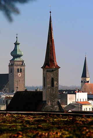
Mühldorf am Inn is a town in Bavaria, Germany, and the capital of the district Mühldorf on the river Inn. It is located at 48°14′30″N12°31′30″E, and had a population of about 17,808 in 2005.

Simbach am Inn is a town on the River Inn in the Rottal-Inn district of Bavaria, Germany. The Austrian city Braunau am Inn lies on the opposite side of the river from Simbach.

Lauf an der Pegnitz is a town to the East of Nuremberg, Germany. It is the capital of the district Nürnberger Land, in Bavaria. It is in the valley of the River Pegnitz, which flows through the town.

Bad Windsheim is a small historic town in Bavaria, Germany with a population of almost 12,000. It lies in the district Neustadt an der Aisch-Bad Windsheim, west of Nuremberg. In the Holy Roman Empire, Windsheim held the rank of Imperial City. Since 1810 Windsheim is part of Bavaria. In 1961, it became a spa town and has since been called "Bad Windsheim".

Illertissen is a town in the district of Neu-Ulm in Bavaria. It is situated approximately 20 km south from Ulm nearby the river Iller.
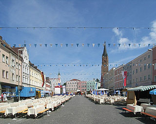
Eggenfelden is a municipality in the district of Rottal-Inn in Bavaria, Germany.

Burglengenfeld is a town in the district of Schwandorf, in Bavaria, Germany. It is situated on the river Naab, 22 km north of Regensburg.

Nabburg is a municipality in the district of Schwandorf, in Bavaria, Germany. It is situated on the river Naab, 23 km east of Amberg.

Nonnenhorn is one of the three Bavarian towns on Lake Constance in the Swabian district of Lindau. The air health resort and famous wine town is located between Wasserburg (Bodensee) and Kressbronn am Bodensee (Baden-Württemberg).

Winkelhaid is a municipality in the district of Nürnberger Land in Bavaria in Germany. It is situated 18 km southeast of Nuremberg in the Middle Franconia. Winkelhaid is bounded by the districts of Altdorf bei Nürnberg, Schwarzenbruck and Feucht.

Stötten is a municipality in the district of Ostallgäu in Bavaria in Germany.

Tiefenbach is a municipality in the district of Passau in Bavaria in Germany.

Kirchberg im Wald is a municipality in the district of Regen, in Bavaria, Germany.
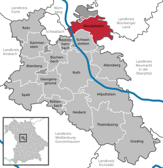
Wendelstein is a municipality in the district of Roth, in Bavaria, Germany, located about 12 kilometres (7.5 mi) southeast of Nuremberg.

Chieming is a municipality in the district of Traunstein in Bavaria, Germany.

Giebelstadt is a municipality in the district of Würzburg in Bavaria in Germany.

Fürstenzell is a municipality in the district of Passau in Bavaria in Germany.
The Styria municipal structural reform was a local government reform in the Austrian state of Styria, which was made effective January 1, 2015. The reform nearly halved the number of Styrian municipalities as the reduced from 542 to 287. The reform was intended to reduce costs and ease election of new town officials. The terms of the reform is formalized in the Styrian Municipality Structural Reform Act. (StGsrG). The law was adopted on December 17, 2013 by the Landtag of Styria, and promulgated on April 2, 2014.


