Cameron Bar Indian Reserve No. 13, referred to as Cameron Bar 13 for census purposes, is an Indian reserve in the Fraser Canyon region of the Canadian province of British Columbia. As of 2001, the population was 0. The area of the reserve was .35 square kilometres. It is under the administration of the Lytton First Nation based in nearby Lytton, 15 miles to the south, which is a band government of the Nlaka'pamux people.
The Santa Clara River Valley is a rural, mainly agricultural, valley in Ventura County, California that has been given the moniker Heritage Valley by the namesake tourism bureau. The valley includes the communities of Santa Paula, Fillmore, Piru and the national historic landmark of Rancho Camulos. Named for the Santa Clara River, which winds through the valley before emptying into the Pacific Ocean between the cities of Ventura and Oxnard, the tourist bureau describes it as ".... Southern California's last pristine agricultural valley nestled along the banks of the free-flowing Santa Clara River."
San Antonio de Flores is a municipality in the Honduran department of Choluteca.

The Niut Range is 3600 km2 in area. It is a subrange of the Pacific Ranges of the Coast Mountains of British Columbia, although in some classifications it is considered part of the Chilcotin Ranges. The Niut is located in the angle of the Homathko River and its main west fork, Mosley Creek. It is isolated, island-like, by those rivers from its neighbour ranges, as both streams have their source on the Chilcotin Plateau in behind the range. Razorback Mountain is its highest peak.
The Klinaklini River is one of the major rivers of the Pacific Ranges section of the Coast Mountains in the Canadian province of British Columbia. It originates in the Pantheon Range and empties into the head of Knight Inlet.
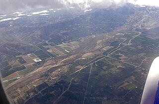
Nicolum River Provincial Park, formerly Nicolum Provincial Park, is a provincial park in British Columbia, Canada, located at the confluence of the Nicolum and Coquihalla Rivers near the town of Hope. The park is a Class A, category 6 Provincial Park.
Pine River Breaks Provincial Park is a provincial park in British Columbia, Canada in the Peace River Lowland between the communities of East Pine and Chetwynd.
Pyramid Creek Falls Provincial Park is a provincial park in British Columbia, Canada, located on the east side of the North Thompson River between the towns of Blue River (S) and Valemount (N).

The Bonaparte Indian Band a.k.a. Bonaparte First Nation, is a member band of the Shuswap Nation Tribal Council of the Secwepemc (Shuswap) people.
The Lytton First Nation, a First Nations band government, has its headquarters at Lytton in the Fraser Canyon region of the Canadian province of British Columbia. While it is the largest of all Nlaka'pamux bands, unlike all other governments of the Nlaka'pamux (Thompson) people, it is not a member of any of the three Nlaka'pamux tribal councils, which are the Nicola Tribal Association, the Fraser Canyon Indian Administration and the Nlaka'pamux Nation Tribal Council.

The Ha-Iltzuk Icefield is an icefield in the central Pacific Ranges of the Coast Mountains in British Columbia, Canada. It is the largest icefield in the Coast Mountains south of the Alaska Panhandle, with an area of 3,610 km2 (1,390 sq mi). It is located on the west side of the Klinaklini River and the Waddington Range. The highest summit in the icefield is Mount Silverthrone, which is a mountain on the northeast edge of a circular, 20 km (12 mi) wide, deeply dissected caldera complex called the Silverthrone Caldera.

ALSIB was the Soviet Union portion of the Alaska-Siberian air road receiving Lend-Lease aircraft from the Northwest Staging Route. Aircraft manufactured in the United States were flown over this route for World War II combat service on the Eastern Front.

Koumogo is a small town in Chad.
Giscome Canyon is a canyon on the Fraser River in the northern Central Interior of British Columbia, Canada, upstream from the city of Prince George near Tay Creek and at the southern end of the route known as the Giscome Portage.

The Pashleth Glacier is a glacier south of the Machmell River and west of the Klinaklini Glacier in southwestern British Columbia, Canada.

The Klinaklini Glacier is a glacier west of the Klinaklini River and head of Knight Inlet the Coast Land District of British Columbia, Canada. It flows generally southward from Mt. Silverthrone. The glacier is one of the largest glaciers in western North America. The Hakai Institute has installed a weather station and camera above Klinaklini Glacier that will provide data in near real time to scientists and operational users.

Fimbulheimen is a mountain range in Queen Maud Land, Antarctica. It stretches from Jutulstraumen by 1° west of Carsten Borchgrevink Ice at 18° east, about 200 km from the ice edge. Fimbulheimen is thus between Maudheim Plateau and Sør-Rondane.
The West Klinaklini River is a brief but voluminous tributary of the Klinaklini River in British Columbia, Canada, joining it in its lower reaches above its mouth into Knight Inlet. Only 7 km long, it is formed by the meltwater from the Klinaklini Glacier, the main tongue of the vast Ha-Iltzuk Icefield, which lies west of the Klinaklini.
Kitselas First Nation is the band government of the Kitselas subgroup of the Tsimshian. The band government is based at Gitaus in the Skeena Valley in the Skeena River valley to the northeast of the city of Terrace, British Columbia, Canada. Though there is no Tsimshian tribal council, they are a participant in the Tsimshian First Nations treaty council.
The Liard Plateau is a plateau in far northern British Columbia, Canada, located between the Smith and Liard Rivers, and extending north into the Yukon.