In geography and geology, a cliff is an area of rock which has a general angle defined by the vertical, or nearly vertical. Cliffs are formed by the processes of weathering and erosion, with the effect of gravity. Cliffs are common on coasts, in mountainous areas, escarpments and along rivers. Cliffs are usually composed of rock that is resistant to weathering and erosion. The sedimentary rocks that are most likely to form cliffs include sandstone, limestone, chalk, and dolomite. Igneous rocks such as granite and basalt also often form cliffs.

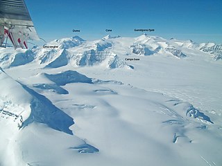
Gunnbjørn Fjeld is the tallest mountain in Greenland, the Kingdom of Denmark, and north of the Arctic Circle. It is a nunatak, a rocky peak protruding through glacial ice.

An ultra-prominent peak, or ultra for short, is a mountain summit with a topographic prominence of 1,500 metres (4,900 ft) or more; it is also called a P1500. The prominence of a peak is the minimum height of climb to the summit on any route from a higher peak, or from sea level if there is no higher peak. There are approximately 1,524 such peaks on Earth. Some well-known peaks, such as the Matterhorn and Eiger, are not ultras because they are connected to higher mountains by high cols and therefore do not achieve enough topographic prominence.
The Princess Margaret Range, also called the Princess Margaret Mountains, are a mountain range on Axel Heiberg Island in Nunavut, Canada. The range is one of the most northern ranges in the world and of the Arctic Cordillera. The highest mountain in the range is Outlook Peak at 2,210 m (7,251 ft). The range has an area of 42,865 km2 (16,550 sq mi).

Mont Forel is a mountain in King Christian IX Land, Sermersooq Municipality, Greenland. It is part of the Schweizerland range, also known as 'Schweizerland Alps'.

The Watkins Range is Greenland's highest mountain range. It is located in King Christian IX Land, Sermersooq municipality.

Mount Paatusoq, also known as 'Mount Patuersoq', is the highest mountain in the Kujalleq municipality, SE Greenland.

The Stauning Alps are a large system of mountain ranges in Scoresby Land, King Christian X Land, northeastern Greenland. Administratively the Stauning Alps are part of the Northeast Greenland National Park zone.

Schweizerland, also known as Schweizerland Alps, is a mountain range in King Christian IX Land, eastern Greenland. Administratively this range is part of the Sermersooq Municipality. Its highest point is one of the highest peaks in Greenland.

The Lemon Range or Lemon Mountains is a mountain range in King Christian IX Land, eastern Greenland. Administratively this range is part of the Sermersooq Municipality.

Ejnar Mikkelsen Range is a mountain range in King Christian IX Land, eastern Greenland. Administratively it is part of the Sermersooq Municipality.

The Roosevelt Range or Roosevelt Mountains is a mountain range in Northern Greenland. Administratively this range is part of the Northeast Greenland National Park. Its highest peak is the highest point in Peary Land.
Nathorst Land is an area in King Christian X Land, Eastern Greenland. It lies in the Northeast Greenland National Park zone. The area is remote and uninhabited.


