
The Chenango River is a 90-mile-long (140 km) tributary of the Susquehanna River in central New York in the United States. It drains a dissected plateau area in upstate New York at the northern end of the Susquehanna watershed.

The Segreganset River is a small river in Bristol County, Massachusetts that flows 9.6 miles (15.4 km) in a southeasterly direction through Taunton and Dighton into the Taunton River. Named tributaries include the Maple Swamp, Poppasquash Swamp, Sunken Brook and Cedar Swamp.

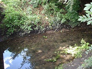
The Lost River is a 6.5-mile-long (10.5 km) stream located in the White Mountains of New Hampshire in the United States. It is a tributary of the Pemigewasset River, part of the Merrimack River watershed.

Old Speck Mountain, also known as Old Speckle Mountain, is a mountain located in Oxford County, Maine, United States. The mountain, the fourth-highest in the state, is the northeasternmost and highest of the Mahoosuc Range, the northeasternmost part of the White Mountains. Old Speck is flanked to the southwest by Mahoosuc Arm, and faces Baldpate Mountain to the northeast across Grafton Notch.
Mount Weeks, formerly Round Mountain, is a mountain located in Coos County, New Hampshire. Mt. Weeks is the northeasternmost of the Pliny Range of the White Mountains and the highest point within the city limits of Berlin, New Hampshire. Mount Weeks is flanked to the southwest by South Weeks, and faces Terrace Mountain to the northwest across Willard Notch.

The Williams River is a 27.0-mile (43.5 km) river in the U.S. state of Vermont. It is a tributary of the Connecticut River. Its watershed covers 117 square miles; land use is about 80% forested and 4% agricultural, and the upper river supports wild brook trout and brown trout.

A stream is a body of water with surface water flowing within the bed and banks of a channel. The stream encompasses surface and groundwater fluxes that respond to geological, geomorphological, hydrological and biotic controls.

The Titicus River is an 8.5-mile-long (13.7 km) river in southwestern Connecticut and southeastern New York that drains into the Titicus Reservoir, part of New York City's water supply system. Part of both the Croton River watershed and the system's Croton Watershed, has a 23.8 square miles (62 km2) drainage area. It is one of the few rivers with headwaters in Connecticut that is part of the system. The source of the river is in Ridgefield, Connecticut. About one mile down stream, the stream marks the southern boundary of the Kiahs Brook Reserve. Another 0.5 miles downriver, it joins with Kiahs Brook, and then runs fairly close to Route 116. Once past the New York border, the Titicus River still runs close to New York 116 until emptying into the Titicus Reservoir. After the Titicus Reservoir, it runs another 0.5 miles, under I-684, and drains into the Muscoot Reservoir.
Knapps Brook is a minor tributary of the River Lea in Bedfordshire, England. The source of the river Lea is on Leagrave Common in Luton. It forms from a combination of brooks from East End, Houghton Regis and from the Lewsey Estate near the old Lewsey Farm. It joins the River Lea from culverts under the railway embankment and Toddington Road in Leagrave.

A water resource region is the first level of classification used by the United States Geological Survey to divide and sub-divide the United States into successively smaller hydrologic units.
Trout Brook, also called Ball Brook, is a cold water tributary of the Quinapoxet River located in Holden, Massachusetts. Trout Brook is stocked with trout each spring by the Massachusetts Fisheries and Wildlife Division. As the Quinapoxet River is part of the water supply for Worcester, Massachusetts, both the Quinapoxet and all of its major tributaries including Trout Brook are monitored by the USGS for water quality.
The Center Brook converges with the Unadilla River in New Berlin, New York. The Center Brook has one main tributary, the Shawler Brook which converges with Center Brook in New Berlin, New York. The Center Brook is part of the Unadilla River watershed.

Shadow Brook is a river in northern Otsego County, New York. It begins north-northeast of East Springfield, and flows into Otsego Lake south-southeast of Springfield Center, near Glimmerglass State Park.
Blue Brook flows into the Mohawk River near West Branch, New York.
Beaver Brook flows into the Mohawk River near Herkimer, New York.
The South Branch Grass River flows into the Grass River in Clare, New York. The South Branch Grass River and Middle Branch Grass River combine here and become Grass River.
Trout Brook is a river in Delaware County, New York. It flows into the East Branch Delaware River by Shinhopple.
Steele Brook is a river in Delaware County, New York. It flows into the West Branch Delaware River by Delhi. Steele Brook flows through Delhi Reservoir.
East Brook is a river in Delaware County, New York. It flows into the West Branch Delaware River by Walton, New York.
