| Kołacin | |
|---|---|
| Settlement | |
 Kołacin | |
| Coordinates: 53°58′13″N16°54′34″E / 53.97028°N 16.90944°E | |
| Country | |
| Voivodeship | Pomeranian |
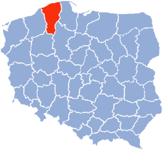
| County | Bytów |
| Gmina | Miastko |
| Sołectwo | Wołcza Mała |
| Population | 10 |
Kołacin [kɔˈwat͡ɕin] (German : Louisenhof) [1] is a settlement in Gmina Miastko, Bytów County, Pomeranian Voivodeship, in northern Poland. It lies approximately 30 kilometres (19 mi) south-west of Bytów and 109 km (68 mi) south-west of Gdańsk (capital city of the Pomeranian Voivodeship).

German is a West Germanic language that is mainly spoken in Central Europe. It is the most widely spoken and official or co-official language in Germany, Austria, Switzerland, South Tyrol (Italy), the German-speaking Community of Belgium, and Liechtenstein. It is also one of the three official languages of Luxembourg and a co-official language in the Opole Voivodeship in Poland. The languages which are most similar to German are the other members of the West Germanic language branch: Afrikaans, Dutch, English, the Frisian languages, Low German/Low Saxon, Luxembourgish, and Yiddish. There are also strong similarities in vocabulary with Danish, Norwegian and Swedish, although those belong to the North Germanic group. German is the second most widely spoken Germanic language, after English.

In geography, statistics and archaeology, a settlement, locality or populated place is a community in which people live. The complexity of a settlement can range from a small number of dwellings grouped together to the largest of cities with surrounding urbanized areas. Settlements may include hamlets, villages, towns and cities. A settlement may have known historical properties such as the date or era in which it was first settled, or first settled by particular people.
Gmina Miastko is an urban-rural gmina in Bytów County, Pomeranian Voivodeship, in northern Poland. Its seat is the town of Miastko, which lies approximately 37 kilometres (23 mi) west of Bytów and 115 km (71 mi) west of the regional capital Gdańsk.
From 1975 to 1998 the village was in Słupsk Voivodeship.
Słupsk Voivodeship was a unit of administrative division and local government in Poland from 1975 to 1998, previously part of Szczecin Voivodeship (1945–50) and Koszalin Voivodeship (1950–75), superseded by Pomeranian Voivodeship and West Pomeranian Voivodeship. Its capital city was Słupsk. The Pomeranian province has a Tri-city with Słupsk as the 4th City, but it was supposed to be the third or second but the city of Gdansk did not want it as there were political issues.
It had a population of 10 in 2006.


