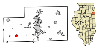
Herscher is a village in Kankakee County, Illinois, United States. The population was 1,591 at the 2010 census. It is part of the Kankakee–Bradley metropolitan area.

Central Stadium is a multi-purpose stadium in Astrakhan, Russia. It is used mostly for football matches and is the home stadium of Volgar Astrakhan. The stadium holds 17,712 people, all seated.

Sadków is a village in the administrative district of Gmina Kąty Wrocławskie, within Wrocław County, Lower Silesian Voivodeship, in south-western Poland. Prior to 1945 it was in Germany. It lies approximately 5 kilometres (3 mi) north-east of Kąty Wrocławskie and 17 km (11 mi) south-west of the regional capital Wrocław.
Małe Szczepanki is a village in the administrative district of Gmina Łasin, within Grudziądz County, Kuyavian-Pomeranian Voivodeship, in north-central Poland. It lies approximately 4 kilometres (2 mi) south-west of Łasin, 19 km (12 mi) east of Grudziądz, and 59 km (37 mi) north-east of Toruń.

Mets Mantash is a village in the Shirak Province of Armenia.
Borki is a village in the administrative district of Gmina Księżpol, within Biłgoraj County, Lublin Voivodeship, in eastern Poland. It lies approximately 4 kilometres (2 mi) west of Księżpol, 14 km (9 mi) south of Biłgoraj, and 92 km (57 mi) south of the regional capital Lublin.
Kolonie Lipsk is a village in the administrative district of Gmina Lipsk, within Augustów County, Podlaskie Voivodeship, in north-eastern Poland, close to the border with Belarus.
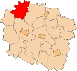
Koło is a village in the administrative district of Gmina Sulejów, within Piotrków County, Łódź Voivodeship, in central Poland. It lies approximately 10 kilometres (6 mi) north-west of Sulejów, 11 km (7 mi) east of Piotrków Trybunalski, and 47 km (29 mi) south-east of the regional capital Łódź.
Ruda Pilczycka is a village in the administrative district of Gmina Słupia Konecka, within Końskie County, Świętokrzyskie Voivodeship, in south-central Poland. It lies approximately 6 kilometres (4 mi) north-west of Słupia, 29 km (18 mi) south-west of Końskie, and 42 km (26 mi) north-west of the regional capital Kielce.
Czarna Wieś is a village in the administrative district of Gmina Pionki, within Radom County, Masovian Voivodeship, in east-central Poland.
Zdziechów is a village in the administrative district of Gmina Zakrzew, within Radom County, Masovian Voivodeship, in east-central Poland.
Kamieńczyk is a village in the administrative district of Gmina Sterdyń, within Sokołów County, Masovian Voivodeship, in east-central Poland.

Podgór is a village in the administrative district of Gmina Kramsk, within Konin County, Greater Poland Voivodeship, in west-central Poland.
Zamość is a village in the administrative district of Gmina Wierzbinek, within Konin County, Greater Poland Voivodeship, in west-central Poland. It lies approximately 7 kilometres (4 mi) east of Wierzbinek, 34 km (21 mi) north-east of Konin, and 116 km (72 mi) east of the regional capital Poznań.
Wilanów is a village in the administrative district of Gmina Strzelce Krajeńskie, within Strzelce-Drezdenko County, Lubusz Voivodeship, in western Poland. It lies approximately 8 kilometres (5 mi) west of Strzelce Krajeńskie and 21 km (13 mi) north-east of Gorzów Wielkopolski.
Kocury is a village in the administrative district of Gmina Dobrodzień, within Olesno County, Opole Voivodeship, in south-western Poland. It lies approximately 6 kilometres (4 mi) north of Dobrodzień, 11 km (7 mi) south of Olesno, and 37 km (23 mi) east of the regional capital Opole.
Gogolewko is a village in the administrative district of Gmina Dębnica Kaszubska, within Słupsk County, Pomeranian Voivodeship, in northern Poland. It lies approximately 18 kilometres (11 mi) east of Dębnica Kaszubska, 29 km (18 mi) south-east of Słupsk, and 79 km (49 mi) west of the regional capital Gdańsk.
Wieliszewo is a village in the administrative district of Gmina Potęgowo, within Słupsk County, Pomeranian Voivodeship, in northern Poland. It lies approximately 13 kilometres (8 mi) south-west of Potęgowo, 20 km (12 mi) east of Słupsk, and 85 km (53 mi) west of the regional capital Gdańsk.
Skarbimierzyce is a village in the administrative district of Gmina Dobra, within Police County, West Pomeranian Voivodeship, in north-western Poland, close to the German border. It lies approximately 7 kilometres (4 mi) south-east of Dobra, 15 km (9 mi) south-west of Police, and 11 km (7 mi) west of the regional capital Szczecin.
Vukovići is a village in the municipality of Hadžići, Bosnia and Herzegovina.