
The Gulf of Thailand, historically known as the Gulf of Siam, is a shallow inlet in the southwestern South China Sea, bounded between the southwestern shores of the Indochinese Peninsula and the northern half of the Malay Peninsula. It is around 800 km (500 mi) in length and up to 560 km (350 mi) in width, and has a surface area of 320,000 km2 (120,000 sq mi). The gulf is surrounded on the north, west and southwest by the coastlines of Thailand, on the northeast by Cambodia and the Mekong Delta region of Vietnam, and opens to the South China Sea in the southeast.

Krabi is a province (changwat) of southern Thailand, on the shore of the Andaman Sea. Neighbouring provinces are Phang Nga, Surat Thani, Nakhon Si Thammarat, and Trang. Phuket province lies to the west across Phang Nga Bay. Krabi town is the seat of the provincial government.
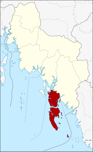
Trat province, also spelt Trad province, is one of Thailand's seventy-six provinces (changwat), and is located in the region of eastern Thailand. It borders Chanthaburi province to the northwest, and Cambodia and its provinces of Pailin, Battamabang, Pursat, and Koh Kong to its north, northeast and east. To the south, it borders the Gulf of Thailand and Pacific Ocean. In Thailand, it is the 15th smallest province at 2,819 km2 (1,088 sq mi) and 4th least populated province at 229,958 in 2019. Its capital is Trat town.
The Phi Phi Islands are an island group in Thailand between the large island of Phuket and the Straits of Malacca coast of Thailand. The islands are administratively part of Krabi Province. Ko Phi Phi Don is the largest and most populated island of the group, although the beaches of the second largest island, Ko Phi Phi Le are visited by many people as well. The rest of the islands in the group, including Bida Nok, Bida Nai, and Ko Mai Phai, are not much more than large limestone rocks jutting out of the sea. The islands are reachable by ferries, speedboats or long-tail boats, most often from Krabi town or from ports in Phuket Province.

Ko Samui, often locally shortened to Samui, is an island off the east coast of Thailand. Geographically in the Chumphon Archipelago, it is part of Surat Thani Province, though as of 2012, Ko Samui was granted municipal status and thus is now locally self-governing. Ko Samui, with an area of 228.7 square kilometres (88.3 sq mi), is Thailand's second largest island after Phuket. In 2018, it was visited by 2.7 million tourists.

Ko Tao is an island in Thailand and is part of the Chumphon Archipelago on the western shore of the Gulf of Thailand. It covers an area of about 21 km2. Administratively it is a subdistrict (tambon) of Ko Pha-ngan District (amphoe) of Surat Thani Province. As of 2006, its official population was 1,382. The main settlement is Ban Mae Haad.
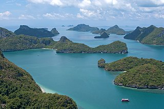
Mu Ko Ang Thong is a marine national park in the Gulf of Thailand in Surat Thani Province. It covers 42 islands in a total area of 63,750 rai ~ 102 square kilometres (39 sq mi), of which about 50 square kilometres (19 sq mi) are land and the rest is water. The park was established on 12 November 1980. The northern tip of Ko Phaluai is also part of the marine park. There is a ranger station, bungalows, a shop, and a restaurant at Ao Phi Beach on Ko Wua Talap.

Ko Samet is one of the eastern seaboard islands of Thailand. It is in the Gulf of Thailand off the coastline of the Thai province of Rayong, approximately 220 kilometres (140 mi) southeast of Bangkok. Ko Samet is part of the Phe Subdistrict of the Amphoe Mueang Rayong, of Rayong Province. Ko Samet is the largest and westernmost of a cluster of islands not far from the coast. Ko Samet measures 6.8 kilometres (4.2 mi) from north to south. At its closest point to the mainland, the island is 2.6 kilometres (1.6 mi) south of mainland Rayong Province; however the actual travelling distance from the main commercial tourist pier in the town of Phe to the island's closest tourist beach is about 10 kilometres (6.2 mi).

Ko Lanta Yai is an island in the Strait of Malacca off the west coast of Thailand, between the Phi Phi Islands and the mainland. It is administratively part of Krabi Province, most of which is on the mainland. Together with neighboring Ko Lanta Noi, which forms the Ko Lanta archipelago, and several other islands, it forms the amphoe of Ko Lanta District.
Ko Lanta is a district (amphoe) in Krabi province, Thailand.
Korphai Ensemble, Korphai or kor phai which literally means a 'bunch of bamboo', is an ensemble of traditional Thai percussion music.

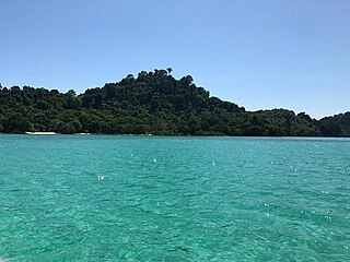
Tarutao National Park consists of 51 islands in the Strait of Malacca, off the coast of Satun Province of southern Thailand. The Tarutao National Park consists of two island groups: Tarutao and Adang-Rawi, which are scattered from 20 to 70 kilometres' distance from the south-westernmost point of mainland Thailand. The park covers an area of 931,250 rai ~ 1,490 square kilometres (580 sq mi) of which 1,260 square kilometres (490 sq mi) ocean and 230 square kilometres (89 sq mi) island. The southernmost end of the park lies on the border with Malaysia, just north of Langkawi. Tarutao became Thailand's second marine national park on 19 April 1974. The coastal Khao Sam Roi Yot National Park had been designated in 1966.
Mueang Nakhon Ratchasima is one of 32 districts of Nakhon Ratchasima province, northeastern Thailand.

MS King Cruiser was a car ferry that sank off the West Coast of Southern Thailand on 4 May 1997.

Ko Lipe is a small island in the Adang-Rawi Archipelago of the Strait of Malacca, in Satun Province of southwest Thailand, close to the Malaysian border. Its Thai name, the corrupted form of the original Malay name, Pulau Nipis is transliterated in many different ways into English. The most common names are "Koh Lipe", "Koh Lipeh", "Ko Lipey", and "Ko Lipe".
Ko Lan is one of the eastern seaboard islands of Thailand. Ko Lan lies 7.5 km from the nearest shore, Pattaya. "Ko Lan" is the name of the island in the Royal Thai General System of Transcription. It is also known as "Koh Larn" and "Ko Laan".
Ko Phai is the largest island in Mu Ko Phai (หมู่เกาะไผ่), a small uninhabited archipelago on the eastern seaboard of Thailand. It is about 21 km to the west of Pattaya. It is also known as "Koh Pai". It is also mentioned as "Bamboo Island", the meaning of its name in Thai, in tourist guides.
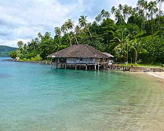
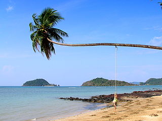
Ko Mai Si or Ko Mai Si Don is a small island near Ko Kut in Trat province, Thailand.
Ko Kradan is an island in Trang province, Southern Thailand. Ko Kradan is described by Tourism Thailand as one of the most beautiful islands in Trang. Ko Kradan has white sandy beaches and transparent water which allow the coral reef to be seen clearly. Most of Ko Kradan is controlled by Hat Chao Mai National Park. The rest is privately owned.

