Babugarh Chavani is a town and a nagar panchayat in, near Hapur city in Hapur district, in the state of Uttar Pradesh, India. Babugarh Chavani is located almost 7 km away from Hapur towards Holy Pilgrimage Garhmukteshwar after crossing toll bridge near village "Tatarpur & Simroli". The name Chavani comes from EBS of the Indian Army. People of Babugarh are rich because their land is acquired by government for construction work. According to Land rules of Government of India government give them a huge amount of compensation for Land acquisition.
Bharthana is a town and a municipal board in Etawah district in the state of Uttar Pradesh, India. Bharthana is located at 26.75°N 79.23°E. It has an average elevation of 135 metres (442 feet).
Chaklasi is a city and a municipality in Kheda district in the state of Gujarat, India.
Chhata is a small city and a nagar panchayat in Mathura district in the state of Uttar Pradesh, India. Earlier this city was known as Chhatravan.
Gauribidanur is a taluk situated in Chikkaballapur district in the Indian state of Karnataka.
Killiyoor is a panchayat town in Kanniyakumari district in the Indian state of Tamil Nadu.
Kiraoli is a town and a nagar panchayat in Agra district in the Indian state of Uttar Pradesh.

Madhugiri is a city in Tumkur district in the Indian state of Karnataka. The city derives its name from a hillock, Madhu-giri (honey-hill) which lies to its south. Madhugiri is one of the 34 educational districts of the Karnataka state.
Mohgaon is a town and a nagar parishad in Pandhurna District in the Indian state of Madhya Pradesh.
Peraiyur is a panchayat town in Madurai district in the Indian state of Tamil Nadu. It is one of the Revenue blocks of Madurai District. Peraiyur is the headquarters of the peraiyur taluk.

Rahuri is a town and a municipal council in Ahmednagar district in the Indian state of Maharashtra.
Rohru is a town and a municipal committee in Shimla district in the Indian state of Himachal Pradesh. It is at the banks of the Pabbar River, and it is about 115 km from Shimla city. Rohru is at 31.202°N 77.7519°E. It has an average elevation of 1,525 metres (5,003 feet).
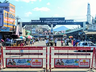
Tiruvaikuntam, also referred to as Srivaikuntam is a panchayat town in Thoothukudi district in the Indian state of Tamil Nadu. It is located on the banks of the river Thamirabarani.

Usilampatti is a town and a second grade municipality of Madurai district in the Indian state of Tamil Nadu. It is also a designated taluk and revenue division.
Utran is a census town situated in Surat district alongside Tapi river in the Indian state of Gujarat. Utran's Nearest airport is Surat. Nearest railway station is Utran Railway station.the first railway in Gujarat started from Utran to ankleshwar.
Vadakkuvalliyur is a panchayat town in Tirunelveli district in the Indian state of Tamil Nadu.
Vengathur is a census town in Thiruvallur district in the Indian state of Tamil Nadu.
Vijayapur is a town in Devanahalli taluk and Bangalore Rural district in the Indian state of Karnataka. Vijayapura's old name is Vadigenahalli. Local villagers still refer Vijayapura as Vadigenahalli.
Shahpura or Shahpura Bhitoni is a town and a nagar panchayat in Jabalpur district in the Indian state of Madhya Pradesh.
Nandgaon is a historical town and a nagar panchayat in Mathura district in the Indian state of Uttar Pradesh. Nandgaon is a religious centre in Braj region.


