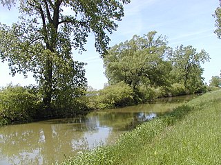
The geography of France consists of a terrain that is mostly flat plains or gently rolling hills in the north and west and mountainous in the south and the east.

The Jubilee line is a London Underground line that runs between Stratford in east London and Stanmore in the suburban north-west, via the Docklands, South Bank and West End. Opened in 1979, it is the newest line on the network, although some sections of track date back to 1932 and some stations to 1879.

The Piccadilly line is a London Underground line that runs between Cockfosters in suburban north London and Acton Town in the west, where it divides into two branches: one of these runs to Heathrow Airport and the other to Uxbridge in northwest London, with some services terminating at Rayners Lane.

A superstreet, also known as a restricted crossing U-turn (RCUT), J-turn, or reduced conflict intersection, is a type of road intersection that is a variation of the Michigan left. In this configuration, in contrast to the Michigan left, traffic on the minor road is not permitted to proceed straight across the major road or highway. Drivers on the minor road wishing to turn left or go straight must turn right onto the major road, then, a short distance away, queue (wait) into a designated U-turn lane in the median. When traffic clears, they complete the U-turn and then either go straight or make a right turn when they intersect the other half of the minor road.

Petra Procházková is a Czech journalist and humanitarian worker. She is best known as a war correspondent from conflict areas of the former Soviet Union.

The European route E 22 is one of the longest European routes. It has a length of about 5,320 km (3,310 mi). Many of the E-roads have been extended into Asia since the year 2000; the E 22 was extended on 24 June 2002.
The arrondissement of Montmorillon is an arrondissement of France in the Vienne department in the Nouvelle Aquitaine region. Since the January 2017 reorganization of the arrondissements of Vienne, it has 91 communes.
Shuswap Lake Marine Provincial Park is an 896-hectare provincial park in British Columbia, Canada, comprising 991 ha. The Park has a variety of amenities including boat launch ramps, picnic areas, and 27 campsites around the perimeter of Shuswap Lake. The lake's name and that of the surrounding Shuswap Country is from the Shuswap people (Secwepemc), the most northern of the Salishan speaking people.

Advanced Landing Grounds (ALGs) were temporary advance airfields constructed by the Allies during World War II during the liberation of Europe. They were built in the UK prior to the invasion and thereafter in northwest Europe from 6 June 1944 to V-E Day, 7 May 1945.

Indian Creek Township is one of nine townships in Lawrence County, Indiana, United States. As of the 2010 census, its population was 2,775 and it contained 1,176 housing units.
Tai chi chih is a series of 19 movements and 1 pose that together make up a meditative form of movement to which practitioners attribute physical, personal and spiritual health benefits. Some studies have found the practice to reduce stress and relieve certain ailments.

Fayetteville is an unincorporated community in Indian Creek Township, Lawrence County, in the U.S. state of Indiana.

Ottawa National Wildlife Refuge Complex is a National Wildlife Refuge complex in the state of Ohio.
Svanevatn is a lake on the border between Norway and Russia. The Norwegian branch is situated in Sør-Varanger municipality in Finnmark county.
Rátka is a village in Borsod-Abaúj-Zemplén County in northeastern Hungary.
Rumah District is a district of the Mahrah Governorate, Yemen. As of 2003, the district had a population of 6,357 inhabitants.
In algebraic topology, a transgression map is a way to transfer cohomology classes. It occurs, for example in the inflation-restriction exact sequence in group cohomology, and in integration in fibers. It also naturally arises in many spectral sequences; see spectral sequence#Edge maps and transgressions.

The Black Horse was formerly a pub at 168 Mile End Road, Stepney, London E1.


