The geography of France consists of a terrain that is mostly flat plains or gently rolling hills in the north and west and mountainous in the south and the east.

The Jubilee line is a London Underground line that runs between Stratford in east London and Stanmore in the suburban north-west, via the Docklands, South Bank and West End. Opened in 1979, it is the newest line on the network, although some sections of track date back to 1932 and some stations to 1879.

The Piccadilly line is a London Underground line that runs between Cockfosters in suburban north London and Acton Town in the west, where it divides into two branches: one of these runs to Heathrow Airport and the other to Uxbridge in northwest London, with some services terminating at Rayners Lane.

The Mangapps Railway Museum is a heritage railway centre located near Burnham-on-Crouch in Essex. The 0.75 miles (1.21 km) of standard gauge running line and museum are owned and operated by the Jolly family assisted by volunteers.

The European route E 22 is one of the longest European routes. It has a length of about 5,320 km (3,310 mi). Many of the E-roads have been extended into Asia since the year 2000; the E 22 was extended on 24 June 2002.
Shuswap Lake Marine Provincial Park is an 896-hectare provincial park in British Columbia, Canada, comprising 991 ha. The Park has a variety of amenities including boat launch ramps, picnic areas, and 27 campsites around the perimeter of Shuswap Lake. The lake's name and that of the surrounding Shuswap Country is from the Shuswap people (Secwepemc), the most northern of the Salishan speaking people.

Advanced Landing Grounds (ALGs) were temporary advance airfields constructed by the Allies during World War II during the liberation of Europe. They were built in the UK prior to the invasion and thereafter in northwest Europe from 6 June 1944 to V-E Day, 7 May 1945.
Nghĩa Hò is a commune (xã) and village in Lục Ngạn District, Bắc Giang Province, in northeastern Vietnam.
Svanevatn is a lake on the border between Norway and Russia. The Norwegian branch is situated in Sør-Varanger municipality in Finnmark county.
Rátka is a village in Borsod-Abaúj-Zemplén County in northeastern Hungary.

Post mill Rosmalen is a post mill in Rosmalen, Netherlands. The mill is situated in the neighbourhood of Molenhoek. The mill was built in 1732 on a natural slope. This slope is accented with old millstones.
Rumah District is a district of the Mahrah Governorate, Yemen. As of 2003, the district had a population of 6,357 inhabitants.
Maturahu is an island belonging to the country of Estonia.

Submarine U-475 Black Widow was a Soviet Navy submarine of the Cold war period, which is now in private hands. It is currently moored at Strood, on the River Medway, in South-East England.

The Black Horse was formerly a pub at 168 Mile End Road, Stepney, London E1.

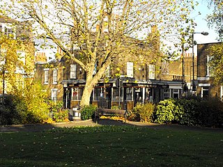
The Queen's Head is a pub at 8 Flamborough Street, Stepney, London E14.

The Salmon and Ball is a pub at 502 Bethnal Green Road, Bethnal Green, London E2.
Szymon Kuźma, is a Polish professional footballer who plays as midfielder for Sandecja Nowy Sącz.


