
A drainage basin is any area of land where precipitation collects and drains off into a common outlet, such as into a river, bay, or other body of water. The drainage basin includes all the surface water from rain runoff, snowmelt, hail, sleet and nearby streams that run downslope towards the shared outlet, as well as the groundwater underneath the earth's surface. Drainage basins connect into other drainage basins at lower elevations in a hierarchical pattern, with smaller sub-drainage basins, which in turn drain into another common outlet.
Walter Sisulu University (WSU) is a university of technology and science located in Mthatha, East London, Butterworth and Komani (Queenstown) in the Eastern Cape, South Africa, which came into existence on 1 July 2005 as a result of a merger between Border Technikon, Eastern Cape Technikon and the University of the Transkei. The university is named after Walter Sisulu, a prominent figure in the struggle against apartheid.

The Great Kei River is a river in the Eastern Cape province of South Africa. It is formed by the confluence of the Black Kei River and White Kei River, northeast of Cathcart. It flows for 320 km (199 mi) and ends in the Great Kei Estuary at the Indian Ocean with the small town Kei Mouth on the west bank. Historically the Great Kei River formed the southwestern border of the Transkei region as was formerly known as the Nciba River.

The R61 is a provincial route in South Africa that connects Beaufort West with Port Shepstone via Graaff-Reinet, Queenstown, Mthatha and Port Edward.

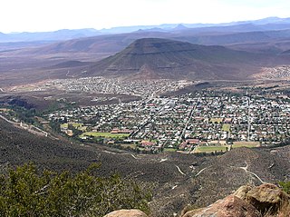
Queenstown, officially Komani, is a town in the middle of the Eastern Cape Province of South Africa, roughly halfway between the smaller towns of Cathcart and Sterkstroom. The town was established in 1853 and is currently the commercial, administrative, and educational centre of the surrounding farming district.

The Mzimkulu River is a river in South Africa. In the past, the Mzimkulu formed part of the border between Eastern Cape and KwaZulu-Natal provinces. Presently this river is part of the Mvoti to Umzimkulu Water Management Area. In late February of every year, the river is host to one of South Africa's most popular canoe races, the Drak Challenge.

The Nahoon River is situated in the city of East London on the east coast of South Africa.
The Sundays River or Nukakamma is a river in the Eastern Cape Province of South Africa. It is said to be the fastest flowing river in the country. The Khoisan people originally named this river Nukakamma because the river's banks are always green and grassy despite the arid terrain that it runs through.

Chris Hani is a landlocked district situated in the centre of the Eastern Cape and is made up of eight local municipalities. Most of the communities live in rural areas. The landscape ranges from moist uplands and grassland hills to the arid Karoo scrubland.

The N6 is a national route in South Africa that connects East London with Bloemfontein, via Komani and Maletswai. It runs roughly from north to south, connecting the N1 with the N2.

Cacadu is a small town in Chris Hani District Municipality in the Eastern Cape province of South Africa. The town was renamed to Cacadu in 2017, after amendments of changing colonial names in South Africa. Cacadu, meaning “bulrush water”, is the Xhosa name for the White Kei River, which rises in the district.
Kei Mouth is a resort town on the southeast coast of South Africa, situated in the Wild Coast region of the Eastern Cape Province, situated 94 kilometres from the city of East London. The town is situated on the Indian Ocean coast, on the western bank of the Great Kei River, and has one of the country's three remaining car transporting pontoon river ferries.
Mzimvubu to Keiskamma WMA, or Mzimvubu to Keiskamma Water Management Area , includes the following major rivers: the Swane River, Mntafufu River, Mzimvubu River, Mngazi River, Mthatha River, Xora River, Mbashe River, Nqabara River, Gqunube River, Buffalo River, Nahoon River, Groot Kei River and Keiskamma River, and covers the following Dams:
Bongolo Dam, is located on the Komani River, near Queenstown, Eastern Cape, South Africa. The dam has a capacity of 7,015,000 cubic metres (247,700,000 cu ft). The Bongolo Dam, about 5 kilometres (3.1 mi) from town on the Dordrecht road, is one of Queenstown's main sources of water, its main purpose is for industrial and municipal usage. The wall was begun in 1905 and was for years the largest concrete dam wall in South Africa. Incidentally the origin of the name Bongola has caused some controversy, but it is believed by some to have been derived from the Xhosa language word mbongolo meaning donkey, as these animals were extensively used in the construction of the dam.

The Klaas Smits River is a river part of the Great Kei River system in the Eastern Cape, South Africa. It originates south of Molteno and flows through Sterkstroom, first southwards and then southeastwards before joining up with the Black Kei River. Presently the Klaas Smits River is part of the Mzimvubu to Keiskama Water Management Area.
The White Kei River or Wit-Kei River is a river in the Eastern Cape, South Africa. It originates north of Queenstown, beginning its course as the Grootvleispruit river and eventually joining the Black Kei River, to form the Great Kei River.
The Black Kei River, originates southwest of Queenstown, and eventually joins the White Kei River, to become the Great Kei River. Several villages are situated on its banks, including McBride Village, Qabi, Ntabelanga, Thornhill, Loudon, Mitford, Basoto, Baccle's Farm and Tentergate.

The Keiskamma River is a river in the Eastern Cape Province in South Africa. The river flows into the Indian Ocean in the Keiskamma Estuary, located by Hamburg Nature Reserve, near Hamburg, midway between East London and Port Alfred. The Keiskamma flows first in a southwestern and then in a southeastern direction after meeting its main tributary, the Tyhume River.
The Amathole Offshore Marine Protected Area is an offshore conservation region in the territorial waters of South Africa
The Amathole Marine Protected Area is an inshore conservation region in the territorial waters of South Africa, near East London on the coast of the Eastern Cape.
