
Tenkasi is a town and headquarters of the Tenkasi district in Indian state of Tamil Nadu.
Karur District is one of the 38 districts in the Indian state of Tamil Nadu. The main town in Karur District is the city of Karur, which is also the district headquarters. The district has a population of 1,064,493 with a sex-ratio of 1,015 females for every 1,000 males, according to 2011 census.

Dindigul District is one of the 38 districts in the state of Tamil Nadu in India. Dindigul District is the largest district in Tamil Nadu by area. The district was carved out of Madurai District in 1985. It has an area of 6266.64 km2 and comprises 3 revenue divisions, 10 taluks, and 14 panchayat unions. The district is located in Southwest of Tamil Nadu. The district is bound by Madurai district in the south,Tiruppur district in the northwest, Karur district in the north, Tiruchirappalli district in the northeast, Theni district in the Southwest and Idukki district of Kerala to the west. As of 2011, the district had a population of 2,159,775 with a sex-ratio of 998 females for every 1,000 males.

Dharapuram is a town situated along the banks of Amaravati River in Tiruppur district in the Indian state of Tamil Nadu. Dharapuram is one of the oldest towns in South India and was the capital of Kongu Nadu under the Cheras, Western Ganga Dynasty and later Kongu Cholas, at which time it was known as Viradapuram. Amaravathi River flows through the town. As of 2011, the town had a population of 67,007. The city houses famous temples including Agatheeswarar Temple, Kaadu Hanumanthasamy temple and many others.

Oddanchatram is a town in Dindigul district in the Indian state of Tamil Nadu. Oddanchatram is a region in the southwest of Tamil Nadu. The town was carved out of Madurai District in 1985. Oddanchatram is known for its vegetable and cattle market. As of 2011, the town had a population of 30,064. It is known as the vegetable city of Tamil Nadu. Oddanchatram's vegetable market is the largest supplying of vegetables in Tamilnadu and Kerala. Agriculture is the major economy for the town.

Jayankondam is a First Grade Municipality in Ariyalur district of Tamil Nadu in India. As of 2023, the town had a population of 46,000.
Kilpennathur is a Panchayat Town in Tiruvanamalai district in the Indian state of Tamil Nadu. Kilpennathur is one of the taluks of Tiruvannamalai district and an assembly constituency of Tamil Nadu. The MLA of Kilpennathur assembly constituency is DMK party Mr. K. Pichandi. Vettavalam is the most populous town panchayat in this taluk. Kilpennathur is located a 12.25 degrees latitude and 79.224 degrees longitude. Nearest towns are Avalurpet, Vettavalam, Gingee and Tiruvannamalai, and Chennai is about 177 km away.
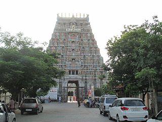
Mulanur is a panchayat town under in Dharapuram taluk in Tirupur District in the Indian state of Tamil Nadu.

Muthur is a panchayat town in Vellakovil block which comes under Kangeyam taluk in Tirupur district, Tamil Nadu, India.
Nallur (Nalloor) is a panchayat town in Kanniyakumari district in the Indian state of Tamil Nadu.
Thevur is a Town Panchayat city in Salem district, Tamil Nadu.

Udumalai, also known as Udumalaipettai and Udumalpet, is a town in Tiruppur district in the Indian state of Tamil Nadu. It is located 535 km south west from the state capital, Chennai and 72 km from Coimbatore. It is the headquarters of Udumalaipettai taluk and had a population of 61,133 as per 2011 Census of India. The town comes under the Udumalaipettai Assembly constituency.

Valparai is a Taluk and hill station in the Coimbatore district of Tamil Nadu, India. It consists of Anamalai Tiger Reserve. It is located 3,474 feet (1,059 m) above sea level on the Anaimalai Hills range of the Western Ghats. There are a total of 56 estates here. The game of football is very popular here. State level competitions are held every year. The foothill starts exactly from Monkey Falls which is at a distance of 38 kilometres (24 mi) to Valparai. The route to Valparai from the foothills consists of 40 hairpin bends. The Kerala state border town of Malakkappara is at a distance of 27 kilometres from Valparai. While major portions of the land are owned by private tea companies, large forest areas continue to be out of bounds.
Vellakovil is a municipal town in Kangeyam taluk of Tirupur District, in the Indian state of Tamil Nadu. It is located on National Highway 81 between Trichy and Coimbatore. The town is spread in an area of 64.75 km2. As of 2011, the town had a population of 40,359. Kannapuram village located near to this town is famous for Kangeyam breed cattle market that happens on every year during Mariyamman temple festival in the month of April. It is an industrialized town with traditional agriculture being the occupation for most of the people. It holds lot of Power looms weaving bedsheets, floor mats and cotton materials being exported to foreign countries via exporters present in Karur.

Vennanthur or Vennandur is a town panchayat in Vennandur block in Rasipuram taluk of Namakkal district in the state of Tamil Nadu, India.
Kaniyur is a suburb of palani which is also a town panchayat in Tirupur District in the Indian state of Tamil Nadu. Kaniyur is also called Dravida Iyakkathin Thotti. It is one of the 'K' villages located near to Udumalaipettai.
Komarapalayam is a Municipality and textile town situated on the bank of the Cauvery river, Bhavani River of South India, and is a taluk of Namakkal District, Tamil Nadu, India. Komarapalayam is also called Kumarapalayam. Komarapalayam and Bhavani are twin cities separated by the Cauvery river. However, Bhavani belongs to Erode district. Komarapalayam is famous for its textile industries; also Kumarapalayam is famous for traditional leather chappals. As of 2011, the town had a population of 71,594. Some of the native people call it as Guberapuri due to high industrial production.
Tiruppur District is one of the 38 districts of the Indian state of Tamil Nadu, formed in 22 February 2009. Dharapuram was the largest taluk by area in the district. The district is well-developed and industrialized. The Tiruppur banian industry, the cotton market, Kangeyam bull and Uthukkuli butter, among other things, provide for a vibrant economy. The city of Tiruppur is the administrative headquarters for the district. As of 2011, the district had a population of 2,479,052 with a sex-ratio of 989 females for every 1,000 males.
Midalam is a village in Killiyur block in Kaniyakumari District of Tamil Nadu, India. It is located 27 km towards west from District headquarters Nagercoil, 741 km from State capital Chennai, 55 km from Thiruvananthapuram, the capital of Kerala. It shares border with Enayam and Thengapattanam at the west, Kurumpanai and Colachel at the east, Karungal at the north and Arabian Sea to the south.
Palayam is a town panchayat in Dindigul district in the Indian state of Tamil Nadu. It falls under Vedasandur Assembly constituency and Karur Lok Sabha constituency.
