
Kottayam is one of 14 districts in the Indian state of Kerala. Kottayam district comprises six municipal towns: Kottayam, Changanassery, Pala, Erattupetta, Ettumanoor, and Vaikom. It is the only district in Kerala that does not border either the Arabian Sea or another Indian state.

Changanassery, is a municipality in the Kottayam district of Kerala, India. It is located 17 km (10.6 mi) south of the district headquarters in Kottayam and about 115 km (71.5 mi) north of the state capital Thiruvananthapuram. As per the 2011 Indian census, Changanassery has a population of 47,485 people, and a population density of 3,517/km2 (9,110/sq mi).

Thodupuzha is a municipality and Taluka in the Idukki district of Kerala, India. It is located 55 km (34.2 mi) west of the district headquarters in Painavu and about 192 km (119.3 mi) north of the state capital Thiruvananthapuram. As per the 2011 Indian census, Thodupuzha has a population of 52,045 people, and a population density of 1,468/km2 (3,800/sq mi).
Kothamangalam is a municipality at the foot of the Western Ghats in the Ernakulam district of Kerala, India. It is located 41 km (25.5 mi) east of the district collectorate in Thrikkakara and about 218 km (135.5 mi) north of the state capital Thiruvananthapuram. As per the 2011 Indian census, Kothamangalam has a population of 38,837 people, and a population density of 969/km2 (2,510/sq mi).

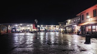
Pampady is a major town in Kottayam district of Kerala, India. It lies midway between the backwaters of Western Kerala and the mountains of the Western Ghats.

Varappuzha, IPA:[ʋɐɾɐːpːuɻɐ], is a northern suburb of the city of Kochi. It is a census town in Paravur Taluk, Ernakulam district in the Indian state of Kerala. Situated around 15 km (9 mi) from the city centre and 8 km (5 mi) from Edapally, the areas lies in the NH 66 connecting Vytilla with North Paravur. Its specialty is that considerably large-scale paddy cultivating area is situating western part of Varapuzha which is called Devaswompadam, specialised with Pokkali paddy cultivation and interim crop as fish cultivation locally called 'Kettu'. The common work of the natives are fishing and agriculture. Varapuzha is known for its fish market.

The Kingdom of Thekkumkur was an independent kingdom in the southern part of Kerala in India from 1103 CE until 1750 CE. It was ruled by the Thekkumkur Royal Family. Thekkumkur lies between the Meenachil River and the Pamba River, from the Western Ghats to the Vembanad Kayal. Thekkumkur emerged as a result of administrative changes in the princely states at the end of the Chera Kulasekhara dynasty of Mahodayapuram. The literal meaning of the title is the southern regent and the attribute southern distinguished them from another kingdom known as Vadakkumkur which bordered it in the northern side. The royal household, Thekkumkur Kovilakam, were at Vennimala and Manikandapuram near Puthuppally, later it shifted to Neerazhi Palace at Puzhavathu of Changanassery and Thalilkotta at Thaliyanthanapuram (Kottayam).
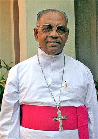
Kuriakose Kunnassery was a Syro-Malabar Catholic hierarch. He was the fourth bishop of the Syro-Malabar Catholic Archeparchy of Kottayam and the first Archbishop of the Archdiocese of Kottayam. He served as priest in the Diocese of Kottayam for 13 years from December 21, 1955 to February 24, 1968. Then he was bishop for 49 years from February 24, 1968 to June 14, 2017. Kunnacherry was head of the Diocese of Kottayam for 31 years from May 5, 1974 to December 19, 2005. He was elevated as Archbishop on May 19, 2005.

Kangazha is a panchayath and village in the Changanacherry Taluk of the Kottayam District of Kerala State in India. It is located 21 kilometers east of Kottayam and 10 kilometers north of Karukachal. It lies midway between the backwaters of Western Kerala and the misty mountains of the Western Ghats.

This article lists the various old and ancient churches that exist among the Saint Thomas Christians in Kerala.
Vakathanam is a Panchayat in Kottayam district of Kerala, India. It is 12 kilometres (7.5 mi) from Kottayam on the way to Changanassery via Puthupally. Vakathanam panchayat consists of two villages: Vakathanam and Thottakkad.
Pallickathodu, also spelled Pallikkathodu which includes Anickadu village, is a town in eastern Kottayam district, Kerala, India. It falls under the Kanjirappally assembly constituency.
Elanji is a village in Ernakulam district, Indian state of Kerala.

Thamarassery, formerly known as Thazhmalachery, is one of the taluks and a major hill town in the Kozhikode district of Kerala, India, 30 km north-east of Kozhikode (Calicut) city and 29 km east of Koyilandy. The town lies on National highway 766.
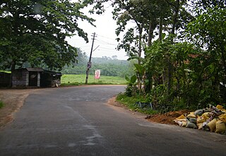
Lakkattoor is a small village in Kooroppada panchayat, about 17 km east of Kottayam, Kerala located between Kottayam, Ettumanoor, Pala and Ponkunnam. Surrounded by small hills, valleys, streams and rubber trees. Lakkattoor is a unique name. It is believed that the name might have changed from 'Plakkattoor', because the area has lot of jackfruit trees known as 'Plavu'. Jackfruit is also known as 'Plakka'.
Mathrumala is a hill located 16 km (9.9 mi) east of the town of Kottayam in Kooroppada, Kottayam District, Kerala, India. The hilltop has a temple shrine dedicated to Rajarajeshwari (Devi).
Kottayam district is a centre of education in Kerala state. The Orthodox Theological Seminary at Chungam was the first institution to teach English in South India. It was founded in 1815 by Colonel John Monroe. The C.M.S High School was founded by the British missionary, Benjamin Bailey. The first college in Kerala state and the second established under British rule in India was the C.M.S. College (1840). Mahatma Gandhi University is located in Kottayam district. Later, the clergies of Catholic Church, on seeing a need for a English High School for students of Central Travancore, established a residential high school St Berchmans English High School in 1891 in Changanasserry under leadership of Fr Charles Lavigne, then vicariate apostolate of Kottayam. Even though it was started as a school for seminarians, it was made to public soon itself. In 1922, Venerable Mar Thomas Kurialacherry founded the famous SB College Changanassery for both intermediate students and scholars in Central Travancore. Today, both CMS College and SB College are recognised, for their legacy, as reputed and noted institutions of Kerala.
Reflecting the religious constitution of the population, a large number of Hindu temples and Christian churches dot the townscape of Kottayam district. Some of them are the Thirunakkara Mahadeva temple, Kumaranalloor Devi temple, Thiruvarrpu Sri Krishna Temple, Thaliyil Mahadeva Temple, Pallippurathukavu Bhagavathi Temple, Elia Cathedral, Kottayam Valiya Pally, Manarcad Cathedral, Cheriya Palli, CSI Holy Trinity cathedral, Puthuppally St. George Church and Thazhathangadi Juma Masjid. All the temples of Kottayam were also built under royal patronage of Hinduism during the 2nd millennium.

Kottayam Diocese is one of the 32 dioceses of the Malankara Orthodox Syrian Church. The diocese was created in Mulanthuruthy Synod in 1876.

