Korçë District, was one of the 36 districts of Albania, which were dissolved in July 2000 and replaced by 12 counties. It had a population of 143,499 in 2001, and an area of 1,752 km2 (676 sq mi). Its capital was the city of Korçë. Its territory is now part of Korçë County: the municipalities of Korçë, Maliq and Pustec.
This article includes information on the demographic history of Kosovo.

Prizren is the second most populous city and municipality of Kosovo and seat of the eponymous municipality and district. It is located on the banks of the Prizren River between the foothills of the Sharr Mountains in southern Kosovo. Prizren experiences a continental climate with some mediterranean influences.

The League of Prizren, officially the League for the Defense of the Rights of the Albanian Nation, was an Albanian political organization that was officially founded on June 10, 1878 in the old town of Prizren in the Kosovo Vilayet of the Ottoman Empire. It was suppressed in April 1881.

During World War II, some individuals and groups helped Jews and others escape the Holocaust conducted by Nazi Germany.
Sui iuris, also spelled sui juris, is a Latin phrase that literally means "of one's own right". It is used in both the Catholic Church's canon law and secular law. The term church sui iuris is used in the Catholic Code of Canons of the Eastern Churches (CCEO) to denote the autonomous churches in Catholic communion. The Catholic Church consists of 24 churches, including the Latin Church and 23 Eastern Catholic churches.
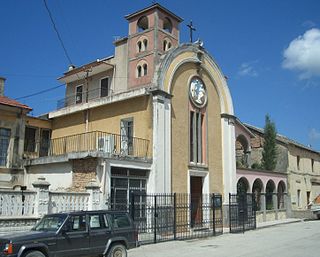
The Albanian Greek Catholic Church, or the Albanian Byzantine Catholic Church, is an autonomous Byzantine Rite particular church in full communion with the Catholic Church and the Pope of Rome, whose members live in Albania and which comprises the Apostolic Administration of Southern Albania. The Albanian Greek Catholic Church, with its Byzantine Rite, is closely linked to the Italo-Albanian Catholic Church sharing a significant commonality of history, identity and traditions.
The history of Kosovo dates back to pre-historic times when the Starčevo culture, Vinča culture, Bubanj-Hum culture, and Baden culture were active in the region. Since then, many archaeological sites have been discovered due to the abundance of natural resources which gave way to the development of life.
Albania is a secular and religiously diverse country with no official religion and thus, freedom of religion, belief and conscience are guaranteed under the country's constitution. Islam is the most common religion in Albania, followed by Christianity, though religiosity is low and there are many irreligious Albanians. In the 2023 census, Muslims accounted for 51% of the total population, Christians made up 16%, while irreligious were 17%. The other 16% were undeclared.

Kastoria is one of the 74 regional units of Greece and is part of the region of Western Macedonia. Its capital is the homonymous city of Kastoria.
The Vilayet of Kosovo was a first-level administrative division (vilayet) of the Ottoman Empire in the Balkan Peninsula which included the modern-day territory of Kosovo and the north-western part of the Republic of North Macedonia. The areas today comprising Sandžak (Raška) region of Serbia and Montenegro, although de jure under Ottoman control, were de facto under Austro-Hungarian occupation from 1878 until 1909, as provided under Article 25 of the Treaty of Berlin. Üsküb (Skopje) functioned as the capital of the province and the midway point between Istanbul and its European provinces. Üsküb's population of 32,000 made it the largest city in the province, followed by Prizren, also numbering at 30,000.

Chiprovtsi is a small town in northwestern Bulgaria, administratively part of Montana Province. It lies on the shores of the river Ogosta in the western Balkan Mountains, very close to the Bulgarian-Serbian border. A town of about 2,000 inhabitants, Chiprovtsi is the administrative centre of Chiprovtsi Municipality that also covers nine nearby villages.

The Catholic Church in Albania is part of the worldwide Catholic Church, under the spiritual leadership of the Pope in Rome.

Arbanasi is a village in Veliko Tarnovo Municipality, Veliko Tarnovo Province of central northern Bulgaria, set on a high plateau between the larger towns of Veliko Tarnovo and Gorna Oryahovitsa. It is known for the rich history and large number of historical monuments, such as 17th- and 18th-century churches and examples of Bulgarian National Revival architecture, which have turned it into a popular tourist destination.

The Chiprovtsi uprising was an uprising against Ottoman rule organized in northwestern Bulgaria by Roman Catholic Bulgarians, but also involving many Eastern Orthodox Christians. It broke out after the capture of Belgrade by Austria on 6 September 1688 and ended unsuccessfully, with the centre of insurrectionary activity, Chiprovtsi, being completely destroyed by Ottoman forces.

Albanians are a minority ethnic group in Bulgaria. Although according to the 2011 census they only numbered 220, their number in the Bulgarian lands was much larger in the past. Between the 15th and 17th century, groups of Albanians settled in many parts of modern northern Bulgaria, with a less numerous group of settlers in southern Thrace. Afterwards they were fully assimilated in the neighboring Bulgarian communities.

The massacres of Albanians in the Balkan Wars were perpetrated on several occasions by the Serbian and Montenegrin armies and paramilitaries during the conflicts that occurred in the region between 1912 and 1913. During the 1912–13 First Balkan War, Serbia and Montenegro committed a number of war crimes against the Albanian population after expelling Ottoman Empire forces from present-day Albania, Kosovo, and North Macedonia, which were reported by the European, American and Serbian opposition press. Most of the crimes occurred between October 1912 and the summer of 1913. The goal of the forced expulsions and massacres was statistical manipulation before the London Ambassadors Conference to determine the new Balkan borders. According to contemporary accounts, around 20,000 to 25,000 Albanians were killed in the Kosovo Vilayet during the first two to four months, before the violence climaxed. The total number of Albanians that were killed in Kosovo and Macedonia or in all Serbian occupied regions during the Balkan Wars is estimated to be at least 120,000. Most of the victims were children, women and the elderly. In addition to the massacres, some civilians had their lips and noses severed. Multiple historians, scholars, and contemporary accounts refer to or characterize the massacres as a genocide of Albanians or the Muslim population in the Balkans as a whole. Further massacres against Albanians occurred during the First World War and continued during the interwar period.

The Catholic Church has a population of approximately 65,000 in a region of roughly 2 million people.

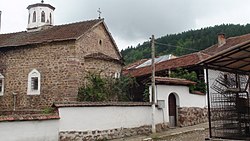
Boboshticë is a village in the former Drenovë Municipality of the Korçë County in southeastern Albania. At the 2015 local government reform it became part of the municipality Korçë.

During the decline and dissolution of the Ottoman Empire, Muslim inhabitants living in Muslim-minority territories previously under Ottoman control often found themselves persecuted after borders were re-drawn. These populations were subject to genocide, expropriation, massacres, religious persecution, mass rape, and ethnic cleansing.