Kostel, Croatia

Last updated
Kostel
Village
Krapina-Zagorje County OpenStreetMap.svg
Red pog.svg
Kostel
Croatia location map.svg
Red pog.svg
Kostel
Coordinates: 46°11′02″N15°43′32″E / 46.183987°N 15.725673°E / 46.183987; 15.725673
CountryFlag of Croatia.svg  Croatia
County Krapina-Zagorje County
Municipality Pregrada
Area
[1]
  Total
3.7 km2 (1.4 sq mi)
Population
 (2021) [2]
  Total
119
  Density32/km2 (83/sq mi)

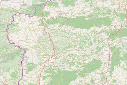
Kostel is a village in northern Croatia. It is located just south of the D206 connecting Pregrada to Hum na Sutli. Two nearby villages, Kostelsko and Bregi Kostelski have the same name root.
Climate

Between 1981 and 1987, the highest temperature recorded at the local weather station was 35.2 °C (95.4 °F), on 28 July 1983. [3] The coldest temperature was −23.4 °C (−10.1 °F), on 13 February 1985. [4]

References

  1. Register of spatial units of the State Geodetic Administration of the Republic of Croatia. Wikidata   Q119585703.
  2. "Population by Age and Sex, by Settlements" (xlsx). Census of Population, Households and Dwellings in 2021. Zagreb: Croatian Bureau of Statistics. 2022.
  3. DHMZ (2022-07-19). "Najviše izmjerene temperature zraka u Hrvatskoj za razdoblje od kada postoje mjerenja". Državni hidrometeorološki zavod.
  4. DHMZ (2022-01-21). "Najniže izmjerene temperature zraka u Hrvatskoj za razdoblje od kada postoje mjerenja". Državni hidrometeorološki zavod.