Gmina Łabunie is a rural gmina in Zamość County, Lublin Voivodeship, in eastern Poland. Its seat is the village of Łabunie, which lies approximately 10 kilometres (6 mi) south-east of Zamość and 86 km (53 mi) south-east of the regional capital Lublin.
Gmina Sitno is a rural gmina in Zamość County, Lublin Voivodeship, in eastern Poland. Its seat is the village of Sitno, which lies approximately 10 kilometres (6 mi) north-east of Zamość and 78 km (48 mi) south-east of the regional capital Lublin.

Antoniówka is a village in the administrative district of Gmina Komarów-Osada, within Zamość County, Lublin Voivodeship, in eastern Poland. It lies approximately 3 kilometres (2 mi) north-west of Komarów-Osada, 17 km (11 mi) south-east of Zamość, and 92 km (57 mi) south-east of the regional capital Lublin.
Huta Komarowska is a village in the administrative district of Gmina Komarów-Osada, within Zamość County, Lublin Voivodeship, in eastern Poland. It lies approximately 17 kilometres (11 mi) south-east of Zamość and 93 km (58 mi) south-east of the regional capital Lublin.
Kadłubiska is a village in the administrative district of Gmina Komarów-Osada, within Zamość County, Lublin Voivodeship, in eastern Poland. It lies approximately 5 kilometres (3 mi) north-east of Komarów-Osada, 20 km (12 mi) east of Zamość, and 93 km (58 mi) south-east of the regional capital Lublin.
Komarów Dolny is a village in the administrative district of Gmina Komarów-Osada, within Zamość County, Lublin Voivodeship, in eastern Poland.
Komarów Górny is a village in the administrative district of Gmina Komarów-Osada, within Zamość County, Lublin Voivodeship, in eastern Poland. It lies approximately 21 kilometres (13 mi) south-east of Zamość and 97 km (60 mi) south-east of the regional capital Lublin.
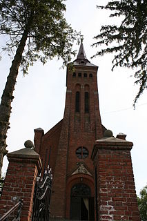
Komarów-Osada is a village in Zamość County, Lublin Voivodeship, in eastern Poland. It is the seat of the gmina called Gmina Komarów-Osada. It lies approximately 19 kilometres (12 mi) south-east of Zamość and 94 km (58 mi) south-east of the regional capital Lublin.
Krzywystok is a village in the administrative district of Gmina Komarów-Osada, within Zamość County, Lublin Voivodeship, in eastern Poland. It lies approximately 5 kilometres (3 mi) west of Komarów-Osada, 15 km (9 mi) south-east of Zamość, and 91 km (57 mi) south-east of the regional capital Lublin.
Krzywystok-Kolonia is a village in the administrative district of Gmina Komarów-Osada, within Zamość County, Lublin Voivodeship, in eastern Poland. It lies approximately 17 kilometres (11 mi) south-east of Zamość and 93 km (58 mi) south-east of the regional capital Lublin.
Księżostany is a village in the administrative district of Gmina Komarów-Osada, within Zamość County, Lublin Voivodeship, in eastern Poland. It lies approximately 16 kilometres (10 mi) south-east of Zamość and 92 km (57 mi) south-east of the regional capital Lublin.
Ruszczyzna is a village in the administrative district of Gmina Komarów-Osada, within Zamość County, Lublin Voivodeship, in eastern Poland. It lies approximately 16 kilometres (10 mi) south-east of Zamość and 91 km (57 mi) south-east of the regional capital Lublin.
Śniatycze is a village in the administrative district of Gmina Komarów-Osada, within Zamość County, Lublin Voivodeship, in eastern Poland. It lies approximately 21 kilometres (13 mi) east of Zamość and 95 km (59 mi) south-east of the regional capital Lublin.
Swaryczów is a village in the administrative district of Gmina Komarów-Osada, within Zamość County, Lublin Voivodeship, in eastern Poland. It lies approximately 25 kilometres (16 mi) east of Zamość and 98 km (61 mi) south-east of the regional capital Lublin.
Wolica Brzozowa is a village in the administrative district of Gmina Komarów-Osada, within Zamość County, Lublin Voivodeship, in eastern Poland. It lies approximately 22 kilometres (14 mi) south-east of Zamość and 96 km (60 mi) south-east of the regional capital Lublin.
Wolica Śniatycka is a village in the administrative district of Gmina Komarów-Osada, within Zamość County, Lublin Voivodeship, in eastern Poland. It lies approximately 16 kilometres (10 mi) east of Zamość and 91 km (57 mi) south-east of the regional capital Lublin.
Zubowice is a village in the administrative district of Gmina Komarów-Osada, within Zamość County, Lublin Voivodeship, in eastern Poland. It lies approximately 25 kilometres (16 mi) south-east of Zamość and 99 km (62 mi) south-east of the regional capital Lublin.
Kaczórki is a village in the administrative district of Gmina Krasnobród, within Zamość County, Lublin Voivodeship, in eastern Poland. It lies approximately 6 kilometres (4 mi) north-west of Krasnobród, 20 km (12 mi) south-west of Zamość, and 85 km (53 mi) south-east of the regional capital Lublin.
Dąbrowa is a village in the administrative district of Gmina Łabunie, within Zamość County, Lublin Voivodeship, in eastern Poland. It lies approximately 9 kilometres (6 mi) south-east of Łabunie, 18 km (11 mi) south-east of Zamość, and 94 km (58 mi) south-east of the regional capital Lublin.


