| Kralevo, Haskovo Province | |
|---|---|
| Village | |
| Country | |
| Province | Haskovo Province |
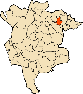
| Municipality | Stambolovo |
| Time zone | EET (UTC+2) |
| • Summer (DST) | EEST (UTC+3) |
Kralevo is a village in Stambolovo Municipality, in Haskovo Province, in southern Bulgaria. [1]

Stambolovo Municipality is a municipality in Haskovo Province, Bulgaria. The administrative centre is Stambolovo.

Haskovo Province is a province in southern Bulgaria, neighbouring Greece and Turkey to the southeast, comprising parts of the Thracian valley along the river Maritsa. It is named after its administrative and industrial centre - the city of Haskovo. The province embraces a territory of 5,533.3 km² that is divided into 11 municipalities with a total population, as of December 2009, of 256,408 inhabitants.

Bulgaria, officially the Republic of Bulgaria, is a country in Southeast Europe. It is bordered by Romania to the north, Serbia and North Macedonia to the west, Greece and Turkey to the south, and the Black Sea to the east. The capital and largest city is Sofia; other major cities are Plovdiv, Varna and Burgas. With a territory of 110,994 square kilometres (42,855 sq mi), Bulgaria is Europe's 16th-largest country.