Krausnick hills

Last updated
Krausnick hills
Krausnicker Berge
Lage Krausnicker Berge.png
Highest point
Peak Wehlaberg
Elevation 144 m (472 ft)
Geography
Location Brandenburg, Germany

The Krausnick hills [1] (German : Krausnicker Berge) are a small range of hills in Eastern Germany in the federal state of Brandenburg.

German language West Germanic language

German is a West Germanic language that is mainly spoken in Central Europe. It is the most widely spoken and official or co-official language in Germany, Austria, Switzerland, South Tyrol (Italy), the German-speaking Community of Belgium, and Liechtenstein. It is also one of the three official languages of Luxembourg and a co-official language in the Opole Voivodeship in Poland. The languages which are most similar to German are the other members of the West Germanic language branch: Afrikaans, Dutch, English, the Frisian languages, Low German/Low Saxon, Luxembourgish, and Yiddish. There are also strong similarities in vocabulary with Danish, Norwegian and Swedish, although those belong to the North Germanic group. German is the second most widely spoken Germanic language, after English.

Germany Federal parliamentary republic in central-western Europe

Germany, officially the Federal Republic of Germany, is a country in Central and Western Europe, lying between the Baltic and North Seas to the north, and the Alps to the south. It borders Denmark to the north, Poland and the Czech Republic to the east, Austria and Switzerland to the south, France to the southwest, and Luxembourg, Belgium and the Netherlands to the west.

Brandenburg State in Germany

Brandenburg is a state of Germany.

Contents

Name and location

The Krausnick hills are named after the village of Krausnick to their south. Their highest point is the Wehlaberg at 144 metres above sea level. The Krausnick hills form the boundary between the Spreewald to the southeast and the Dahmeland to the northwest. Both the hills themselves and the adjacent lakes (the Heideseen and Luchsee) belong to the Spreewald Biosphere Reserve and are popular tourist destinations.

Krausnick-Groß Wasserburg Place in Brandenburg, Germany

Krausnick-Groß Wasserburg is a municipality in the district of Dahme-Spreewald in Brandenburg in Germany.

Wehlaberg is a hill in Brandenburg, Germany.

Spreewald region in Brandenburg, Germany

The Spreewald is a section of the German state of Brandenburg located about 100 km south-east of Berlin. It was the center of the Battle of Halbe at the end of World War II, which included the last major land conflicts between German and Soviet forces. Spreewald was designated a biosphere reserve by UNESCO in 1991. It is known for its traditional irrigation system, consisting of more than 200 small canals within the 484-square-kilometre (187 sq mi) area. The landscape was shaped during the ice age. Alder forests on wetlands and pine forests on sandy dry areas are characteristic for the region. Grasslands and fields can be found as well.

Sights

The Bunter Stiel border stone Bunter-Stiel.jpg
The Bunter Stiel border stone
Jänschwalde Power Station coal power plant

Jänschwalde Power Station is located near the village of Jänschwalde in Brandenburg on the German-Polish border. The lignite-fired power station has an installed capacity of 3,000 megawatts and consists of six 500 MW units. It is the third-largest brown coal power plant in operation in Germany and is currently owned by EPH, who took over its ownership from Vattenfall in 2016.

Saxony State in Germany

Saxony, officially the Free State of Saxony, is a landlocked federal state of Germany, bordering the federal states of Brandenburg, Saxony Anhalt, Thuringia, and Bavaria, as well as the countries of Poland and the Czech Republic. Its capital is Dresden, and its largest city is Leipzig.

Prussia state in Central Europe between 1525–1947

Prussia was a historically prominent German state that originated in 1525 with a duchy centred on the region of Prussia on the southeast coast of the Baltic Sea. It was de facto dissolved by an emergency decree transferring powers of the Prussian government to German Chancellor Franz von Papen in 1932 and de jure by an Allied decree in 1947. For centuries, the House of Hohenzollern ruled Prussia, successfully expanding its size by way of an unusually well-organised and effective army. Prussia, with its capital in Königsberg and from 1701 in Berlin, decisively shaped the history of Germany.

Related Research Articles

Uckermark is a Kreis (district) in the northeastern part of Brandenburg, Germany. Neighboring districts are Barnim and Oberhavel, the districts Mecklenburgische Seenplatte and Vorpommern-Greifswald in Mecklenburg-Vorpommern, and to the east Poland. It is the largest district of Germany areawise. The district is named after the historical region of Uckermark.

Teltow-Fläming District in Brandenburg, Germany

Teltow-Fläming is a Kreis (district) in the southwestern part of Brandenburg, Germany. Neighboring districts are Dahme-Spreewald, Elbe-Elster, the districts Wittenberg in Saxony-Anhalt, the district Potsdam-Mittelmark, and the Bundesland Berlin.

Dahme-Spreewald District in Brandenburg, Germany

Dahme-Spreewald is a district in Brandenburg, Germany. It is bounded by the districts of Oder-Spree, Spree-Neiße, Oberspreewald-Lausitz, Elbe-Elster and Teltow-Fläming, and by the city of Berlin.

Oder-Spree District in Brandenburg, Germany

Oder-Spree is a Kreis (district) in the eastern part of Brandenburg, Germany. Neighboring are the district Märkisch-Oderland, the district-free city Frankfurt (Oder), Poland, the districts Spree-Neiße and Dahme-Spreewald, and the Bundesland Berlin.

Tegel Quarter of Berlin in Germany

Tegel  is a locality (Ortsteil) in the Berlin borough of Reinickendorf on the shore of Lake Tegel. The Tegel locality, the second largest in area of the 96 Berlin districts, also includes the neighbourhood of Saatwinkel.

Müggelturm tower

The Müggelturm is a popular day-trip destination in Köpenick, in southeastern Berlin, Germany. It is located to the south of the Müggelsee lake in the Müggelberg hills atop the Kleiner Müggelberg. Berlin’s highest natural elevation is the nearby Großer Müggelberg at 115 m.

Lower Lusatia geographic region

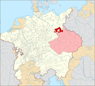
Lower Lusatia is a historical region in Central Europe, stretching from the southeast of the German state of Brandenburg to the southwest of Lubusz Voivodeship in Poland. Like adjacent Upper Lusatia in the south, Lower Lusatia is a settlement area of the West Slavic Sorbs whose endangered Lower Sorbian language is related to Upper Sorbian and Polish.

Kleinmachnow Place in Brandenburg, Germany

Kleinmachnow is a municipality in the Potsdam-Mittelmark district, in Brandenburg, Germany.

Storkow, Brandenburg Place in Brandenburg, Germany

Storkow (Mark) is a town in Oder-Spree district, in Brandenburg, Germany.

Teupitz Place in Brandenburg, Germany

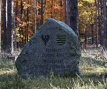
Teupitz is a small town in the Dahme-Spreewald district, in Brandenburg, Germany. It is the administrative seat of the Schenkenländchen municipal association (Amt).

Eichwalde Place in Brandenburg, Germany

Eichwalde is a municipality of the Dahme-Spreewald district in Brandenburg, Germany, situated at the southeastern Berlin city limits. With 2.8 km² it is the smallest Brandenburg municipality by area, while its population density is the second highest.

Heidesee Place in Brandenburg, Germany

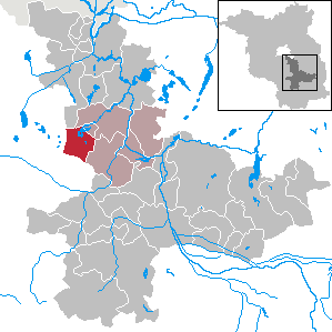
Heidesee is a municipality in the district of Dahme-Spreewald in Brandenburg, which is located in the eastern part of Germany.

Dahme-Heideseen Nature Park nature park in Brandenburg, Germany

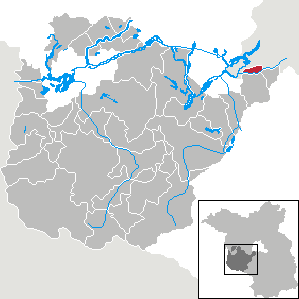
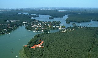
Dahme-Heideseen Nature Park is a nature park and reserve in the state of Brandenburg, Germany. It covers an area of 594 km². It was established September 19 1998 and is located southeast of Berlin.

Schmöckwitz Quarter of Berlin in Germany

Schmöckwitz is a German locality (Ortsteil) within the Berlin borough (Bezirk) of Treptow-Köpenick. Until 2001 it was part of the former borough of Köpenick.

Rudow Quarter of Berlin in Germany

Rudow  is a locality (Ortsteil) within the Berlin borough (Bezirk) of Neukölln.

Brand-Briesen Airfield former military aerodrome in Germany

Brand-Briesen Airfield is a redeveloped military air base located at Briesen/Brand, part of Halbe in Dahme-Spreewald, Brandenburg, Germany, about 60 km (37 mi) south-southeast of Berlin. Since 2004, the former CargoLifter airship hangar has been converted by a Malaysian company Tanjong into a leisure resort called Tropical Islands Resort.

References

  1. Kohl, Horst; Marcinek, Joachim and Nitz, Bernhard (1986). Geography of the German Democratic Republic, VEB Hermann Haack, Gotha, p. 49. ISBN   978-3-7301-0522-1.

Coordinates: 52°04′N13°48′E / 52.067°N 13.800°E / 52.067; 13.800

Geographic coordinate system Coordinate system

A geographic coordinate system is a coordinate system that enables every location on Earth to be specified by a set of numbers, letters or symbols. The coordinates are often chosen such that one of the numbers represents a vertical position and two or three of the numbers represent a horizontal position; alternatively, a geographic position may be expressed in a combined three-dimensional Cartesian vector. A common choice of coordinates is latitude, longitude and elevation. To specify a location on a plane requires a map projection.