This article needs additional citations for verification .(March 2021) |
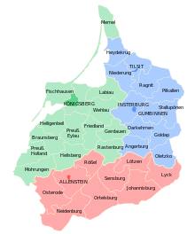
The Goldap district was a Prussian district in East Prussia that existed from 1818 to 1945. Its territory is now divided between the Polish Warmian-Masurian Voivodeship and the Russian Kaliningrad Oblast. 54°18′58″N22°18′34″E / 54.31611°N 22.30944°E
On 1 September 1818 the new Goldap district was formed in Regierungsbezirk Gumbinnen from parts of the old Insterburgdistrict. This included the parishes of Dubeningken, Gawaiten, Goldap, Grabowen, Gurnen, Mehlkehmen, Szirgupönen (from 1824) and Szittkehmen. The district office was in Goldap.
On 1 February 1843 a major exchange of territory took place between the district of Goldap and the district of Stallupönen. The parish of Mehlkehmen was transferred from the district of Goldap to the district of Stallupönen, and in return, the parish of Tollmingkehmen was transferred from the district of Stallupönen to the district of Goldap.
Since 1871, the district belonged to the German Empire. After the province of Prussia was divided into the provinces of East Prussia and West Prussia, the Goldap district became part of East Prussia on 1 April 1878.
In the spring of 1945 the district was occupied by the Red Army and in the summer of 1945, the Soviet occupation forces placed the southern part of the district including the district town of Goldap under Polish administration and the northern part under Soviet administration, in accordance with the Potsdam Agreement. The German population either fled or were subsequently expelled from the district by the local administrative authorities.
The Goldap district had a majority German population, with significant minorities of Poles and Lithuanians. The vast majority of the population (99.1% in 1849) was Protestant. [1]
Year | 1837 | 1849 | 1861 | |||
---|---|---|---|---|---|---|
Germans | 25,516 | 80.5% | 31,417 | 87.7% | 37,584 | 91.2% |
Poles | 3,333 | 10.5% | 2,358 | 6.6% | 1,947 | 4.7% |
Lithuanians | 2,854 | 9.0% | 2,047 | 5.7% | 1,700 | 4.1% |
Total | 31,703 | 35,822 | 41,231 |
In the German Empire, the district of Goldap, together with the districts of Darkehmen and Stallupönen, formed the constituency Gumbinnen 4. [2]
After the municipal reform of 1928, the Goldap district comprised the town of Goldap and 171 other municipalities until 1945: [3] [4]
|
|
|
|
|
From 1936 to 1938, the Nazis implemented extensive renaming of place names in the Goldap district, as in all of East Prussia, as many place names did not seem German enough for them. Some renaming had already taken place before 1936. [3]
|
|
On 27 October 1933 the rural community of Sutzken (now known in Polish as Suczki) was renamed Hitlershöhe. This was based on the following application by the municipality dated 9 March 1933:
"The village of Sutzken in the Goldap district is a farming village with 167 inhabitants. It is located on the heights south of the town of Goldap. 95% of the residents are National Socialists, while the remaining 5% are German nationalists. There hasn't been a Marxist here for years. [...]."
Hitler gave his approval on 12 April 1933 and the new name Hitlershöhe came into effect on 27 October 1933.
Gusev is a town and the administrative center of Gusevsky District of Kaliningrad Oblast, Russia, located at the confluence of the Pissa and Krasnaya Rivers, near the border with Poland and Lithuania, east of Chernyakhovsk. Population: 28,177 (2021 Census); 28,260 (2010 Census); 28,467 (2002 Census); 27,031 (1989 Census).
The Battle of Stallupönen, fought between Russian and German armies on August 17, 1914, was the opening battle of World War I on the Eastern Front. The Germans under the command of Hermann von François conducted a successful counterattack against four Russian infantry divisions from different infantry corps, which heavily outnumbered them but were separated from each other, creating a gap between the 27th Infantry Division and the 40th Infantry Division, and had little coordination with each other. It was a minor German success, but did little to upset the Russian timetable.
Gołdap is a spa town in northeastern Poland, in the region of Masuria, seat of Gołdap County in the Warmian-Masurian Voivodeship. It is located on the Gołdapa River, between the Szeskie Hills, Gołdap Lake and the Puszcza Romincka forest. It has a population of 15,600.
Lithuania Minor, or Prussian Lithuania, is a historical ethnographic region of Prussia, where Prussian Lithuanians lived, now located in Lithuania and the Kaliningrad Oblast of Russia. Lithuania Minor encompassed the northeastern part of the region and got its name from the territory's substantial Lithuanian-speaking population. Prior to the invasion of the Teutonic Knights in the 13th century, the main part of the territory later known as Lithuania Minor was inhabited by the tribes of Skalvians and Nadruvians. The land depopulated during the incessant war between Lithuania and the Teutonic Order. The war ended with the Treaty of Melno and the land was repopulated by Lithuanian newcomers, returning refugees, and the remaining indigenous Baltic peoples; the term Lithuania Minor appeared for the first time between 1517 and 1526.
Węgorzewo is a tourist town on the Angrapa River in northeastern Poland, within the historical region of Masuria. It is the seat of Węgorzewo County in the Warmian-Masurian Voivodeship and is located not far from the border with Russia's Kaliningrad Oblast. Lake Mamry is close to the town.
The Battle of Gumbinnen, initiated by forces of the German Empire on 20 August 1914, was a German offensive on the Eastern Front during the First World War. Because of the hastiness of the German attack, the Russian Army emerged victorious.
The Province of Brandenburg was a province of Prussia from 1815 to 1945. Brandenburg was established in 1815 from the Kingdom of Prussia's core territory, comprised the bulk of the historic Margraviate of Brandenburg and the Lower Lusatia region, and became part of the German Empire in 1871. From 1918, Brandenburg was a province of the Free State of Prussia until Prussia was dissolved in 1945 after World War II, and replaced with reduced territory as the State of Brandenburg in East Germany, which was later dissolved in 1952. Following the reunification of Germany in 1990, Brandenburg was re-established as a federal state of Germany, becoming one of the new states.
Chistye Prudy is a rural locality in Nesterovsky District of Kaliningrad Oblast, Russia. The settlement is located about 15 kilometres (9.3 mi) from the Russian border with Lithuania.
Regierungsbezirk Gumbinnen was a Regierungsbezirk, or government region, of the Prussian province of East Prussia from 1808 until 1945. The regional capital was Gumbinnen (Gusev).
Yasnaya Polyana is a rural settlement (posyolok) in the Nesterovsky District of Kaliningrad Oblast, Russia. It is located in the southeast of the oblast, north of the Romincka Forest. Nearby Diwnoje Nowoje is a railway station on the former Prussian Eastern Railway from Kaliningrad to Kybartai in Lithuania.
Nesterov, until 1938 known by its German name Stallupönen and in 1938-1946 as Ebenrode, is a town and the administrative center of Nesterovsky District in Kaliningrad Oblast, Russia, located 140 kilometers (87 mi) east of Kaliningrad, near the Russian-Lithuanian border on the railway connecting Kaliningrad Oblast with Moscow. Population figures: 4,595 (2010 Census); 5,049 (2002 Census); 4,826 (1989 Census).
Kutuzovo is an abandoned rural locality in Krasnoznamensky District of Kaliningrad Oblast, Russia, located at the eastern extreme of the oblast. It is notable for being the easternmost settlement of the old German Reich, before the region was annexed into the Soviet Union after World War II.
Joachim Ludwig Schultheiss von Unfriedt was a German Baroque architect, official, and councillor most active in Königsberg and throughout East Prussia.
Dobrovolsk is a village in Krasnoznamensky District of Kaliningrad Oblast, Russia. It has a population of 1,693 (2010). It is located in the historical region of Lithuania Minor.
Hausen is a village in the town Greding in the district of Roth in Middle Franconia in Bavaria.
The Mohrungen district was a district in the southwestern part of the Prussian province of East Prussia. It existed from 1818 to 1945 and belonged to Regierungsbezirk Königsberg. The seat of the district administration was the town of Mohrungen. Prior to this, from 1752 to 1818 there was a Mohrungen district in East Prussia, which however, encompassed a much larger area.
The Darkehmen district was a Prussian district in East Prussia from 1818 to 1945. Its former territory is now divided between the Warmian-Masurian Voivodeship of Poland and the Kaliningrad Oblast of Russia.
The Rößel district was a Prussian district in the administrative region of Königsberg in the Prussian province of East Prussia. It was located in Warmia in the middle of East Prussia and existed from 1818 to 1945. The seat of the district administration was initially Rößel (Reszel) and, from 1862, Bischofsburg (Biskupiec).
Heilsberg was a district in East Prussia and existed as a Prussian-German district in the period from 1818 to 1945. Due to its affiliation with Warmia, the district had a majority Catholic population, and the Center Party won an absolute majority of votes in elections until 1933. From 1773 to 1818, there had already been a district of Heilsberg in Warmia, which covered a much larger area.