Krideia

Last updated
Krideia
village
Κρίδεια (Greek) Kilitkaya (Turkish)
Cyprus location map.svg
Red pog.svg
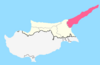
Krideia
Location in Cyprus
Coordinates: 35°23′41″N33°58′26″E / 35.39472°N 33.97389°E / 35.39472; 33.97389 Coordinates: 35°23′41″N33°58′26″E / 35.39472°N 33.97389°E / 35.39472; 33.97389
Country ( de jure )Flag of Cyprus.svg  Cyprus
   District Famagusta District
Country ( de facto )Flag of the Turkish Republic of Northern Cyprus.svg  Northern Cyprus [1]
   District İskele District
Government
  MukhtarAhmet Tumbo
Population
(2011) [2]
  Total172
Time zone UTC+2 (EET)
  Summer (DST) UTC+3 (EEST)

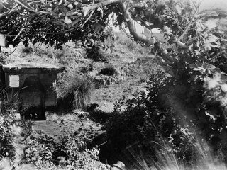
Krideia (Greek : Κρίδεια, Turkish : Kilitkaya) is a village in the Famagusta District of Cyprus, located on the Karpas Peninsula. It is under the de facto control of Northern Cyprus.

Greek language language spoken in Greece, Cyprus and Southern Albania

Greek is an independent branch of the Indo-European family of languages, native to Greece, Cyprus and other parts of the Eastern Mediterranean and the Black Sea. It has the longest documented history of any living Indo-European language, spanning more than 3000 years of written records. Its writing system has been the Greek alphabet for the major part of its history; other systems, such as Linear B and the Cypriot syllabary, were used previously. The alphabet arose from the Phoenician script and was in turn the basis of the Latin, Cyrillic, Armenian, Coptic, Gothic, and many other writing systems.

Turkish language Turkic language (possibly Altaic)

Turkish, also referred to as Istanbul Turkish, is the most widely spoken of the Turkic languages, with around ten to fifteen million native speakers in Southeast Europe and sixty to sixty-five million native speakers in Western Asia. Outside Turkey, significant smaller groups of speakers exist in Germany, Bulgaria, North Macedonia, Northern Cyprus, Greece, the Caucasus, and other parts of Europe and Central Asia. Cyprus has requested that the European Union add Turkish as an official language, even though Turkey is not a member state.

Famagusta District district of Republic of Cyprus

Famagusta District is one of the six districts of Cyprus. Its main town is the island's most important port, Famagusta.

Related Research Articles

Gerolakkos Place in Nicosia District, Cyprus

Gerolakkos is a village near Nicosia, the capital of Cyprus. It is immediately north of the Green Line. Nicosia International Airport is located about 2 km to its south-east. De facto, Gerolakkos is under the control of Northern Cyprus.

Kizilbash Place in Nicosia District, Cyprus

Kizilbash or Trachonas is a northern suburb of Nicosia, Cyprus. De facto, it is under the control of Northern Cyprus.

Argaki Place in Nicosia District, Cyprus

Argaki is a village in Cyprus, southeast of the city of Morphou. De facto, it is under the control of Northern Cyprus.

Avlona, Cyprus Place in Nicosia District, Cyprus

Avlona is a village in Cyprus, about halfway between Nicosia and Morphou. De facto, it is under the control of Northern Cyprus.

Kanlıköy Place in Nicosia District, Cyprus

Kanlıköy is a village in Cyprus, 5 km west of Gönyeli. De facto, it is under the control of Northern Cyprus.

Syrianochori Place in Nicosia District, Cyprus

Syrianochori is a village located in the Nicosia District of Cyprus. De facto, it is under the control of Northern Cyprus.

Kalo Chorio (Çamlıköy) Place in Nicosia District, Cyprus

Kalo Chorio is a village east of Lefka in Cyprus. De facto, it is under the control of Northern Cyprus.

Prastio, Nicosia Place in Nicosia District, Cyprus

Prastio is a village in Cyprus, 6 km southwest of Morphou. De facto, it is under the control of Northern Cyprus.

Fyllia Place in Nicosia District, Cyprus

Fyllia is a village in Cyprus, 9 km east of Morphou. De facto, it is under the control of Northern Cyprus.

Nikitas Place in Nicosia District, Cyprus

Nikitas is a village in Cyprus, 4 km southwest of Morphou. De facto, it is under the control of the Turkish Republic of Northern Cyprus.

Kazivera Place in Nicosia District, Cyprus

Kazivera or Ghaziveran is a small village in Cyprus, west of Morphou. De facto, it is under the control of Northern Cyprus.

Pentageia Place in Nicosia District, Cyprus

Pentageia is a village in Cyprus, west of Morphou and 5 km (3 mi) east of Karavostasi. De facto, it is under the control of Northern Cyprus.

Ampelikou Place in Nicosia District, Cyprus

Ampelikou is a village in Cyprus, west of Lefka. De facto, it is under the control of Northern Cyprus.

Loutros, Cyprus Place in Nicosia District, Cyprus

Loutros is a small village located in the Nicosia District of Cyprus, west of the town of Karavostasi. De facto, it is under the control of Northern Cyprus.

Kato Zodeia Place in Nicosia District, Cyprus

Kato Zodeia is a village on the island of Cyprus, east of Morphou. De facto, it is under the control of Northern Cyprus.

Agia, Cyprus Place in Nicosia District, Cyprus

Agia is a village in the Nicosia District of Cyprus, east of Tymvou and Ercan International Airport. It is under the de facto control of Northern Cyprus. The village was almost exclusively inhabited by Turkish Cypriots even before 1974. As of 2011, it had a population of 619.

Goufes Place in Famagusta District, Cyprus

Goufes is a village in Cyprus, 6 km northwest of Lefkoniko. It is under the de facto control of Northern Cyprus. As of 2011, it had a population of 100.

Flamoudi Place in Famagusta District, Cyprus

Flamoudi or Phlamoudhi is a village in the Famagusta District of Cyprus, located on the northern coast, east of Kyrenia. It is under the de facto control of Northern Cyprus.

Eptakomi village in Famagusta District, Cyprus

Eptakomi is a village in Cyprus, located on the Karpas Peninsula. It is under the de facto control of Northern Cyprus.

Masari Place in Nicosia District, Cyprus

Masari is a small village in Cyprus, east of Morphou. De facto, it is under the control of Northern Cyprus.

References

  1. In 1983, the Turkish Republic of Northern Cyprus unilaterally declared independence from the Republic of Cyprus. The de facto state is not recognised by any UN state except Turkey.
  2. KKTC 2011 Nüfus ve Konut Sayımı [TRNC 2011 Population and Housing Census](PDF), TRNC State Planning Organization, 6 August 2013, archived from the original (PDF) on November 6, 2013