Brochów is a village in Sochaczew County, Masovian Voivodeship, east-central Poland. It is the seat of Gmina Brochów and lies some 11 kilometres (7 mi) north of Sochaczew and 52 km (32 mi) west of Warsaw.

Famułki Brochowskie is a village in the administrative district of Gmina Brochów, within Sochaczew County, Masovian Voivodeship, in east-central Poland. It lies approximately 7 kilometres (4 mi) east of Brochów, 13 km (8 mi) north-east of Sochaczew, and 46 km (29 mi) west of Warsaw.
Famułki Królewskie is a village in the administrative district of Gmina Brochów, within Sochaczew County, Masovian Voivodeship, in east-central Poland. It lies approximately 9 kilometres (6 mi) east of Brochów, 16 km (10 mi) north-east of Sochaczew, and 44 km (27 mi) west of Warsaw.
Górki is a village in the administrative district of Gmina Brochów, within Sochaczew County, Masovian Voivodeship, in east-central Poland. It lies approximately 6 kilometres (4 mi) north of Brochów, 16 km (10 mi) north of Sochaczew, and 52 km (32 mi) west of Warsaw.
Gorzewnica is a village in the administrative district of Gmina Brochów, within Sochaczew County, Masovian Voivodeship, in east-central Poland. It lies approximately 10 kilometres (6 mi) north-east of Brochów, 19 km (12 mi) north-east of Sochaczew, and 46 km (29 mi) west of Warsaw.
Janów is a village in the administrative district of Gmina Brochów, within Sochaczew County, Masovian Voivodeship, in east-central Poland. It lies approximately 10 km (6 mi) north of Sochaczew and 52 km (32 mi) west of Warsaw.
Konary is a village in the administrative district of Gmina Brochów, within Sochaczew County, Masovian Voivodeship, in east-central Poland. It lies approximately 3 kilometres (2 mi) south-east of Brochów, 9 km (6 mi) north of Sochaczew, and 50 km (31 mi) west of Warsaw.
Łasice is a village in the administrative district of Gmina Brochów, within Sochaczew County, Masovian Voivodeship, in east-central Poland. It lies approximately 4 kilometres (2 mi) north of Brochów, 14 km (9 mi) north of Sochaczew, and 53 km (33 mi) west of Warsaw.
Lasocin is a village in the administrative district of Gmina Brochów, within Sochaczew County, Masovian Voivodeship, in east-central Poland. It lies approximately 7 kilometres (4 mi) south-east of Brochów, 11 km (7 mi) north-east of Sochaczew, and 46 km (29 mi) west of Warsaw.
Miszory is a village in the administrative district of Gmina Brochów, within Sochaczew County, Masovian Voivodeship, in east-central Poland. It lies approximately 5 kilometres (3 mi) north-east of Brochów, 14 km (9 mi) north-east of Sochaczew, and 48 km (30 mi) west of Warsaw.
Olszowiec is a village in the administrative district of Gmina Brochów, within Sochaczew County, Masovian Voivodeship, in east-central Poland. It lies approximately 6 kilometres (4 mi) south-east of Brochów, 10 km (6 mi) north-east of Sochaczew, and 47 km (29 mi) west of Warsaw.
Piaski Duchowne is a village in the administrative district of Gmina Brochów, within Sochaczew County, Masovian Voivodeship, in east-central Poland. It lies approximately 12 kilometres (7 mi) north-east of Brochów, 20 km (12 mi) north-east of Sochaczew, and 44 km (27 mi) north-west of Warsaw.
Piaski Królewskie is a village in the administrative district of Gmina Brochów, within Sochaczew County, Masovian Voivodeship, in east-central Poland. It lies approximately 12 kilometres (7 mi) north-east of Brochów, 20 km (12 mi) north-east of Sochaczew, and 44 km (27 mi) north-west of Warsaw.
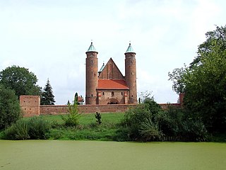
Plecewice is a village in the administrative district of Gmina Brochów, within Sochaczew County, Masovian Voivodeship, in east-central Poland. It lies approximately 5 kilometres (3 mi) south-east of Brochów, 8 km (5 mi) north-east of Sochaczew, and 49 km (30 mi) west of Warsaw.
Przęsławice is a village in the administrative district of Gmina Brochów, within Sochaczew County, Masovian Voivodeship, in east-central Poland. It lies approximately 5 kilometres (3 mi) north of Brochów, 16 km (10 mi) north of Sochaczew, and 54 km (34 mi) west of Warsaw.
Sianno is a village in the administrative district of Gmina Brochów, within Sochaczew County, Masovian Voivodeship, in east-central Poland. It lies approximately 4 kilometres (2 mi) east of Brochów, 12 km (7 mi) north-east of Sochaczew, and 49 km (30 mi) west of Warsaw.
Tułowice is a village in the administrative district of Gmina Brochów, within Sochaczew County, Masovian Voivodeship, in east-central Poland. It lies approximately 3 kilometres (2 mi) north-east of Brochów, 13 km (8 mi) north of Sochaczew, and 51 km (32 mi) west of Warsaw.
Wilcze Śladowskie is a village in the administrative district of Gmina Brochów, within Sochaczew County, Masovian Voivodeship, in east-central Poland. It lies approximately 4 kilometres (2 mi) north-east of Brochów, 15 km (9 mi) north of Sochaczew, and 50 km (31 mi) west of Warsaw.
Wólka Smolana is a village in the administrative district of Gmina Brochów, within Sochaczew County, Masovian Voivodeship, in east-central Poland. It lies approximately 5 kilometres (3 mi) south-east of Brochów, 10 km (6 mi) north-east of Sochaczew, and 48 km (30 mi) west of Warsaw.


