Kaunas is the second-largest city in Lithuania after Vilnius, the fourth largest city in the Baltic States and an important centre of Lithuanian economic, academic, and cultural life. Kaunas was the largest city and the centre of a county in the Duchy of Trakai of the Grand Duchy of Lithuania and Trakai Palatinate since 1413. In the Russian Empire, it was the capital of the Kaunas Governorate from 1843 to 1915.

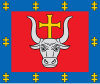
The Alytus District Municipality is a municipality in Alytus County, Lithuania, located in the Dzūkija ethnographic region.

Birštonas is a balneological resort and a spa town in Lithuania situated 30 km (19 mi) south of Kaunas on the right bank of the Nemunas River. Birštonas received its city rights 1529 and was appointed a city in 1966. The city is the administrative centre of the Birštonas municipality.

Simnas is small town on the river Dovinė between Simnas and Giluitis lakes, in Alytus district, Alytus county, in the south of Lithuania. It lies on the 131 a national primary road from Alytus to Kalvarija. Simnas is located within the ethnographical region Dzūkija. According to the 2022 data, 1209 people live in the town with 3148 in Simnas eldership. It is most populous settlement in Alytus district.

Veiveriai is a town in Lithuania. According to the 2011 census, its population was 1,167. It is located about 18 kilometres (11 mi) southwest of Kaunas on the road to Marijampolė.

Vandžiogala is a small town in Kaunas County, Kaunas district municipality in central Lithuania. It is located 20 km (12 mi) north of Kaunas city municipality next to Urka brook. A Holy Trinity church was built in Vandžiogala in 1830.

Lipliūnai is a village in Kėdainiai district municipality, in Kaunas County, central Lithuania. It is located by the Smilga river, near the Josvainiai forest. According to the 2011 census, the village has a population of 182 people.

Stasiūnai is a village in Kėdainiai district municipality, in Kaunas County, in central Lithuania. It is located by the Smilgaitis river and Keleriškiai pond, nearby Josvainiai forest. According to the 2011 census, the village has a population of 19 people. There is a "Ąžuolotas" forestry in the village.

Akademija is the largest town in Lithuania, located in Kaunas district municipality, Kaunas County. According to the 2011 census, the town has a population of 2,807 people. The town began to grow in 1964, when Lithuanian University of Agriculture was transferred to nearby Noreikiškės village. The town was created in 1999 of portions of Noreikiškės and Ringaudai settlements.
Vazgaikiemis is a village in Prienai district municipality, in Kaunas County, central Lithuania. According to the 2011 census, the town has a population of 41 people.

Berželė is a village in Kėdainiai district municipality, in Kaunas County, central Lithuania. According to the 2011 census, the village has a population of 47 people.
Guptilčiai is a village in Kėdainiai district municipality, in Kaunas County, in central Lithuania. According to the 2011 census, the village had a population of 38 people. It is located 1.5 kilometres (0.93 mi) from Pajieslys, between the Lapkalnys-Paliepiai Forest and the Šušvė river.

Krakės is a village in Kėdainiai district municipality, in Kaunas County, in central Lithuania. According to the 2011 census, the village had a population of 32 people. It is located all around Krakės town, scattered by the roads from Krakės to Bokštai, Kėdainiai and Grinkiškis. At the eastern side, nearby the Krakės-Dotnuva Forest there is old Jewish cemetery of the Krakės Jews.

Medininkai is a village in Kėdainiai district municipality, in Kaunas County, in central Lithuania. According to the 2011 census, the village had a population of 62 people. It is located 7 kilometres (4.3 mi) from Dotnuva town, 5 kilometres (3.1 mi) from Meironiškiai, nearby the Smilga river, surrounded by the Josvainiai Forest and the Krakės-Dotnuva Forest. There is a former school.

Vosbučiai is a village in Kėdainiai district municipality, in Kaunas County, in central Lithuania. According to the 2011 census, the village had a population of 8 people. It is located 2 kilometres (1.2 mi) from Pajieslys, on the right bank of the Šušvė river, by its tributary the Pečupė mouth. There are the Vosbučiai hillfort and the Vosbučiai outcrop in the village. The Lapkalnys-Paliepiai Forest begins west from the village. The Vocbučiai Botanical Zoological Sanctuary is located in Vosbučiai.

Josvainiai is a village in Kėdainiai district municipality, in Kaunas County, in central Lithuania. According to the 2011 census, the village had a population of 55 people. It covers an area next to the northwestern limit of Josvainiai town, nearby the Josvainiai Forest. There are nursery garden, petrol station, some agriculture companies.

Ruseiniai is a village in Kėdainiai district municipality, in Kaunas County, in central Lithuania. According to the 2011 census, the village had a population of 20 people. It is located 9 kilometres (5.6 mi) from Josvainiai, among the Šušvė, the Smilgaitis and the Amalis rivers, nearby the Josvainiai Forest.

Rugėnai is a village in Kėdainiai district municipality, in Kaunas County, in central Lithuania. According to the 2011 census, the village had a population of 19 people. It is located 6 kilometres (3.7 mi) from Pernarava, surrounded by the Pernarava-Šaravai Forest. There is a fire brigade.

Žostautai or Zaštautai is a village in Kėdainiai district municipality, in Kaunas County, in central Lithuania. According to the 2011 census, the village had a population of 53 people. It is located 4 kilometres (2.5 mi) from Pernarava, between the Lapkalnys-Paliepiai Forest and the Šušvė river. There is a farm.