Raseiniai District Municipality Raseinių rajono savivaldybė | |
|---|---|
 Pond near Raseiniai | |
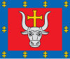
 Flag  Coat of arms | |
 Location of Raseiniai district municipality within Lithuania | |
 Map of Raseiniai district municipality | |
| Country | |
| Ethnographic region | Samogitia |
| County | |
| Capital | Raseiniai |
| Elderships | 12 |
| Area | |
• Total | 1,573 km2 (607 sq mi) |
| • Rank | 12th |
| Population (2021 [1] ) | |
• Total | 31,192 |
| • Rank | 23-24th |
| • Density | 20/km2 (51/sq mi) |
| • Rank | 34-35th |
| Time zone | UTC+2 (EET) |
| • Summer (DST) | UTC+3 (EEST) |
| Telephone code | 428 |
| Major settlements | |
| Website | www |
Raseiniai District Municipality is one of 60 municipalities in Lithuania.