Pasvalys District Municipality Pasvalio rajono savivaldybė | |
|---|---|
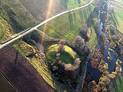 Migoniai mound | |
 Coat of arms | |
 Location of Pasvalys district municipality within Lithuania | |
 Map of Pasvalys district municipality | |
| Country | |
| Ethnographic region | Aukštaitija |
| County | |
| Capital | Pasvalys |
| Elderships | 11 |
| Area | |
• Total | 1,289 km2 (498 sq mi) |
| • Rank | 27th |
| Population (2021 [1] ) | |
• Total | 23,148 |
| • Rank | 36th |
| • Density | 18/km2 (47/sq mi) |
| • Rank | 37th |
| Time zone | UTC+2 (EET) |
| • Summer (DST) | UTC+3 (EEST) |
| Telephone code | 451 |
| Major settlements |
|
| Website | www |
Pasvalys District Municipality is one of 60 municipalities in Lithuania.
