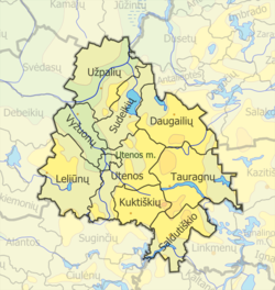
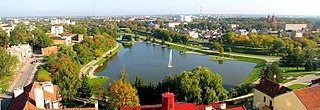
Utena County is one of ten counties in Lithuania. It is the country's most sparsely populated county. The capital and the largest city in the county is Utena, which is 95 km (59 mi) from Vilnius, the capital of Lithuania. On 1 July 2010, the county administration was abolished. Since that date, Utena County remains as the territorial and statistical unit.
Panevėžys County is one of ten counties in Lithuania. It is in the north-east of the country, and its capital is Panevėžys. On 1 July 2010, the county administration was abolished, and since that date, Panevėžys County remains as the territorial and statistical unit.

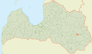
The Molėtai District Municipality is one of 60 municipalities in Lithuania.

The Îles Laval are an island grouping in the Rivière des Prairies in southwestern Quebec, part of the Hochelaga Archipelago.
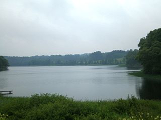
Tauragnas is the deepest lake in Lithuania reaching 62.5 metres of depth. The surface area is 5.13 km2 and average depth 18.7 m. It is situated in Aukštaitija National Park near Tauragnai in Utena County. This is also a lake with the highest altitude in Lithuania.
Lazılar is a village in the Tovuz Rayon of Azerbaijan. The village forms part of the municipality of Ağbaşlar.
Sakstagals Parish is an administrative unit of Rēzekne Municipality, Latvia.

Natá is a district (distrito) of Coclé Province in Panama. The population according to the 2000 census was 17,811. The district covers a total area of 608 km². The capital lies at the city of Natá.

Slatina is a village in the municipality of Šabac, Serbia. According to the 2002 census, the village has a population of 251 people.
Maćedonce is a village in the municipality of Medveđa, Serbia. According to the 2002 census, the village has a population of 81 people.

Vašuoka is a river of Anykščiai district municipality, Utena County, northeastern Lithuania. It flows for 34 kilometres (21 mi) and has a basin area of 128 km2 (49 sq mi).
Braunschweig or Landkreis Braunschweig was a district in Lower Saxony, Germany. The administrative centre of the district was the independent city of Braunschweig, which, however, was not part of the district itself.
Bikuškis Manor is a former residential manor near Sudeikiai, Utena district.
Degsnys Manor is a former residential manor in Degsnys village, Utena District Municipality, Lithuania.
Jotaučiai Manor was a former residential manor in Jotaučiai village, Utena District Municipality, Lithuania.
Eugenija Šimkūnaitė was a Lithuanian pharmacist, ethnographer, and herbalist.

Awutu Senya East Municipal District is one of the twenty-two districts in Central Region, Ghana. Originally it was formerly part of the then-larger Awutu Senya District on 29 February 2008, until the eastern part of the district was split off to create Awutu Senya East District on 28 June 2012, which it was later elevated to municipal district assembly status on 15 March 2018 to become Awutu Senya East Municipal District; thus the remaining part has been renamed as Awutu Senya West District. The municipality is located in the southeast part of Central Region and has Kasoa as its capital town.

Naistenmatka is the town and at the same time the administrative center of the municipality of Pirkkala in Pirkanmaa, Finland. Its population was 800 people in 1997, or about 15% of Pirkkala's population.
The Švenčionėliai massacre was the mass murder of Jews during the Holocaust on October 8-10 1941, at the former Soviet military training ground in Žeimena forest, about 1.5km away from Švenčionėliai in Lithuania, then known as the Generalbezirk Litauen in the Reichskommissariat Ostland.