Thirunindravur is a neighbourhood situated on the western part of Chennai, India. It is located around 29 km from Chennai Central railway station. Thirunindravur comes under Chennai Metropolitan Area. The neighbourhood is served by Thirunindravur railway station. It is famous for its temples. The Tiruninravur lake serves the neighbourhood for its water needs.

Dhariawad is a census town in Pratapgarh district (Rajasthan) in the state of Rajasthan, India. It is the administrative headquarters for Dhariawad Tehsil.

Edaganasalai is a panchayat town in Salem district in the state of Tamil Nadu, India.
Ezhudesam is a town panchayat in Kanniyakumari district in the state of Tamil Nadu, India.

Herohalli is a census town in Bangalore district in the Indian state of Karnataka.

Jamhore is a village and a notified area in Aurangabad district in the Indian state of Bihar. Jamhore is Famous For DEVI MAA TEMPLE, Place Of Worship. As of 2001 India census, Jamhore had a population of 8575. Males constitute 52% of the population and females 48%. Jamhore has an average literacy rate of 50%, lower than the national average of 59.5%: male literacy is 60%, and female literacy is 38%. In Jamhor, 18% of the population is under 6 years of age.
Kangeyanallur is a small locality in Vellore city in the Indian state of Tamil Nadu. This locality is located on the bank of river "Palar". Present(2011), vellore corporation mayor Mrs.P.Karthiyayini resides here.
Nangavaram is a panchayat town in Karur district in the Indian state of Tamil Nadu.
Odaiyakulam is a panchayat town in Coimbatore district in the Indian state of Tamil Nadu.

Peerkankaranai is a town in Southern part of the metropolitan city of Chennai in the Indian state of Tamil Nadu.
Poolambadi is a panchayat town in Perambalur district in the Indian state of Tamil Nadu. Located 1,921 kilometres (1,194 mi) from New Delhi, the Indian capital.

Ramjibanpur is a city and a municipality in Paschim Medinipur district in the Indian state of West Bengal.

Singaperumal Kovil is a census town located close to Chengalpet and Maraimalai Nagar in Chengalpattu taluk, Chengalpattu district in the Indian state of Tamil Nadu.

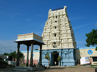
Thadicombu is a panchayat town in Dindigul district in the Indian state of Tamil Nadu. It has a famous temple for Lord Vishnu Soundarraja perumal temple considered to be as sacred as the Kallazhagar Temple near Madurai. Arulmighu Soundarraja Perumal is found in the sleeping posture in this temple and it is said this place was previously known as Thaalamaapuri. Though it is a Vaishnava temple, the sthala vriksha is the vilva tree. The special features of the temple are a separate shrine for the Hindu God of love Manmatha and Rathi. It is also has a shrine for Lord Svarna Akarshana Bhairava which is usually found only in Shiva temples.
Thenkarai is a suburban area in Coimbatore City Municipal Corporation, in the Indian state of Tamil Nadu. It is in the western suburbs of Coimbatore. It recently merged with the Coimbatore Corporation limits. Thenkarai is one of the town panchayats in Coimbatore and consists of small villages such as Sennanur, Mathipalayam, Karadimadai, Thaneer Panthal, Appachimaar Kovil, Challikkuzhi and Krishnavarayam Pudur.
Thevaram is a town in Theni district in the Indian state of Tamil Nadu. Thevaram is located in Tamil Nadu near on border of Kerala at the Eastern side foot-hill of the Western Ghats. It is connected with State Highway SH100.
Myladi is a panchayat town in Kanniyakumari district in the Indian state of Tamil Nadu.
Uthukottai is a border town and panchayat town in Tamil Nadu, next to Andhra Pradesh, located on the banks of the Arani river. The town features a channel which helps to direct water from the Krishna river for local irrigation.
Shirahatti is a panchayat town in Gadag district in the Indian state of Karnataka.
Kerur is a City in Bagalkot district in Karnataka, which located on NH 218. It has an average elevation of 617 meters (2024 feet). It's a birthplace of Jagadish Shettar, a former Chief Minister of Karnataka. Kerur is a Town Panchayat city in district of Bagalkot, Karnataka. The Kerur city is divided into 16 wards for which elections are held every five years. The Kerur Town Panchayat has population of 19,731 of which 9,929 are males while 9,802 are females as per report released by Census India 2011.


