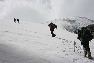
Copa is a mountain in the Andes of Peru whose summit reaches about 6,188 metres (20,302 ft) above sea level. It is situated in the Ancash Region, Asunción Province, Chacas District, and in the Carhuaz Province, Marcará District, south-east of Hualcán.
Qarwaqucha, also known as Qarwa Punta or Flery Punta, is a mountain in the Cordillera Negra in the Andes of Peru. It is located in the Ancash Region, Santa Province, Cáceres del Perú District, near a little lake of that name. It reaches a height of 5,070 m (16,634 ft).

The Pariacaca mountain range, also called Huarochirí mountain range lies in the Andes of Peru. It is located in the Junín Region, in the provinces of Jauja and Yauli, and in the Lima Region, in the provinces of Huarochirí and Yauyos. It is part of the Cordillera Central of Peru.
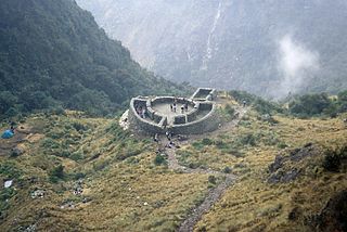
Runkuraqay or Runku Raqay is an archaeological site on a mountain of the same name in Peru located in the Cusco Region, Urubamba Province, Machupicchu District. It is situated southeast of the archaeological site Machu Picchu and south of the Vilcanota river. The ruins lie on the southern slope of the mountain Runkuraqay near the Runkuraqay pass, northeast of the archaeological site Sayacmarca and southeast of the site Qunchamarka.

Kikash or Pampash is a mountain in the Wallanka mountain range in the Andes of Peru, about 5,338 m (17,513 ft)) high. It is located in the Ancash Region, Bolognesi Province, Aquia District. It is situated southwest of the main range in a small subrange called Waman Wiqi. There is a small lake named Waman Wiqi southeast of Kikash. The stream Pampash originates on the west side of the mountain,flowing west to the Patiwillka River.

Lake Auquiscocha or Auquishcocha is a lake in the Cordillera Blanca in the Andes of Peru located in the Ancash Region, Carhuaz Province, Shilla District. It is situated at a height of about 4,303 metres (14,117 ft). Auquiscocha lies at the foot of Chequiaraju in the north and Hualcán in the southeast, southwest of Lake Chequiacocha.
Warahirka or Wara Hirka is a mountain with an archaeological site of the same name in Peru. It is situated in the Huánuco Region, Yarowilca Province, Pampamarca District, about 1.5 km from Pampamarca, near La Florida and Warahirka (Huarajirca).

Tiktiqucha is a lake in Peru located in the Lima Region, Huarochirí Province, Chicla District. Tiktiqucha lies near the Antikuna mountain pass, southwest of a lake named Waqraqucha and southeast of the peak of Tikti Mach'ay.

Carhuascancha or Tumarinaraju is a mountain in the Cordillera Blanca in the Andes of Peru with an elevation of 5,648 metres (18,530 ft) or 5,668 metres (18,596 ft) above sea level. It is situated in the Ancash Region, Huari Province, Huantar District, and in the Huaraz Province, Huaraz District. Carhuascancha lies north-west of Huantsán.
Auqui is a mountain in the Cordillera Blanca in the Andes of Peru, about 4,800 m (15,748 ft) high. It is situated in the Ancash Region, Huari Province, Huari District. Auqui lies southeast of Jacabamba.

Matagaga is a mountain on the eastern extensions of the Cordillera Blanca in the Andes of Peru, about 4,400 metres (14,436 ft) high. It is situated in the Ancash Region, Huari Province, Chavin de Huantar District. Mata Qaqa lies east of the Rangracancha valley and northeast of the Challhua valley. The Mosna River flows along its northern slopes.
Minapata is a mountain in the southern part of the Cordillera Blanca in the Andes of Peru, about 5,400 m (17,700 ft) high. It is located in the Ancash Region, Bolognesi Province, Aquia District, and in the Recuay Province, Catac District. Minapata lies south of Challwa and northeast of Qiwllarahu.
Ukrupata is a mountain in the Andes of Peru, about 5,300 m (17,388 ft) high. It is situated in the Lima Region, Huarochirí Province, on the border of the districts of Chicla and Carampoma. Ukrupata lies northwest of Millpu and east of Wamp'ar and the two lakes named Wamp'arqucha and Wachwaqucha.
Yana Wachuku is a 5,012-metre-high (16,444 ft) mountain in the Andes of Peru. It is located in the Junín Region, Yauli Province, on the border of the districts of Carhuacayan and Marcapomacocha. It lies southeast of Allqay.
Alcay is a 5,300-metre-high (17,388 ft) mountain in the north of the Huayhuash mountain range in the Andes of Peru. It is located in the Huánuco Region, Lauricocha Province, Queropalca District. Alcay lies northwest of a lake named Carhuacocha, east of Mituraju and southeast of Rondoy. The little lake northeast of the mountain is Alcaycocha.
Rukutu is a mountain in the Cordillera Central in the Andes of Peru, about 4,800 metres (15,748 ft) high. It is situated in the Lima Region, Huarochirí Province, on the border of the districts of Huarochirí and San Damian. It lies south of Suyruqucha and Suqlla, and northeast of Wamanripa.
Uqsha Wallqa is a mountain in the Paryaqaqa mountain range in the Andes of Peru, about 5,000 metres (16,404 ft) high. It is situated in the Lima Region, Huarochirí Province, on the border of the districts of San Mateo and Quinti. It lies northwest of Paqcha and Wararayuq and southeast of Wamanripa.
Ancaracra or Anka Raqra is a mountain in the northern part of the Cordillera Blanca in the Andes of Peru which reaches a height of approximately 4,400 m (14,436 ft). It is located in the Ancash Region, Corongo Province, Cusca District. Ancaracra lies southwest of Gaico and southeast of Pacra.
Hatun Kunka is a mountain in the Cordillera Negra in the Andes of Peru which reaches a height of approximately 4,400 m (14,436 ft). It is located in the Ancash Region, Huaylas Province, Pamparomas District, and in the Yungay Province, Quillo District.

