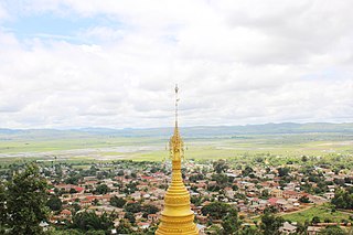
Kunlon is a small town in Taunggyi Township, Taunggyi District, Shan State, eastern Burma. It contains a lake and Kunlon Dam. It lies along National Road 43, north of Taunggyi and south of Yedwingyi. [1] [2]
Kunlon is a small town in Taunggyi Township, Taunggyi District, Shan State, eastern Burma. It contains a lake and Kunlon Dam. It lies along National Road 43, north of Taunggyi and south of Yedwingyi. [1] [2]

Taunggyi is the capital and largest city of Shan State, Myanmar (Burma) and lies on the Thazi-Kyaingtong road at an elevation of 4,712 feet (1,436 m), just north of Shwenyaung and Inle Lake within the Myelat region. Taunggyi is the fifth largest city of Myanmar, and has an estimated population of 380,665 as of 2014. The city is famous for its hot air balloon festival held annually on the full moon day of Tazaungmon.

Kalaw is a hill town in the Shan State of Myanmar. It is located in Kalaw Township in Taunggyi District.

Heho is a small town in Kalaw Township, Taunggyi District, Shan State of Myanmar. It is the primary air gateway to tourist areas such as Inle Lake.
Battle of Yunnan-Burma Road was the name of the Chinese intervention to aid their British allies in the 1942 Burma Campaign. Its forces were composed of the Fifth, Sixth and Sixty-sixth Army under the command of the Chinese Expeditionary Force in Burma, commanded by Lt. General Joseph Stilwell, Lt. General Luo Zhuoying was his executive officer.

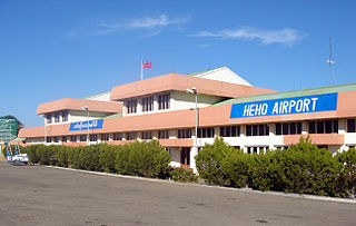
Heho Airport is an airport serving Heho, a town in Kalaw Township, Taunggyi District, Shan State, Myanmar. It is the main airport serving Inle Lake and Taunggyi the former of the top tourist destinations of Myanmar.

Taunggyi Township is a township of Taunggyi District in the Shan State of Myanmar. The principal town is Taunggyi.

Nyaungshwe Township is a township of Taunggyi District in Shan State, Myanmar. It is located south of Sakangyi and south-west of Taunggyi. The principal town is Nyaungshwe.

Taunggyi District is a district of Shan State in Burma. The principal town and administrative center is Taunggyi. This district has 12 towns and 3001 villages.

Hopong (Burmese: ဟိုပုန်းမြို့( is a town in the Shan State of eastern Burma. Hopong is the capital of Pa'O Self-Administered Zone. It is located in Hopong Township in Taunggyi District.

Hsi Hseng or Hsi-hseng is a town in the Shan State of eastern Burma. It is located in Hsi Hseng Township in Taunggyi District and lies along National Highway 5. It is connected to Loisawn in the north and Tongkaw in the south. The area is a known producer of opium and methamphetamine; poppy fields and a methamphetamine factory have been reported in Hsi Hseng. Gee Dong was killed near Hsi Hseng in 1974.

Nawnghkio, variously spelt Naunghkio, Naungcho or Nawngcho, is a town in Kyaukme District, in northern Shan State, Burma. It is the principal town and administrative seat of Nawnghkio Township. It is connected to Mandalay, Pyin U Lwin, Kyaukme, Hsipaw and Lashio by road and rail and by road to Taunggyi via National Road 43. Asia World Company won the contract to rebuild part of the road in 2002. Originally on the Mandalay-Lashio Road, after Pyin U Lwin and before Kyaukme, Nawnghkio is on what is now the Mandalay-Muse Road, part of the Asian Highway Route 14 (AH14).
Chaunggauk is a village in Taunggyi Township, Taunggyi District, Shan State, of Burma (Myanmar). It lies to the north of the town of Taunggyi.

Sike Khaung or Sai Khao is a village in Hsi Hseng Township, Taunggyi District, Pa'O Self-Administered Zone, in the Shan State of eastern Myanmar. It is located north of the township capital of Hsi Hseng by National Highway 5. Nawnge and Lothkan are located to the west, Loimut to the southeast, and Hsohsa to the northeast.
Lothkan is a village in Taunggyi Township, Taunggyi District, in the Shan State of eastern Burma. It is located west of the town of Loisawn. A road connects it to Nawnge in the east and Nampan on the south shore of Inle Lake in the west.
Pawnyang is a village in Hsi Hseng Township, Taunggyi District, in the Shan State of eastern Burma. It is located to the east of the township capital of Hsi Hseng. It is located northeast of the town of Loisawn. It is a primary agricultural village, with extensive fields around it.
Veng-lek is a village in Hsi Hseng Township, Taunggyi District, in the Shan State of eastern Burma. It is located to the south of Tongkaw along the National Highway 5. A river runs to the west of the village from north to south.
Maihpit is a village in Hsi Hseng Township, Taunggyi District, in the Shan State of eastern Burma. It is located southwest of Nawnghkathpa and Loisawn. It is a primarily agricultural village with extensive fields surrounding it.
Htisöm is a village in Hsi Hseng Township, Taunggyi District, in the Shan State of eastern Burma. It is located southeast of Loisawn, near Loimut. It is a primarily agricultural village with extensive fields surrounding it.
Sakangyi is a town in Taunggyi Township in Taunggyi District in the Shan State of eastern Burma. It is located west along National Highway 4 from Aye Thar Yar and Taunggyi. The National Road 43 begins in the eastern part of the town and connects National Highway 4 to National Highway 3 in the north at Nawnghkio. It is connected via National Highway 4 to Heho in the west.