
The Kura is an east-flowing river south of the Greater Caucasus Mountains which drains the southern slopes of the Greater Caucasus east into the Caspian Sea. It also drains the north side of the Lesser Caucasus, while its main tributary, the Aras, drains the south side of those mountains. Starting in northeastern Turkey, the Kura flows through Turkey to Georgia, then to Azerbaijan, where it receives the Aras as a right tributary, and enters the Caspian Sea at Neftçala. The total length of the river is 1,515 kilometres (941 mi).
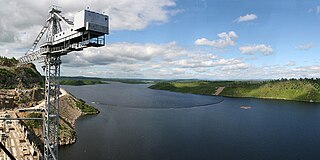
The Bureya is a south-flowing, left tributary of the Amur river in Russia. It is 623 kilometres (387 mi) long, and has a drainage basin of 70,700 square kilometres (27,300 sq mi). Its name comes from the Evenk word birija, meaning river.
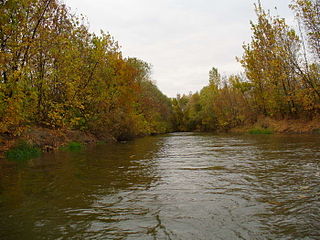
The Mius is a river in Eastern Europe that flows through Ukraine and Russia. It is 258 kilometres (160 mi) long, and has a drainage basin of 6,680 square kilometres (2,580 sq mi).

The Seym or Seim is a river that flows westward in Russia and Ukraine. It is 748 kilometres (465 mi) long and its basin area about 27,500 square kilometres (10,600 sq mi). It is the largest tributary of the Desna.

Klistervatnet (Norwegian) or Клистерватн (Russian) is a lake that lies on the border between Norway and Russia. The 17.2-square-kilometre (6.6 sq mi) lake lies on the river Pasvikelva in Sør-Varanger Municipality in Finnmark county, Norway and the Pechengsky District of Murmansk Oblast in Russia. The lake is about 10 kilometres (6.2 mi) long and 2 kilometres (1.2 mi) wide. The lake is located north of lake Bjørnevatnet.
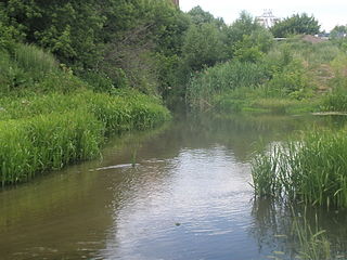
The Kur is a river in central Russia. It flows through the city of Kursk, where it falls into the Tuskar, which then falls into the Seym. The name relates to a dialect word kur'ya, which itself may represent a borrowing from Komi kurya 'bay'.

The water bodies of Azerbaijan were formed over a long geological timeframe and changed significantly throughout that period. This is particularly evidenced by remnants of ancient rivers found throughout the country. The country's water systems are continually changing under the influence of natural forces and human-introduced industrial activities. Artificial rivers (canals) and ponds are a part of Azerbaijan's water systems.

The Nanai language is spoken by the Nanai people in Siberia, and to a much smaller extent in China's Heilongjiang province, where it is known as Hezhe. The language has about 1,400 speakers out of 17,000 ethnic Nanai, but most are also fluent in Russian or Chinese, and mostly use one of those languages for communication.

The Chumysh is a river in Russia, a right branch of the Ob River. It enters the Ob 88 kilometres (55 mi) downriver from Barnaul. The Chumysh begins at the confluence of the Kara-Chumysh and the Tom-Chumysh rivers in Kemerovo Oblast. The Chumysh is 644 kilometres (400 mi) long, and it drains a basin of 23,900 square kilometres (9,200 sq mi).
The Udege language is the language of the Udege people. It is a member of the Tungusic family. It is a moribund language, and classified as critically endangered by the UNESCO Atlas of the World’s Languages in Danger.
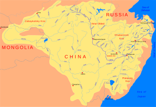
The Urmi is a river in Khabarovsk Krai of Russia. It is 458 kilometres (285 mi) long and drains a basin of 15,000 square kilometres (5,800 sq mi). There are some 1,040 lakes in the Urmi basin; their total surface area is more than 32 square kilometres (12 sq mi).

The Oskil or Oskol is a south-flowing river in Russia and Ukraine. It arises roughly between Kursk and Voronezh and flows south to join the Siverskyi Donets which flows southeast to join the Don. It is 472 kilometres (293 mi) long, with a drainage basin of 14,800 square kilometres (5,700 sq mi).

The Razdolnaya or Suifen is a river in People's Republic of China and Russia. It flows into the Amur Bay of the Sea of Japan.
Kili, known as Hezhe or more specifically Qile'en in Chinese and also as the Kur-Urmi dialect of Nanai, is a moribund Tungusic language of Russia and China. Nanai is a Southern Tungusic language, and Kili has traditionally been considered one of the diverse dialects of Nanai, but it "likely belongs to the northern group".

Progress M-19M, identified by NASA as Progress 51P, is a Progress spacecraft used by Roskosmos to resupply the International Space Station during 2013. Progress M-19M was launched on a standard 2-day rendezvous profile towards the ISS. The 19th Progress-M 11F615A60 spacecraft to be launched, it had the serial number 419 and was built by RKK Energia.

Kura or Kurkosa, also known as Kurinskiy in the Russian language, is the largest island of Azerbaijan. It lies in the Caspian Sea, off the coast of the Aran Region, 33 kilometers (21 mi) to the south of Neftchala and about 150 kilometers (93 mi) to the SSE of Baku.

The Chilik, Shilik, or Shelek is a major flowing river in the Almaty Region in the Republic of Kazakhstan, one of the largest left tributaries of the Ili, and the main waterway of southeastern Kazakhstan. The Bartogay reservoir has been created on the river, from where the Great Almaty canal begins.

The Tunguska is a river in the Khabarovsk Krai in Russia. It is a left tributary of the Amur. It is formed at the confluence of the rivers Kur and Urmi. It flows into the Amur about 15 km north of the city Khabarovsk. The Tunguska is 86 kilometres (53 mi) long, and has a drainage basin of 30,200 square kilometres (11,700 sq mi).
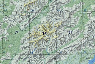
The Badzhal Range is a mountain range in Khabarovsk Krai, Russian Far East.


