
Masaka District is a district in Buganda Kingdom in Uganda. Its main town is Masaka City, whose estimated population in 2011 was 74,100.
Masaka is a district and a city in the Buganda Region in southern Uganda, west of Lake Victoria. The city is the headquarters of Masaka District.

Mbarara City is a city in the Western Region of Uganda and the second largest city in Uganda after Kampala. The city is divided into 6 boroughs of Kakoba Division, Kamukuzi Division, Nyamitanga Division, Biharwe Division, Kakiika Division, Nyakayojo Division. It is the main commercial centre of most of south western districts of Uganda and the site of the district headquarters. In May 2019, the Uganda's cabinet granted Mbarara a city status, which started on 1 July 2020.

Uganda Martyrs University (UMU) is a private University affiliated with the Roman Catholic Church in Uganda. The University is owned by the Episcopal Conference of the Catholic Bishops of Uganda. It is licensed by the Uganda National Council for Higher Education. UMU consists of seven Faculties, two Institute, six Campuses, nine Departments, and three schools. As of March 2022, total student enrollment is 4,632. Of these, about 1,500 students were residential, while nearly 3,000 students were enrolled in UMU's distance learning programs. The number of staff members was over 400.

Wakiso is a city in the Central Region of Uganda. It is the headquarters of Wakiso District.

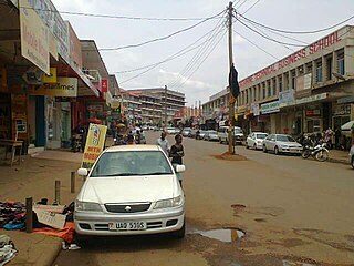
Lyantonde is a town in the southern part of the Central Region of Uganda. It is the main municipal, administrative, and commercial center of Lyantonde District.
Lukaya is a town in the Kalungu District of the Central Region of Uganda.
Masaka Regional Referral Hospital, commonly known as Masaka Hospital is a hospital in the city of Masaka, in south-central Uganda. It is the referral hospital for the districts of Kalangala District, Lyantonde, Masaka and Sembabule, Kalungu, Lwengo, Bukomansimbi and Rakai.
Finance Trust Bank (FTB), commonly called Finance Trust, is a commercial bank in Uganda. It is licensed by the Bank of Uganda, the central bank and national banking regulator.
Lwengo is a town in Central Uganda. It is the chief municipal, administrative and commercial center of Lwengo District. It was known as Mbiriizi, prior to 1 July 2010.
Makenke is a neighborhood within Mbarara City, in the Western Region of Uganda.
Sanga, is an urban center in the Kiruhura District, Ankole sub-region, in the Western Region of Uganda.
Nyakahita is a sparsely populated settlement in the Western Region of Uganda.
The Masaka–Mbarara Road is a road in the Central and Western Regions of Uganda, connecting the cities of Masaka in Masaka District, Central Region and Mbarara in Mbarara District, Western Region.
Mbarara–Ishaka Road is a road in the Western Region of Uganda, connecting the towns of Mbarara in Mbarara District with Ishaka in Bushenyi District.
Lyantonde General Hospital, also Lyantonde District Hospital or Lyantonde Government Hospital, is a hospital in the Central Region of Uganda.
Kawanda–Birembo High Voltage Power Line is a high voltage electricity power line, under construction, connecting the high voltage substation at Kawanda, in Uganda to another high voltage substation at Birembo, in Rwanda.
Mbiriizi is a town in the southern part of the Central Region of Uganda. It is the administrative center of Lwengo District.
Lwensinga is a town in the Buganda Region of Uganda.

