Lwensinga | |
|---|---|
 Lwensinga Location in Uganda | |
| Coordinates: 00°23′31″S31°27′35″E / 0.39194°S 31.45972°E | |
| Country | |
| District | Lwengo District |
| Sub-county | Lwengo sub-county |
| Elevation | 4,124 ft (1,257 m) |
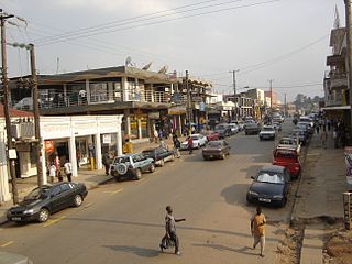
Lwensinga is a town in the Buganda Region of Uganda. [1]
Lwensinga | |
|---|---|
| Lwensinga Location in Uganda | |
| Coordinates: 00°23′31″S31°27′35″E / 0.39194°S 31.45972°E | |
| Country | |
| District | Lwengo District |
| Sub-county | Lwengo sub-county |
| Elevation | 4,124 ft (1,257 m) |
Lwensinga is a town in the Buganda Region of Uganda. [1]
The town is in Mbiriizi Parish, in Lwengo sub-county, Lwengo District. [2] Lwensinga lies along the Masaka–Mbarara Road, approximately 34 kilometres (21 mi), west of Masaka, the nearest large city. [3] This is approximately 168 kilometres (104 mi), by road, southwest of Kampala, the capital and largest city of Uganda. [4] The geographical coordinates of Lwensinga are: 0°23'31.0"S, 31°27'35.0"E (Latitude:-0.391944; Longitude:31.459722). [5] The town lies at an average elevation of 1,257 metres (4,124 ft), above sea level. [6]
Lwensinga is the southern terminus of the 37 kilometres (23 mi) Sembabule–Mateete–Lwensinga Road. [7] Here, this road joins the Masaka–Mbarara Road, which passes through the town, in a general east to west direction. [8] Finance Trust Bank, a commercial bank with headquarters in Kampala, maintains a branch in Lwensinga. [9] The town is also home to Kyamaganda Health Centre II, [8] owned and administered by the Uganda Catholic Medical Bureau. [10]

Masaka District is a district in Buganda Kingdom in Uganda. Its main town is Masaka, whose estimated population in 2011 was 74,100.

Sembabule District is a district in the Central Region of Uganda. The town of Sembabule is the site of the district headquarters. Other urban centers in the district include Lwemiyaga and Ntuusi.
Mbarara City is a city in the Western Region of Uganda. It is the main municipal, administrative, and commercial centre of Mbarara District and the site of the district headquarters.

Sembabule is a town in Sembabule District in the Central Region of Uganda. The town is the main municipal, administrative, and commercial center of the district and the site of the district headquarters.
Lyantonde is a town in the southern part of the Central Region of Uganda. It is the main municipal, administrative, and commercial center of Lyantonde District.
Kyazanga is a town council in the Lwengo District of the Central Region of Uganda.
Masaka Regional Referral Hospital, commonly known as Masaka Hospital is a hospital in the city of Masaka, in south-central Uganda. It is the referral hospital for the districts of Kalangala District, Lyantonde, Masaka and Sembabule, Kalungu, Lwengo, Bukomansimbi and Rakai.
Kanoni, also Kanoni, Gomba or Kanoni–Gomba, is a town in the Central Region of Uganda. It is the commercial, administrative, and political headquarters of Gomba District.
Lwengo is a town in Central Uganda. It is the chief municipal, administrative and commercial center of Lwengo District. It was known as Mbiriizi, prior to 1 July 2010.
Nyakahita is a sparsely populated settlement in the Western Region of Uganda.
Kazo is a town in the Western Region of Uganda.
Kabulasoke is a town in Gomba District in the Central Region of Uganda.
Villa Maria, is a village in Kalungu District in the Central Region of Uganda.
The Masaka–Mbarara Road is a road in the Central and Western Regions of Uganda, connecting the cities of Masaka in Masaka District, Central Region and Mbarara in Mbarara District, Western Region.
Mbarara–Ishaka Road is a road in the Western Region of Uganda, connecting the towns of Mbarara in Mbarara District with Ishaka in Bushenyi District.
Lyantonde General Hospital, also Lyantonde District Hospital or Lyantonde Government Hospital, is a hospital in the Central Region of Uganda.
Mateete is a town in the Central Region of Uganda.
Lwemiyaga is a settlement in the Central Region of Uganda. The town is the site of the county headquarters.
Ntuusi is a settlement in the Central Region of Uganda.
Rubanda is a town in the extreme southwest of the Western Region of Uganda. It serves as the commercial, political and administrative center of Rubanda District.
Capital: Lwengo | ||
| Towns and villages |  | |
| Economy |
| |
| Transport |
| |
| Health |
| |