
Stann Creek District is a district in the south east region of Belize. According to the 2010 census, the district had a population of 32,166 people. Its capital is the town of Dangriga, formerly known as "Stann Creek Town." Stann comes from "stanns," or safe havens used by colonialists coming from the "old world" to the "new world."

Toledo District is the southernmost and least populated district in Belize. Punta Gorda is the District capital. According to the Human Development Index (HDI), it is the second most developed region in the country. The district has a diverse topography which features rainforests, extensive cave networks, coastal lowland plains, and offshore cays. Toledo is home to a wide range of cultures such as Mopan, Kekchi Maya, Creole, Garifuna, East Indians, Mennonites, Mestizos, and descendants of US Confederate settlers.

Corozal District is the northernmost district of the nation of Belize. The population was 33,894 in 2000. The district capital is Corozal Town.

Orange Walk District is a district in the northwest of the nation of Belize, with its district capital in Orange Walk Town.

Hattieville is a village in the Belize District of the nation of Belize. It is located at 17N 88W, at an elevation of 196 feet above mean sea level, and has a population of about 1,300 people. Hattieville was established as a refugee camp after Hurricane Hattie made many people homeless in Belize City when it hit in 1961, but it became a permanent town.
Louisville is a village in the Corozal District of the nation of Belize, located at 18°19′N88°30′W. According to the 2000 census, it had a population of 655 people mainly from Maya Mestizo ancestry.

Placencia is a small village located in the Stann Creek District of Belize.

Indian Church is a small remote village in the Orange Walk District of Belize. It is located on the west bank of New River, neighbouring the town of San Carlos to its south, and the Maya ruins of Lamanai to its north. According to the 2010 census, Indian Church has a population of 267 people in 66 households. The village is named for the historic Spanish churches recovered among the ancient Maya ruins. The residents lived among the ruins until 1991 when the Government of Belize established the 2-square-mile (5.2 km2) Lamanai Archaeological Reserve maintained by Belize's Institute of Archaeology.

Hopkins Village is a coastal village in eastern Belize.
Gardenia is a village in Belize District, Belize located about 20 miles (32 km) north of Belize City.
Burrell Boom is on the Belize River twenty miles above Belize City, Belize. Tourists pass through this historic village on their way to the Community Baboon Sanctuary, where the population of black howler monkeys has grown to over 2,000.
Flowers Bank is a village in Belize in Belize District. It is a famous place in Belizean history due to its defence of the then British Honduras by not fleeing in the face of Spanish invasion from Yucatán.
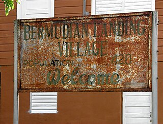
Bermudian Landing is a village in the nation of Belize, located near Scotland Halfmoon in Belize District. The name comes from the Bermuda grass planted by the early loggers to feed their oxen, who were used to drag the mahogany to the landing.
Double Head Cabbage is a village in Belize located in Belize District.
Freetown Sibun is a populated settlement located in the nation of Belize. It is a mainland village that is located in Belize District along the Sibun River.
Pusilhá is an archaeological site in Belize. The location of this Late Classic Maya urban complex, along the east and west flow of trade, made the city a major transfer point for economic activities in the whole region. In addition, the city gave archaeologists a historical view of a secondary Maya site. Large and extended excavation efforts have changed the overall picture of Maya social and political relationships between larger and smaller cities and challenged the prevailing view of conquest and absorption of smaller cities into the larger cities in the region. The research conducted at Pusilhá began in 1927 and continues to this day.

La Milpa is an archaeological site and an ancient Maya city within the Three River region of Northwest Belize bordering Mexico and Guatemala. La Milpa is located between the sites of Rio Azul and Lamanai. Currently, La Milpa lies within the nature preserve owned by the Programme for Belize, a non-profit organization. PfB acquired land for the preserve from the Coco-Cola Company, who purchased land in Belize in 1988 with the goals of tearing down the rainforest to create a citrus plantation, however donated the land to conservation and management project in 1990 and 1992. Following Caracol and Lamanai, La Milpa is the third largest site in Belize with the Main Plaza alone covering 18,000 square meters, making it one of the largest in the entire Maya region.

The extensive trade networks of the Ancient Maya contributed largely to the success of their civilization spanning three millennia. Maya royal control and the wide distribution of foreign and domestic commodities for both population sustenance and social affluence are hallmarks of the Maya visible throughout much of the iconography found in the archaeological record. In particular, moderately long-distance trade of foreign commodities from the Caribbean and Gulf Coasts provided the larger inland Maya cities with the resources they needed to sustain settled population levels in the several thousands. Though the ruling class essentially controlled the trade economy, a middle merchant class supervised import and export from cities and trade ports. Not much is known of the Maya merchant class; however, merchants of royal lineage are sometimes represented in the iconography. Notably, a canoe paddle often accompanies the royal merchant depictions, signifying their association with marine resources.
Maya Beach Village is a village in the Stann Creek District of Belize located on the Placencia Peninsula, between Riversdale Village and Seine Bight. Based on the 2010 national census, Maya Beach has a population of 225 year round residents. The village is home to a number of resorts, boutique hotels, and vacation homes. Notable resorts include Maya Beach Hotel Bistro, Belize Ocean Club, and Naia Resort & Spa. The village is often considered a part of the peninsula's largest community and namesake, Placencia, which is a short drive from the village. Maya Beach is served by the Placencia Airport, with the closest international hub being Philip S. W. Goldson International Airport in Belize City.
Seine Bight is a village on the Placencia Peninsula located in the Stann Creek District of Belize. It is located 2 and a half miles south of Maya Beach Village and North of the village of Placencia. This small village has roughly 1,000 inhabitants, mostly Garifuna people who subsist on fishing, hunting, and homegrown vegetables. The early settlers named their village for their favored fishing tackle, Seine fishing and a bight, a bend or curve in a coastline.
