Estadi Municipal de la Nova Creu Alta is a multi-use stadium in Sabadell, Catalonia, Spain. It is currently used mostly for football matches and hosts the home matches of CE Sabadell FC. The address of the stadium is Plaça Olímpia s/n, 08206 Sabadell, and the offices of the club are in the stadium. The stadium holds 11,981 people, after the last reform. The stadium was built in 1967. During the 1992 Summer Olympics it hosted six football matches.

Cepeda de la Mora is a town located in the province of Ávila within the autonomous community of Castile-Leon in north-western Spain.
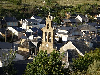
Priaranza del Bierzo is a village and municipality located in the region of El Bierzo. According to the 2006 census (INE), the municipality has a population of 918 inhabitants.
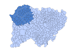
Folgoso de la Ribera is a village and municipality located in the region of El Bierzo. According to the 2010 census (INE), the municipality has a population of 1,233 inhabitants.
Santo Domingo de Silos is a municipality and town located in the province of Burgos, Castile and León, Spain. According to the 2004 census (INE), the municipality has a population of 292 inhabitants. The village is preserved as a conjunto histórico.
Cantalejo is a municipality located in the province of Segovia, Castile and León, Spain. According to the 2004 census (INE), the municipality has a population of 3,622 inhabitants. The dialect known as Gacería was spoken here.
Torreadrada is a municipality located in the province of Segovia, Castile and León, Spain. The town is located about 83 kilometers northeast of Segovia, between Castro de Fuentidueña and Aldeanueva de la Serrezuela. According to the 2010 census (INE), the municipality has a population of 105 inhabitants.
Berlanga de Duero is a municipality located in the province of Soria, Castile and León, Spain. According to the 2004 census (INE), the municipality has a population of 1,099 inhabitants.
Villanueva de los Caballeros es un municipio situado en la provincia de Valladolid, Castilla y León, España. De acuerdo con el censo de 2004 census (INE), el municipio tiene una poblacion de 246 habitantes.
San Juan de Iris District is one of thirty-two districts of the province Huarochirí in Peru.

Hidden Valley is an unincorporated community in El Dorado County, California. It lies at an elevation of 515 feet.

Tarazona y el Moncayo is a comarca in the Province of Zaragoza, within the Aragon region of northeastern Spain.
El Campillo is a village in Valladolid, Castile-Leon, Spain. The municipality covers an area of 32.84 square kilometres (12.68 sq mi) and as of 2011 had a population of 231 people.
El Carpio is a village in the province of Valladolid, Castile-Leon, Spain, some 20 km southwest of the town of Medina del Campo.
La Estrella is a village in the province of Toledo and autonomous community of Castile-La Mancha, Spain.
Avagbodji is an arrondissement in the Ouémé department of Benin. It is an administrative division under the jurisdiction of the commune of Aguegues. According to the population census conducted by the Institut National de la Statistique Benin on February 15, 2002, the arrondissement had a total population of 8668.
Fowlers Mill is an unincorporated community in Geauga County, in the U.S. state of Ohio.

Pine Station is an unincorporated community in Union Township, St. Joseph County, in the U.S. state of Indiana.