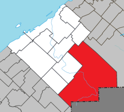
La Mitis is a regional county municipality in the Bas-Saint-Laurent region in eastern Quebec, Canada on the Gaspé peninsula. It is named for the Mitis River which has its source in the region and flows through the central part of the region before emptying into the Saint Lawrence River.
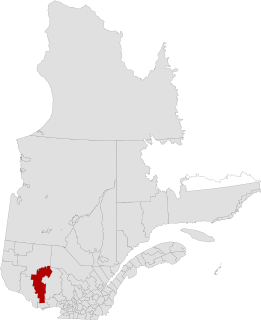
La Vallée-de-la-Gatineau(The Valley of the Gatineau) is a regional county municipality in the Outaouais region of western Quebec, Canada. The seat is in Gracefield. It was incorporated on January 1, 1983 and was named for its location straddling the Gatineau River north of Low.

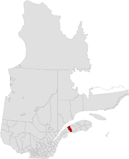
Rimouski-Neigette is a regional county municipality in the Bas-Saint-Laurent region of Quebec, Canada.

Lac-aux-Sables is a parish municipality in the Mékinac Regional County Municipality, in administrative district of the Mauricie region of the province of Quebec in Canada. Its population centres are Lac-aux-Sables and Hervey-Jonction.

Saint-Eugène-de-Ladrière is a parish municipality in the Rimouski-Neigette Regional County Municipality in the Bas-Saint-Laurent region of Quebec, Canada.

Les Lacs-du-Témiscamingue is a large unorganized territory in the Abitibi-Témiscamingue region of Quebec, Canada. With a surface area of 10,410 km2 (4,020 sq mi), it takes up over 60% of the eastern portion of the Témiscamingue Regional County Municipality.

Laniel is an unorganized territory in the Témiscamingue Regional County Municipality, Abitibi-Témiscamingue region, Quebec, Canada. It surrounds the northern portion of Lake Kipawa.
The Kedgwick River is a tributary of the head of the Restigouche River, in New Brunswick, in Canada. It flows southeast in:

Lake Lapeyrère is a municipal unorganized territory, part of Portneuf in Quebec, (Canada). The RCM is included in the administrative region of the Capitale-Nationale. This area of the north shore of St. Lawrence river and the west bank of the Batiscan River is located about 75 kilometers northeast of Shawinigan, Quebec. The unorganized territory Lac-Lapeyrère includes Lapeyrère Township, which was established in 1907. The canton is one sector of Portneuf Wildlife Reserve and Zec Tawachiche. Territory Lac-Lapeyrère has several major water bodies including lakes Garneau, Travers, Robinson, Casgrain, Tage and Lapeyrère, and is drained to the east by the Batiscan River.

Lac-Blanc is an unorganized territory in the Capitale-Nationale region of Quebec, Canada, in the north-east of the Portneuf Regional County Municipality. This unorganized territory covers 567.80 km ². The main lake, designated "White Lake" has the shape of a fine, oriented north–south. The discharge of this lake is on the southern tip, where it flows into the White River.

Lac-Ashuapmushuan is an unorganized territory in the Canadian province of Quebec, Canada, located in the regional county municipality of Le Domaine-du-Roy. The region had a population of 140 as of the Canada 2021 Census, and covered a land area of 14,684.28 km2. It is home to the Ashuapmushuan Wildlife Reserve.

Lac-Jacques-Cartier is a large unorganized territory in the Capitale-Nationale region of Quebec, Canada, in the La Côte-de-Beaupré Regional County Municipality, making up more than 85% of this regional county. It is unpopulated and undeveloped, almost entirely part of the Jacques-Cartier National Park and the Laurentides Wildlife Reserve.

Lac-Walker is an unorganized territory in the Côte-Nord region of Quebec, Canada. It makes up more than half of the Sept-Rivières Regional County Municipality.
Lac-Jérôme is an unorganized territory in the Côte-Nord region of Quebec, Canada, part of the Minganie Regional County Municipality. It is named after Lake Jérôme, a small lake on the Mingan River. The Manitou River originates in Lac-Jérôme in Lake Caobus.

Lac-Oscar is an unorganized territory in the Laurentides region of Quebec, Canada, and one of eleven unorganized areas in the Antoine-Labelle Regional County Municipality. No permanent population resides in this territory.

Lac-De La Bidière is an unorganized territory in the Laurentides region of Quebec, Canada, and one of eleven unorganized areas in the Antoine-Labelle Regional County Municipality.

Lac-des-Eaux-Mortes is an unorganized territory in the Canadian province of Quebec, located in the La Mitis Regional County Municipality.
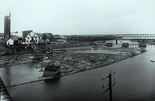
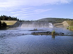
Rimouski River is a river emptying in Rimouski, on the South shore of St. Lawrence River, in the regional county municipality (RCM) Rimouski-Neigette, in the administrative region of Bas-Saint-Laurent, in Quebec, in Canada.
The Brisson River is a tributary of Rimouski River, flowing in the municipality of La Trinité-des-Monts, in the Rimouski-Neigette Regional County Municipality, in the region administrative Bas-Saint-Laurent, in the province of Quebec, in Canada.