Lac-Moncouche, Quebec

Last updated
Lac-Moncouche
Unorganized territory
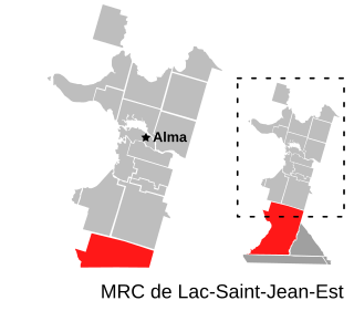
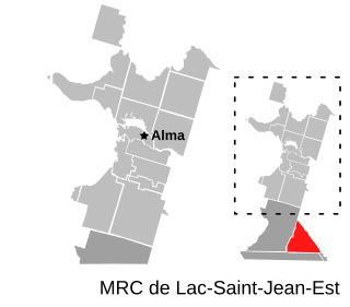
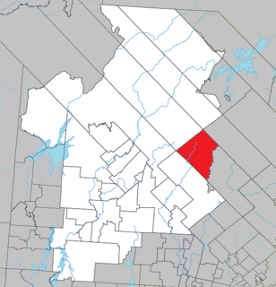
Carte MRC Lac-Saint-Jean-Est - Lac-Moncouche.svg
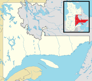
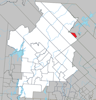
Canada Lac-Saint-Jean Quebec.png
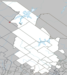
Red pog.svg
Lac-Moncouche
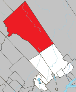
Location in Saguenay–Lac-Saint-Jean Quebec.
Coordinates: 47°57′N71°58′W / 47.950°N 71.967°W / 47.950; -71.967 Coordinates: 47°57′N71°58′W / 47.950°N 71.967°W / 47.950; -71.967 [1]
CountryFlag of Canada.svg  Canada
Province Flag of Quebec.svg  Quebec
Region Saguenay–Lac-Saint-Jean
RCM Lac-Saint-Jean-Est
Constituted January 1, 1986
Government [2]
   Federal riding Roberval—Lac-Saint-Jean
   Prov. riding Lac-Saint-Jean
Area [2] [3]
  Total 260.20 km2 (100.46 sq mi)
  Land 264.90 km2 (102.28 sq mi)
 There is an apparent contradiction between two authoritative sources
Population (2011) [3]
  Total 0
  Density 0.0/km2 (0/sq mi)
  Pop 2006-2011Steady2.svg N/A
  Dwellings 0
Time zone EST (UTC-5)
  Summer (DST) EDT (UTC-4)
HighwaysQc169.svg Route 169

Lac-Moncouche is an unorganized territory in the Canadian province of Quebec, located in the regional county municipality of Lac-Saint-Jean-Est. It had a population of 0 in the Canada 2011 Census and covers a land area of 264.90 km2, entirely within the Laurentides Wildlife Reserve.

Provinces and territories of Canada Top-level subdivisions of Canada

The provinces and territories of Canada are sub-national governments within the geographical areas of Canada under the authority of the Canadian Constitution. In the 1867 Canadian Confederation, three provinces of British North America—New Brunswick, Nova Scotia, and the Province of Canada —were united to form a federated colony, becoming a sovereign nation in the next century. Over its history, Canada's international borders have changed several times, and the country has grown from the original four provinces to the current ten provinces and three territories. Together, the provinces and territories make up the world's second-largest country by area.
Quebec Province of Canada

Quebec is one of the thirteen provinces and territories of Canada. It is bordered to the west by the province of Ontario and the bodies of water James Bay and Hudson Bay; to the north by Hudson Strait and Ungava Bay; to the east by the Gulf of Saint Lawrence and the province of Newfoundland and Labrador; and to the south by the province of New Brunswick and the U.S. states of Maine, New Hampshire, Vermont, and New York. It also shares maritime borders with Nunavut, Prince Edward Island, and Nova Scotia. Quebec is Canada's largest province by area and its second-largest administrative division; only the territory of Nunavut is larger. It is historically and politically considered to be part of Central Canada.

The term regional county municipality or RCM is used in Quebec to refer to one of 87 county-like political entities. In some older English translations they were called county regional municipality.

See also

Related Research Articles

Rivière-Héva, Quebec Municipality in Quebec, Canada

Rivière-Héva is a municipality in northwestern Quebec, Canada in the MRC de La Vallée-de-l'Or. It is named after the Héva River that flows through the municipality.

Lac-Nilgaut, Quebec Unorganized territory in Quebec, Canada

Lac-Nilgaut is a vast unorganized territory in the Outaouais region, Quebec, Canada. With a surface area of 9,851 square kilometres (3,803 sq mi), it makes up over 70% of the northern portion of Pontiac Regional County Municipality.

Les Lacs-du-Témiscamingue, Quebec Unorganized territory in Quebec, Canada

Les Lacs-du-Témiscamingue is a vast unorganized territory in the Abitibi-Témiscamingue region of Quebec, Canada. With a surface area of 10,410 square kilometres (4,020 sq mi), it takes up over 60% of the eastern portion of the Témiscamingue Regional County Municipality.

Lac-Pythonga, Quebec Unorganized territory in Quebec, Canada

Lac-Pythonga is an unorganized territory in the Outaouais region of Quebec, Canada. It surrounds Lake Pythonga and is the largest of the five unorganized territories in the La Vallée-de-la-Gatineau Regional County Municipality.

Lac-Granet, Quebec Unorganized territory in Quebec, Canada

Lac-Granet is an unorganized territory in the Abitibi-Témiscamingue region of Quebec, Canada. It is one of five unorganized territories in the La Vallée-de-l'Or Regional County Municipality.

Lac-des-Dix-Milles, Quebec Unorganized territory in Quebec, Canada

Lac-des-Dix-Milles is an unorganized territory in the Lanaudière region of Quebec, Canada, part of the Matawinie Regional County Municipality. This square-shaped territory is entirely within the Mont-Tremblant National Park.

Lac-Lapeyrère, Quebec Unorganized territory in Quebec, Canada

Lake Lapeyrère is a municipal unorganized territory, part of Portneuf in Quebec, (Canada). The RCM is included in the administrative region of the Capitale-Nationale. This area of the north shore of St. Lawrence river and the west bank of the Batiscan River is located about 75 kilometers northeast of Shawinigan, Quebec. The unorganized territory Lac-Lapeyrère includes Lapeyrère Township, which was established in 1907. The canton is one sector of Portneuf Wildlife Reserve and Zec Tawachiche. Territory Lac-Lapeyrère has several major water bodies including lakes Garneau, Travers, Robinson, Casgrain, Tage and Lapeyrère, and is drained to the east by the Batiscan River.

Lac-Blanc, Quebec Unorganized territory in Quebec, Canada

Lac-Blanc is an unorganized territory in the Capitale-Nationale region of Quebec, Canada, in the north-east of the Portneuf Regional County Municipality. This unorganized territory covers 567.80 km ². The main lake, designated "White Lake" has the shape of a fine, oriented north-south. The discharge of this lake is on the southern tip, where it flows into the White River.

Belle-Rivière, Quebec Unorganized territory in Quebec, Canada

Belle-Rivière is an unorganized territory in the Canadian province of Quebec, located in the regional county municipality of Lac-Saint-Jean-Est. It had a population of zero in the Canada 2006 Census, and covered a land area of 610.30 km2. The Métabetchouane River forms its western boundary.

Lac-Achouakan, Quebec Unorganized territory in Quebec, Canada

Lac-Achouakan is an unorganized territory in the Canadian province of Quebec, located in the regional county municipality of Lac-Saint-Jean-Est. It had a population of zero in the Canada 2006 Census, and covered a land area of 227.35 km2, entirely within the Laurentides Wildlife Reserve. The western boundary of the territory is Bark River, while Quebec Route 169 forms the eastern boundary.

Lac-Croche, Quebec Unorganized territory in Quebec, Canada

Lac-Croche is an unorganized territory in the Capitale-Nationale region of Quebec, Canada, in the north of La Jacques-Cartier Regional County Municipality, taking up more than 50% of this regional county. It is unpopulated and undeveloped, almost entirely part of the Laurentides Wildlife Reserve.

Lac-Jacques-Cartier, Quebec Unorganized territory in Quebec, Canada

Lac-Jacques-Cartier is a large unorganized territory in the Capitale-Nationale region of Quebec, Canada, in the La Côte-de-Beaupré Regional County Municipality, making up more than 85% of this regional county. It is unpopulated and undeveloped, almost entirely part of the Jacques-Cartier National Park and the Laurentides Wildlife Reserve.

Lac-Jérôme, Quebec Unorganized territory in Quebec, Canada

Lac-Jérôme is an unorganized territory in the Côte-Nord region of Quebec, Canada, part of the Minganie Regional County Municipality.

Lac-Matapédia, Quebec Unorganized territory in Quebec, Canada

Lac-Matapédia is an unorganized territory in the Bas-Saint-Laurent region of Quebec, Canada. It is named after and located on the northern shores of Lake Matapedia in the Matapédia Valley.

Lac-Alfred, Quebec Unorganized territory in Quebec, Canada

Lac-Alfred is an unorganized territory in the Bas-Saint-Laurent region of Quebec, Canada.

Lac-Casault, Quebec Unorganized territory in Quebec, Canada

Lac-Casault is an unorganized territory in the Bas-Saint-Laurent region of Quebec, Canada.

Lac-de-la-Maison-de-Pierre, Quebec Unorganized territory in Quebec, Canada

Lac-de-la-Maison-de-Pierre is an unorganized territory in the Laurentides region of Quebec, Canada, and one of eleven unorganized areas in the Antoine-Labelle Regional County Municipality.

Lac-De La Bidière, Quebec Unorganized territory in Quebec, Canada

Lac-De La Bidière is an unorganized territory in the Laurentides region of Quebec, Canada, and one of eleven unorganized areas in the Antoine-Labelle Regional County Municipality.

Lac-de-la-Pomme, Quebec Unorganized territory in Quebec, Canada

Lac-de-la-Pomme is an unorganized territory in the Laurentides region of Quebec, Canada, and one of eleven unorganized areas in the Antoine-Labelle Regional County Municipality.

Lac-du-Taureau, Quebec Unorganized territory in Quebec, Canada

Lac-du-Taureau is an unorganized territory in the Lanaudière region of Quebec, Canada, part of the Matawinie Regional County Municipality.

References

  1. Reference number 149590 of the Commission de toponymie du Québec (in French)
  2. 1 2 Ministère des Affaires municipales, des Régions et de l'Occupation du territoire - Répertoire des municipalités: Lac-Moncouche
  3. 1 2 "Lac-Moncouche census profile". 2011 Census data . Statistics Canada. Retrieved 2010-10-28.