Savoie is a department in the Auvergne-Rhône-Alpes region, Southeastern France. Located in the French Alps, its prefecture is Chambéry. In 2019, Savoie had a population of 436,434.

Haute-Savoie is a department in the Auvergne-Rhône-Alpes region of Southeastern France, bordering both Switzerland and Italy. Its prefecture is Annecy. To the north is Lake Geneva; to the south and southeast are Mont Blanc and the Aravis mountain range.

Rhône-Alpes was an administrative region of France. Since 1 January 2016, it is part of the new region Auvergne-Rhône-Alpes. It is located on the eastern border of the country, towards the south. The region was named after the river Rhône and the Alps mountain range. Its capital, Lyon, is the second-largest metropolitan area in France after Paris. Rhône-Alpes has the sixth-largest economy of any European region.

Les Portes du Soleil is a major skisports destination in the Alps, encompassing thirteen resorts between Mont Blanc in France and Lake Geneva in Switzerland. With more than 650 km of marked pistes and about 200 lifts in total, spread over 14 valleys and about 1,036 square kilometres (400 sq mi), Portes du Soleil ranks among the two largest ski areas in the world. Almost all of the pistes are connected by lifts – a few marginal towns can be reached only by the free bus services in the area. The highest elevation accessible on skis is 2260 m and the lowest is 930 m. As with many other Alpine ski resorts, the lower slopes of the Portes du Soleil have snow-making facilities to extend the ski season by keeping the lower slopes open during the warmer months.
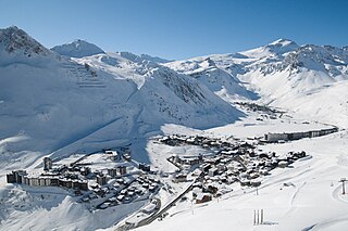
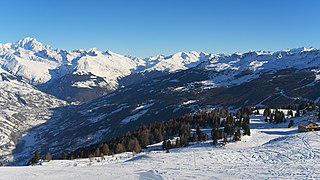
Tignes is a commune in the Tarentaise Valley, in the Savoie department in the Rhône-Alpes region in south-eastern France, known for the highest skiable area and the longest ski season in Europe. It is located in the Savoie region with good transport links in and out of Lyon, Geneva and Chambéry.
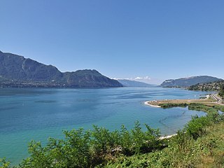
Lac du Bourget, also locally known as Lac Gris or Lac d'Aix, is a lake at the southernmost end of the Jura Mountains in the department of Savoie, France. It is the deepest lake located entirely within France, and either the largest or second largest after Lac de Grand-Lieu depending on season.
La Clusaz is a commune in the Haute-Savoie department in the Auvergne-Rhône-Alpes region in south-eastern France.

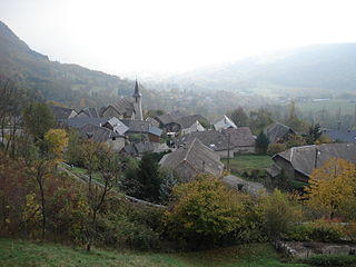
Mouxy is a commune in the Savoie department in the Auvergne-Rhône-Alpes region in south-eastern France.
Verel-Pragondran is a commune in the Savoie department in the Auvergne-Rhône-Alpes region in south-eastern France. It is part of the urban area of Chambéry.

La Chapelle-d'Abondance is a commune in the Haute-Savoie department in the Auvergne-Rhône-Alpes region in south-eastern France.

Montriond is a commune in the Haute-Savoie department in the Auvergne-Rhône-Alpes region in south-eastern France.

Savigny is a commune in the Haute-Savoie department in the Auvergne-Rhône-Alpes region in south-eastern France.

Lac d'Aiguebelette is a natural lake in the commune of Aiguebelette-le-Lac, within the department of Savoie, France.
Lac de Flaine is a lake at Flaine in Haute-Savoie, France. Its surface and depth vary seasonly. Maximum depth can reach 10.5 m in May and only 0.75 m in winter, while the surface area varies from 12 ha to 1.5 ha.

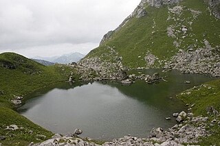
Lac d'Arvouin is a lake south of Cornettes de Bise in the Haute-Savoie region of France. The lake is surrounded by several summits, including Pointe d'Arvouin and Le Linleu . It covers an area of 1.8 hectares and its deepest point is 6.3 metres. It is located at an altitude of 1,663 metres.
Lac de Darbon is a lake in Haute-Savoie, France. Located at an elevation of 1813 m, its surface area is 2 ha.

Lac d'Artouste is a lake in Pyrénées-Atlantiques, France in the region of Nouvelle-Aquitaine. At an elevation of 1997 m, its surface area is 0.56 km².

Gaube Lake is a lake in the French Pyrenees, in the department of the Hautes-Pyrénées, near the town of Cauterets.
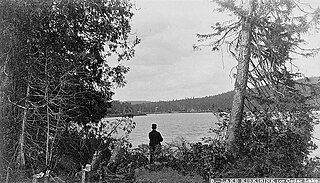
The Lake Kiskissink is located in the La Tuque, in Mauricie, in Quebec, in Canada. The area surrounding the lake is administered by the Zec Kiskissink
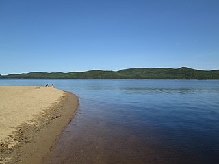
The lac Jacques-Cartier, main source of the Jacques-Cartier River, is a glacial lake located in the Laurentides Wildlife Reserve, about 90 km to the north of the city of Quebec, in the unorganized territory of Lac-Jacques-Cartier, in the La Côte-de-Beaupré Regional County Municipality, in the administrative region of Capitale-Nationale, in the province of Quebec, in Canada.


