The Spöl or Aqua Granda is an Italian and Swiss river and is a right tributary of the Inn.

The Sihl is a Swiss river that rises near the Druesberg mountain in the canton of Schwyz, and eventually flows into the Limmat in the centre of the city of Zürich, after crossing the Zürich–Winterthur railway at Zürich HB. It has a length of 73 km (45 mi), including the Sihlsee reservoir, through which the river flows. Water is abstracted from the river at the Sihlsee, leading to decreased downstream water flows and a consequent reduction in water quality.

Poschiavo is a municipality in the Bernina Region in the canton of Grisons in Switzerland.
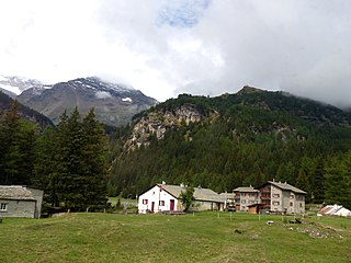
Cavaglia is a hamlet on the western flank of the Val Poschiavo in the canton of Graubünden, Switzerland. It lies at 1,703 metres (5,587 ft) above sea level, and is in the municipality of Poschiavo, some 4.7 kilometres (2.9 mi) north-west of the village of the same name. Because of the 700 metres (2,300 ft) of altitude difference between the two villages, the distance between them by road is 11 kilometres (6.8 mi) and the train journey takes 25 minutes. In 2005, Cavaglia's permanent population was 24.

Brusio is a municipality in the Bernina Region in the canton of Grisons in Switzerland.

Lago Bianco is a reservoir at the Bernina Pass in the Swiss canton of Graubünden.

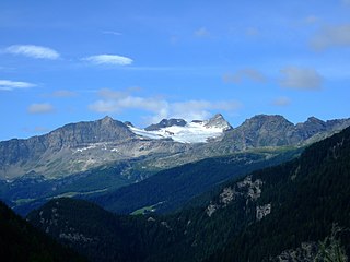
Palü Lake is a lake below Piz Palü in the Swiss canton of Graubünden. It has an elevation of 1,923 m (6,309 ft) and a surface area of 5.2 ha. Water from Palü Glacier feeds into the lake.

The Bernina Express is a train connecting Chur in Switzerland to Poschiavo in Switzerland and Tirano in Italy by crossing the Swiss Engadin Alps. For most of its journey, the train also runs along the World Heritage Site known as the Rhaetian Railway in the Albula / Bernina Landscapes.

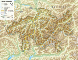
Val Poschiavo is a valley in the southern, Italian-speaking part of the Swiss canton of the Grisons. The main town is Poschiavo.
Piz Cancian is a mountain in the Bernina Range of the Alps, located on the border between Italy and the Switzerland. The summit has an elevation of 3,103 metres (10,180 ft) above sea level.

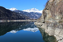
Le Prese is a village in the Val Poschiavo in the canton of Graubünden, Switzerland. It lies at 965 metres (3,166 ft) above sea level at the northern end of Lago di Poschiavo, and is in the municipality of Poschiavo, some 4 kilometres (2.5 mi) south of the village of the same name. The Poschiavino river enters the lake by the village.

San Carlo is a village in the Val Poschiavo in the canton of Graubünden, Switzerland. It lies at 1,092 metres (3,583 ft) above sea level and is in the municipality of Poschiavo, some 2 kilometres (1.2 mi) north of the village of the same name.

Miralago is a village in the Val Poschiavo in the canton of Graubünden, Switzerland. It lies at 964 metres (3,163 ft) above sea level at the southern end of Lago di Poschiavo, and the Poschiavino river flows out of the lake in the village. The village is some 7 kilometres (4.3 mi) south of the village of Poschiavo and 3 kilometres (1.9 mi) north of the village of Brusio.

Poschiavino is an 30-kilometre (19 mi) long river that rises in the Swiss canton of Graubünden and flows into the Italian province of Sondrio. The majority of the river is in Switzerland, with just 3 kilometres (1.9 mi) in Italy.

The Bernina railway line is a single-track 1,000 mmmetre gauge railway line forming part of the Rhaetian Railway (RhB). It links the spa resort of St. Moritz, in the canton of Graubünden, Switzerland, with the town of Tirano, in the Province of Sondrio, Italy, via the Bernina Pass. Reaching a height of 2,253 metres (7,392 ft) above sea level, it is the third highest railway crossing in Europe and the third-highest railway in Switzerland. It also ranks as the highest adhesion railway of the continent, and – with inclines of up to 7% – as one of the steepest adhesion railways in the world. The elevation difference on the section between the Bernina Pass and Tirano is 1,824 m (5,984 ft), allowing passengers to view glaciers along the line.

Le Prese railway station is a railway station in the village of Le Prese, within the municipality of Poschiavo and canton of Graubünden in Switzerland. It is located on the Bernina line of the Rhaetian Railway.

Miralago railway station, previously known as Meschino railway station, is a station in the village of Miralago, within the municipality of Poschiavo and in the Swiss canton of Graubünden. It is located on the Bernina line of the Rhaetian Railway.

The Entracque Power Plant, also known as The Upper Gesso Plant, is a pumped-storage hydroelectric power station located in Valle Gesso just south of Entracque, Italy. The power station contains pump-generators for two co-located but hydraulically separated power schemes; the Chiotas-Piastra Plant and Rovina-Piastra Plant. Both plants use separate upper reservoirs but use Lago della Piastra as their common lower reservoir. To produce power, water is released from the upper reservoirs to the power station located at the lower reservoir. The pump-generators re-fill the reservoirs and the process repeats as needed. The Chiotas' upper reservoir, Lago del Chiotas, is located much higher in the valley and larger than Rovina's Lago della Rovina which affords it the ability to produce more electricity. The installed capacity of Chiotas is 1,184 megawatts (1,588,000 hp) with a hydraulic head of 1,048 m (3,438 ft) while Rovina has an installed capacity of 133.67 megawatts (179,250 hp) and a head of 598 metres (1,962 ft). Construction on the plant began in 1962 and operations started in 1982. It is owned and operated by Enel.

The border between the modern states of Switzerland and Italy extends for 744 kilometres (462 mi), from the French-Swiss-Italian tripoint at Mont Dolent in the west to the Austrian-Swiss-Italian tripoint near Piz Lad in the east. Much of the border runs across the High Alps, rising above 4,600 metres (15,100 ft) as it passes east of Dufourspitze, but it also descends to the lowest point in Switzerland as it passes Lago Maggiore at below 200 metres (660 ft).

The Hauptstrasse 29 is a main road in the Swiss canton of Graubünden, with a total length of 51 km (32 mi). The road begins at a junction with Hauptstrasse 27 between Samedan and Pontresina, and passes Pontresina before climbing over the Bernina pass at a maximum elevation of 2,328 m (7,638 ft) above sea level. From the summit of the pass the road descends into the Val di Poschiavo and passes through San Carlo, Poschiavo, Le Prese and Brusio before reaching the border with Italy at Campocologno.