
The Paluxy River, also known as Paluxy Creek, is a river in the U.S. state of Texas. It is a tributary of the Brazos River. It is formed by the convergence of the North Paluxy River and the South Paluxy River near Bluff Dale, Texas in Erath County and flows a distance of 29 miles (47 km) before joining the Brazos just to the east of Glen Rose, Texas in south central Somervell County.

A fossil track or ichnite is a fossilized footprint. This is a type of trace fossil. A fossil trackway is a sequence of fossil tracks left by a single organism. Over the years, many ichnites have been found, around the world, giving important clues about the behaviour of the animals that made them. For instance, multiple ichnites of a single species, close together, suggest 'herd' or 'pack' behaviour of that species.

Dinosaur Stampede National Monument at Lark Quarry Conservation Park in Queensland, Australia is considered to be the site of the world's only known record of a dinosaur stampede, with fossilised footprints are interpreted as a predator stalking and causing a stampede of around 150 two-legged dinosaurs. This interpretation has been challenged in recent years, with evidence suggesting it may have been a natural river crossing.

The Glen Rose Formation is a shallow marine to shoreline geological formation from the lower Cretaceous period exposed over a large area from South Central to North Central Texas. The formation is most widely known for the dinosaur footprints and trackways found in the Dinosaur Valley State Park near the town of Glen Rose, Texas, southwest of Fort Worth and at other localities in Central Texas.

Eubrontes is the name of fossilised dinosaur footprints dating from the Late Triassic and Early Jurassic. They have been identified from France, Poland, Slovakia, Czech Republic, Italy, Spain, Sweden, Australia (Queensland), US, India, China and Brazil (South).

Dinosaur State Park and Arboretum is a state-owned natural history preserve occupying 80 acres (32 ha) in the town of Rocky Hill, Connecticut. The state park protects one of the largest dinosaur track sites in North America. The park was created in recognition of fossil trackways embedded in sandstone from the beginning of the Jurassic period, about 200 million years ago. The facility is managed by the Connecticut Department of Energy and Environmental Protection.

Cape Espichel is a cape situated on the western coast of the civil parish of Castelo, municipality of Sesimbra, in the Portuguese district of Setúbal, at the very southwestern corner of the Setubal Peninsula. It is characterized by a very acute protrusion of the coastline into the Atlantic Ocean, and it consists of a promontory plateau, over 130 meters above sea level, defined by dramatic, sheer cliffs all around the delimitation of the cape against the ocean.
The location offers elevated sweeping views, from Cascais and the Sintra Mountains, and the Caparica coast to the north, and to the southeast the beaches south of Tróia and beyond to Sines.
Cape Espichel is part of the Espichel Special Protection Zone, the Arrábida / Espichel Special Conservation Zone, and the Arrábida Natural Park.
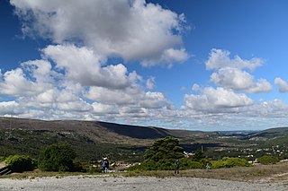
The Aire and Candeeiros Ranges Natural Park is a natural park in the Central-West region of Portugal. It occupies an area of 383.9 km2 (148.2 sq mi) and is the most important limestone deposit in Portugal, with a variety of geological formations and climate associated with karst geomorphology and topography, such as underground caves and sinkholes. It was designated a protected area in 1979 with the intent to preserve its natural aspects, and the architectonic and cultural heritage linked to the local human populations.

Dinosaur Footprints in Holyoke, Massachusetts, USA is an 8-acre (3 ha) wilderness reservation purchased for the public in 1935 by The Trustees of Reservations. The Reservation is currently being managed with the assistance from the Massachusetts Department of Conservation and Recreation (DCR). The fossil and plant resources on the adjacent Holyoke Gas and Electric (HG&E) riverfront property are being managed cooperatively by The Trustees, Mass DCR, and HG&E.

The Purgatoire River track site, also called the Picketwire Canyonlands tracksite, is one of the largest dinosaur tracksites in North America. The site is located on public land of the Comanche National Grassland, along the Purgatoire ("Picketwire") River south of La Junta in Otero County, Colorado.
The Chacarilla Formation is an Oxfordian to Early Cretaceous geologic formation of the Tarapacá Basin in northern Chile, close to the border with Bolivia. The marine and fluvial formation preserves several dinosaur trackways and has been declared a Natural Sanctuary in 2004.
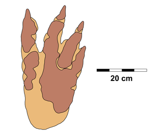
Macropodosaurus is an ichnogenus of therizinosaurid footprints from the Late Cretaceous of Asia, North America and Poland. The ichnogenus is currently monotypic only including the type ichnospecies M. gravis, described and named in 1964.
The Minnes Group, originally named the Minnes Formation, is a geologic unit of latest Jurassic to earliest Cretaceous age in the Western Canada Sedimentary Basin. It is present in the northern foothills of the Canadian Rockies and the adjacent plains in northeastern British Columbia and west-central Alberta. Its strata include natural gas reservoirs and minor coal deposits. Fossil dinosaur tracks have been described from one of its formations.
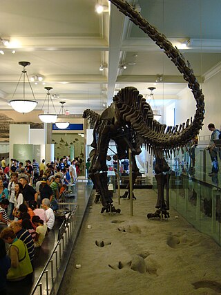
The 20th century in ichnology refers to advances made between the years 1900 and 1999 in the scientific study of trace fossils, the preserved record of the behavior and physiological processes of ancient life forms, especially fossil footprints. Significant fossil trackway discoveries began almost immediately after the start of the 20th century with the 1900 discovery at Ipolytarnoc, Hungary of a wide variety of bird and mammal footprints left behind during the early Miocene. Not long after, fossil Iguanodon footprints were discovered in Sussex, England, a discovery that probably served as the inspiration for Sir Arthur Conan Doyle's The Lost World.
The Gorman Creek Formation is a geologic formation of Early Cretaceous (Valanginian) age in the Western Canada Sedimentary Basin that consists primarily of nonmarine sediments. It is present in the northern foothills of the Canadian Rockies and the adjacent plains in northeastern British Columbia. Plant fossils and dinosaur tracks have been described from its strata.

Bellatoripes is an ichnogenus of footprint produced by a large theropod dinosaur so far known only from the Late Cretaceous of Alberta and British Columbia in Canada. The tracks are large and three-toed, and based on their size are believed to have been made by tyrannosaurids, such as Albertosaurus and Daspletosaurus. Fossils of Bellatoripes are notable for preserving trackways of multiple individual tyrannosaurids all travelling in the same direction at similar speeds, suggesting the prints may have been made by a group, or pack, of tyrannosaurids moving together. Such inferences of behaviour cannot be made with fossil bones alone, so the record of Bellatoripes tracks together is important for understanding how large predatory theropods such as tyrannosaurids may have lived.

The Aire Range Dinosaur Tracks Natural Monument, also known as Ourém - Torres Novas Dinosaur Tracks Natural Monument, is a natural monument in the Serras de Aire e Candeeiros Natural Park, Portugal, known for its long and well-preserved sauropod trackways. When discovered, it had the single longest known sauropod trackway in the world at 147 m (482 ft) long.
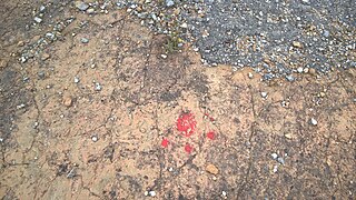
The Natural Monument of Carenque is a natural monument in Belas, Sintra, Portugal. It contains more than one hundred dinosaur footprints and has one of the longest dinosaur tracks in Europe. The original footprints have been covered with soil after being molded onto latex, so the Monument has no pedagogical or tourist use.
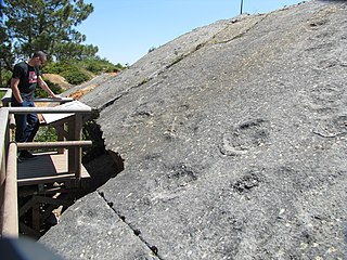
Pedreira do Avelino is a natural monument in Zambujal, Sesimbra, Portugal. The site contains an important set of dinosaur footprints from the Upper Jurassic. The main slab is about 15 metres (49 ft) long by 10 metres (33 ft) wide, and is inclined (30°), which facilitates its observation and pedagogical use. It contains 5 tracks and 108 total footprints.
Wakinyantanka is an ichnogenus of footprint produced by a large theropod dinosaur from the Late Cretaceous Hell Creek Formation of South Dakota. Wakinyantanka tracks are large with three long, slender toes with occasional impressions of a short hallux and narrow metatarsals. Wakinyantanka was the first dinosaur track to be discovered in the Hell Creek Formation, which remain rare in the preservational conditions of the rocks. The potential trackmakers may be a large oviraptorosaur or a small tyrannosaurid.


