
Southern California is a geographic and cultural region that generally comprises the southern portion of the U.S. state of California. It includes the Los Angeles metropolitan area, the second most populous urban agglomeration in the United States. The region generally contains ten of California's 58 counties: Imperial, Kern, Los Angeles, Orange, Riverside, San Bernardino, San Diego, Santa Barbara, San Luis Obispo and Ventura counties.
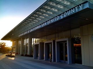
San Benito County, officially the County of San Benito, is a county located in the Coast Range Mountains of the U.S. state of California. As of the 2020 census, the population was 64,209. The county seat is Hollister.

San Mateo County, officially the County of San Mateo, is a county located in the U.S. state of California. As of the 2020 census, the population was 764,442. Redwood City is the county seat, and the third most populated city following Daly City and San Mateo. San Mateo County is included in the San Francisco-Oakland-Berkeley, CA MSA, Silicon Valley, and is part of the San Francisco Bay Area, the nine counties bordering San Francisco Bay. It covers most of the San Francisco Peninsula. San Francisco International Airport is located in the northeastern area of the county and is approximately 7 miles south of the city and county limits of San Francisco, even though the airport itself is assigned a San Francisco postal address. The county's built-up areas are mostly suburban, and are home to several corporate campuses.

Sonoma County is a county located in the U.S. state of California. As of the 2020 United States Census, its population was 488,863. Its county seat and largest city is Santa Rosa. It is to the north of Marin County and the south of Mendocino County. It is west of Napa County and Lake County.

Ventura County is a county in the southern part of the U.S. state of California. As of the 2020 census, the population was 843,843. The largest city is Oxnard, and the county seat is the city of Ventura.

Laguna Beach is a seaside resort city located in southern Orange County, California, in the United States. It is known for its mild year-round climate, scenic coves, environmental preservation efforts, and artist community. The population in the 2020 census was 23,032.

Laguna Niguel is a city in Orange County, California, United States. The name Laguna Niguel is derived from the words "Laguna" and "Niguili". As of the 2020 census, the population was 64,355. Laguna Niguel is located in the San Joaquin Hills in the southeastern corner of Orange County, close to the Pacific Ocean, and borders the cities of Aliso Viejo, Dana Point, Laguna Beach, Laguna Hills, Mission Viejo, and San Juan Capistrano.

Cleveland National Forest encompasses 460,000 acres, mostly of chaparral, with a few riparian areas. A warm dry mediterranean climate prevails over the forest. It is the southernmost U.S. National Forest of California. It is administered by the U.S. Forest Service, a government agency within the United States Department of Agriculture. It is divided into the Descanso, Palomar and Trabuco Ranger Districts and is located in the counties of San Diego, Riverside, and Orange.

The Diablo Range is a mountain range in the California Coast Ranges subdivision of the Pacific Coast Ranges in northern California, United States. It stretches from the eastern San Francisco Bay area at its northern end to the Salinas Valley area at its southern end.

The Santa Monica Mountains National Recreation Area is a United States national recreation area containing many individual parks and open space preserves, located primarily in the Santa Monica Mountains of Southern California. The SMMNRA is in the greater Los Angeles region, with two thirds of the parklands in northwest Los Angeles County, and the remaining third, including a Simi Hills extension, in southeastern Ventura County.
Crystal Springs Reservoir is a pair of artificial lakes located in the northern Santa Cruz Mountains of San Mateo County, California situated in the rift valley created by the San Andreas Fault just to the west of the cities of San Mateo and Hillsborough, and I-280. The lakes are part of the San Mateo Creek watershed.

The Laguna de Santa Rosa is a 22-mile-long (35 km) wetland complex that drains a 254-square-mile (660 km2) watershed encompassing most of the Santa Rosa Plain in Sonoma County, California, United States.

San Benito Mountain is the highest mountain in the Diablo Range of California. The summit is at an elevation of 5,267 feet (1,605 m). The rock is composed of asbestos (chrysotile), an ultramafic rock. It weathers to produce serpentine soils with characteristically low levels of nutrients like nitrogen, phosphorus, potassium, and calcium, and high levels of magnesium and heavy metals including nickel and chromium. This means little vegetation grows in the area though there are some plants that only grow on such soils like the local endemic San Benito evening primrose. The Clear Creek Management Area includes the San Benito Mountain Research Natural Area, recognized for its unique pine and incense cedar forest assemblage. The Mediterranean climate is punctuated by cool, wet winters and hot, dry summers.

Aliso Creek is a 19.8-mile (31.9 km)-long, mostly urban stream in south Orange County, California. Originating in the Cleveland National Forest in the Santa Ana Mountains, it flows generally southwest and empties into the Pacific Ocean at Laguna Beach. The creek's watershed drains 34.9 square miles (90 km2), and it is joined by seven main tributaries. As of 2018, the watershed had a population of 144,000 divided among seven incorporated cities.

Camissonia benitensis is a species of evening primrose known by the common names San Benito suncup and San Benito evening primrose. It is endemic to California, where its range includes far southern San Benito County, far western Fresno County, and far eastern Monterey County.

Sulphur Creek is a 4.5-mile (7.2 km) tributary of Aliso Creek in Orange County in the U.S. state of California. The creek drains about 6 square miles (16 km2) of residential communities and parks in the southern San Joaquin Hills.

Riverside County is a county located in the southern portion of the U.S. state of California. As of the 2020 census, the population was 2,418,185, making it the fourth-most populous county in California and the 10th-most populous in the United States. The name was derived from the city of Riverside, which is the county seat.
Laguna Creek is a 8.5-mile-long (13.7 km) south by southwest-flowing stream originating on Ben Lomond Mountain in the Santa Cruz County, California, United States. It culminates in a lagoon before reaching the Pacific Ocean about six miles northwest of Santa Cruz, California.
San Vicente Redwoods is an emerging 8,500 acres (34 km2) mixed-use open space in Davenport, California. It is the largest privately owned parcel in Santa Cruz County, California, and one of the largest in California.


