Related Research Articles

Angul district; also known as Anugul, is one of the thirty districts of Odisha in eastern India. The city of Angul is the district headquarters of Angul district. A major industrial hub of the state, the district hosts numerous industries relating to coal, bauxite and steel apart from extensive forests including the Satkosia Tiger Reserve.
Debagarh, also known as Deogarh, is a city in Odisha state of eastern India. Located in the North-Western region of the state, it is the headquarters of Debagarh District that was created on 1 January 1994, after being bifurcated from Sambalpur District.
Western Odisha is the western part of the state of Odisha in India, extending from the Kalahandi district in the south to the Sundargarh district in the north.
Sambalpur Lok Sabha constituency is one of the 21 Lok Sabha (parliamentary) constituencies in Odisha state in eastern India. This constituency covers the whole Sambalpur district and parts of Deogarh and Angul districts.
The Telen or Tel River is a tributary of the Mahanadi in East Central India. The Bhede River is a tributary to this river. The historical Kolabira Fort is situated on the bank of this river. Jharsuguda town lies on the bank of this river.

Redhakhol is a town and a notified area council in Sambalpur district in the Indian state of Odisha.It has the following banks: Canara Bank, DCB Bank, State Bank of India, Union Bank, Utkal Gramin Bank, and Central Bank. Redhakhol town, which is the Sub-Divisional headquarter of Rairakhol Sub-division and surrounded by a green belt of reserve forest, is unique for its natural environment and pollution-free status. The town is 67 K.M. from Sambalpur and 260 K.M. from Bhubaneswar. Sambalpur-Cuttack the old National Highway 42 now renamed as National Highway 55 is passing through this town. After the opening of the Kiakata bridge on Rairakhol-Kiakata State Highway, this town has become a junction point, as it opens easy & straight communication to Phulbani & Berhampur. The historical Deogarh town is situated to its North & is connected by 88 K.M. length of Blacktopping road leading to Ranchi Vijayawada Highway.
Birmaharajpur is a subdivision town of Subarnapur district in the state of Odisha, India. Birmaharajpur Subdivisional Headquarter is the Birmaharajpur town. It is located 22 km towards east from district headquarter Sonepur. It is a dispersed town and located on the left bank of the river Mahanadi. It is located about 229 km from state capital Bhubaneswar.
Balsi is a village in Kesinga Block Kalahandi district in the India state of Odisha, near the east coast of India. This Village belongs to Odisha.
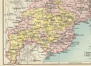
Gangpur State, also known as Gangpore State, was one of the princely states of India during the period of the British Raj. Until 1905 it was one of the Chhota Nagpur States under the Eastern States Agency.
Maneswar is a town in Sambalpur district, Odisha, India, situated 15 kilometres (9.3 mi) from Sambalpur. The postal code of Maneswar 768005. Nearby villages of this town are Sindurpank (3.6 km), Jhankarpali (4.2 km), Gunderpur (4.2 km), Kabrapali (7.3 km), Batemura (7.8 km), chhatabar (6.0 km) Ghenupali (8.0 km).
Panchayat College located in Bargarh, Odisha, India was inaugurated on 5 July 1960 by Utkal Kesari Dr. Hare Krushna Mahatab, the then chief minister of Odisha. Panchayat College comes under the jurisdiction of Sambalpur University. There are streams like arts, commerce and science. B.Ed. and IGNOU courses are also available.
Sambalpur is a Vidhan Sabha constituency of Sambalpur district, Odisha, India. This constituency includes Sambalpur, Hirakud and Burla.
Kuchinda is a Vidhan Sabha constituency of Sambalpur district. Area of this constituency includes Kuchinda, Kuchinda block, Bamra block and Jamankira block.
Rairakhol is a Vidhan Sabha constituency of Sambalpur district, Odisha.
Rengali is a Vidhan Sabha constituency of Sambalpur district, Odisha. This constituency includes Rengali block, Dhankauda block and 10GPs of Maneswar block.

Rairakhol State was a princely state during the British Raj in what is today India. It was one of the Chota Nagpur States and had its capital at Rairakhol (Redhakhol), located in the present-day Sambalpur district of Odisha. It had an area of 2,157 square kilometres (833 sq mi) and a population of 26,888 in 1901, the average revenue was Rs.55,000 in 1904.
Gambharipank is a village situated besides old Ranchi road in Sambalpur district in the Indian state of Odisha, India. The village comes under Kukudapali panchayat and Jujomura block.
Kesaibahal is a village in Sambalpur district, Odisha, India. It is also one of the panchayats of Bamra block. The name Kesaibahal is of historical origins, where the Raja of erstwhile Bamanda state was awarded with the title of Knight Commandent of Indian Empire, by the British, thus the name KCIE of the land leading to the name Kesaibahal. Its geographical coordinates are 21° 55' 0" North, 84° 23' 0" East.
Ambabhona is a rural village in Bargarh district, Odisha. The 2011 India census shows Ambabhona to have a population of 1,746. A police station is located in the village. The Kedarnath Temple stands besides the Mahanadi river at Sambalpur, just south of the village. It was completed by 1765 during the Sambalpur State reign of Ajit Singh.

Keshapali is a small census village in Jujumura Block of Sambalpur district of Indian state, Odisha. It is administered under Keshapali Grampanchayat and comes under the Jujumura Tahsil and it is a crucial booth of Rairakhol constituency. The small village had a population of 832 in 2011. Keshapali has two Aganwadi centers, a primary school, a high school, a primary hospital and also a primary animal hospital. Goverdhan Puja is the famous festival of the village.
References
- ↑ "Village & Panchayats | Sambalpur District : Odisha | India" . Retrieved 25 February 2024.
21°42′47″N84°11′36″E / 21.712931°N 84.193365°E
| | This article related to a location in Odisha is a stub. You can help Wikipedia by expanding it. |