
Hoover Dam, in Blendon Township, near Westerville, Ohio, dams the Big Walnut Creek to form the Hoover Memorial Reservoir. This reservoir is a major water source for the city of Columbus, Ohio. It holds 20.8 billion US gallons (79,000,000 m3) of water and has a surface area of 3,272 acres (13.24 km2), or about five square miles. Construction began during 1953 due to the increased water demand of post-war Columbus. The project was completed and dedicated in 1955 and the dam officially opened in 1958. It was named for two brothers, Charles P. Hoover and Clarence B. Hoover, to honor their careers with the City of Columbus Waterworks.

Ross Lake is a large reservoir in the North Cascade mountains of northern Washington state, United States, and southwestern British Columbia, Canada. The lake runs approximately north–south, is 23 miles (37 km) long, up to 1.5 miles (2.5 km) wide, and the full reservoir elevation is 1,604 feet above sea level.
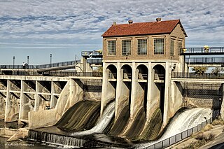
Lake Overholser is a reservoir within the city limits of Oklahoma City, Oklahoma. Lake Overholser is formed by Overholser Dam on the North Canadian River in Oklahoma County, Oklahoma. The lake is 2.9 miles (4.7 km) west of Bethany and 4.4 mi (7.1 km) from Yukon. Lake Overholser is named after Ed Overholser who was the 16th Mayor of the City of Oklahoma City.

Table Rock Lake is an artificial lake or reservoir in the Ozarks of southwestern Missouri and northwestern Arkansas in the United States. Designed, built and operated by the U.S. Army Corps of Engineers, the lake is impounded by Table Rock Dam, which was constructed from 1954 to 1958 on the White River.

Stevens Creek Reservoir is an artificial lake located in the foothills of the Santa Cruz Mountains near Cupertino, California. A 1,063-acre (430 ha) county park surrounds the reservoir and provides limited fishing, picnicking, hiking, and horseback riding activities. Although swimming is not allowed, non-power boating is allowed for certain parts of the year. No powered boats or jet skis are allowed. All vessels must be inspected for invasive Quagga mussels prior to launch.

Skiatook Lake is a federally-owned and operated reservoir located in Osage County, Oklahoma, 4 miles (6.4 km) west of the town of Skiatook, 11 miles (18 km) east of Hominy, Oklahoma and about 18 miles (29 km) from Tulsa. The Skiatook Dam is located on Hominy Creek, 14 miles (23 km) upstream of the confluence of Hominy and Bird Creeks. The project purposes include flood control, water quality, water supply, recreation, and fish and wildlife management. The cities of Skiatook, Sand Springs, Sapulpa, and Tulsa use Skiatook Lake as a municipal water supply. Gentle rolling hills of Blackjack and Post Oak interspersed with Tallgrass prairie surround the lake. The lake is under the management of the U.S. Army Corps of Engineers, Tulsa District.

Neversink Reservoir is a reservoir in the New York City water supply system. It is located in the Catskill Mountain town of Neversink in Sullivan County, New York, 75 miles (121 km) northwest of the City.

El Capitan Reservoir is a reservoir in central San Diego County, California. It is in the Cuyamaca Mountains, about 30 miles (48 km) northeast of the city of San Diego and two miles northwest of the town of Alpine.
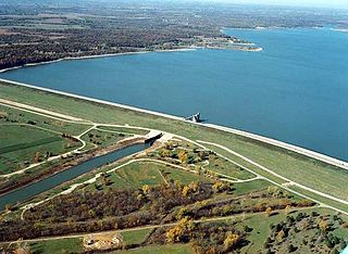
Perry Lake is a US Army Corps of Engineers operated reservoir in northeast Kansas. Its primary purposes are flood control, water reserve for nearby areas and regional recreation. The lake is approximately 11,150 acres (45 km2) in size, with over 160 miles (260 km) of shoreline. Perry Lake's full multi-purpose pool elevation is 891.5 feet (271.7 m) above sea level. Perry Lake is located about 40 miles (64 km) west of Kansas City, just northwest of Lawrence, Kansas. Its close proximity to Kansas City, Lawrence, and the state capitol, Topeka, make it a very popular destination, with the nickname "Paradise on the Plains".
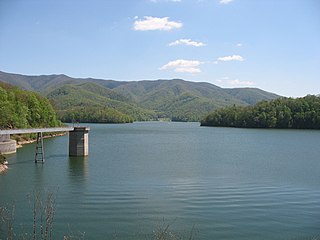
Watauga Lake, located east of Elizabethton, Tennessee, is the local name of the Watauga Reservoir created by the Tennessee Valley Authority (TVA) with the 1948 completion of the TVA Watauga Dam.
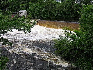
The Quinebaug River is a river in south-central Massachusetts and eastern Connecticut, with watershed extending into western Rhode Island. The name "Quinebaug" comes from the southern New England Native American term, spelled variously Qunnubbâgge, Quinibauge, etc., meaning "long pond", from qunni-, "long", and -paug, "pond". The river is one of the namesake rivers in the Quinebaug and Shetucket Rivers Valley National Heritage Corridor.

The San Pablo Reservoir is an open cut terminal water storage reservoir owned and operated by the East Bay Municipal Utility District (EBMUD). It is located in the valley of San Pablo Creek, north of Orinda, California, United States, and south of El Sobrante and Richmond, east of the Berkeley Hills between San Pablo Ridge and Sobrante Ridge.
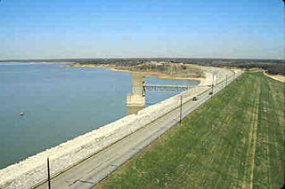
Grapevine Lake is a reservoir in North Texas about 20 mi (32 km) northwest of Dallas and northeast of Fort Worth. It was impounded in 1952 by the U.S. Army Corps of Engineers when they dammed Denton Creek, a tributary of Trinity River.

Hugo Lake is manmade lake located 7 miles (11 km) east of Hugo, in Choctaw County, Oklahoma, United States. It is formed by Hugo Lake Dam on the Kiamichi River 18 miles (29 km) upstream from the Red River. The dam is visible from U.S. Route 70, which crosses its spillway just west of Sawyer. Lake Hugo features approximately 110 miles (180 km) of shoreline and covers over 13,250 acres (53.6 km2), or 20 square miles (52 km2). Its normal pool elevation is 404.5 feet (123.3 m) above sea level and its normal storage capacity is 157,600 acre-feet (194,400,000 m3). At flood stage its elevation is at 437.5 feet (133.4 m) above sea level and it is capable of storing 966,700 acre-feet (1.1924×10⁹ m3) of flood waters. The lake's primary functions are to provide flood control, water storage, and recreational opportunities.
Clinch Mountain Wildlife Management Area is a 25,477-acre (103.10 km2) Wildlife Management Area (WMA) in Virginia. It is the second-largest WMA in the Commonwealth, covering portions of Smyth, Washington, Russell, and Tazewell counties.

Lake Hodges is a lake and reservoir located within the city limits of San Diego, California. It is about 31 miles (50 km) north of downtown San Diego, just north of the Rancho Bernardo community, and just south of the city's border with Escondido. When full, the reservoir has 1,234 acres (4.99 km2), a maximum water depth of 115 feet (35 m), and 27 miles (43 km) of shoreline. Lake Hodges has a total capacity of 30,251 acre-feet of water. Lake Hodges is owned by the city of San Diego, supplies water to the San Dieguito Water District and Santa Fe Irrigation District, and its mailing city address is Escondido.
Nanih Waiya Lake is a small recreational lake in Pushmataha County, Oklahoma. It is in the Ouachita Mountains, 1.5 miles (2.4 km) northeast of Tuskahoma, Oklahoma, and 16.3 miles (26.2 km) from Talihina, Oklahoma.

Okmulgee Park is a city park in Okmulgee, Oklahoma in the United States. The park contains 1,075 acres (435 ha) and sits at an elevation of 758 feet (231 m). The park is adjacent to Dripping Springs Park and is located on Okmulgee Lake. Okmulgee Park, a municipal park established in 1963, is open for year-round recreation including camping, fishing, swimming and hiking.
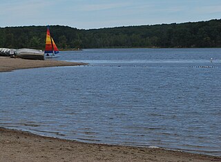
Deam Lake State Recreation Area is an Indiana State Recreation Area in Clark County, Indiana in the United States. The park is 1,300 acres (530 ha) and sits at an elevation of 535 feet (163 m). Deam Lake State Recreation area is open for year-round recreation, however the campground closes each year from the Sunday before Thanksgiving to March 1 of the following year. Much of the recreation is centered on Deam Lake. It is named for Charles C. Deam, the first state forester of Indiana.

Lake Yahola is a reservoir in Tulsa, Oklahoma. The reservoir was completed in 1924. Its primary purpose is to store raw water for treatment and distribution. This city-owned, 2-billion-US-gallon (7,600,000 m3), concrete-lined lake is an integral part of the Tulsa water supply, and receives water by pipeline from Lake Spavinaw. It is located in Mohawk Park, adjacent to the Mohawk Water Treatment Plant.


