Lake De Smet

Last updated
Lake De Smet
Lake de smet from Lower Piney Creek Road.jpg
View from Lower Piney Creek Road
USA Wyoming location map.svg
Red pog.svg
Lake De Smet
Location within Wyoming
Usa edcp relief location map.png
Red pog.svg
Lake De Smet
Lake De Smet (the United States)
Location Johnson County, Wyoming
Coordinates 44°27′58″N106°44′18″W / 44.4661701°N 106.7383183°W / 44.4661701; -106.7383183 Coordinates: 44°27′58″N106°44′18″W / 44.4661701°N 106.7383183°W / 44.4661701; -106.7383183 [1]
Surface elevation4,570 feet (1,390 m) [1]

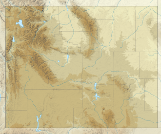
Lake De Smet is a lake located in Johnson County, Wyoming. It services Johnson County with water for industrial, agricultural, and municipal uses. With a maximum depth of 120 feet, and a capacity of 234,897 acre feet, Johnson County is responsible for 68.27% of its annual maintenance and operation costs, while the state of Wyoming covers the other 31.73%. [2]

First described by Pierre-Jean De Smet, a Jesuit priest, in a letter dated August 24, 1851, it was a highly saline lake capable of housing only limited aquatic life in its early years. Throughout its history, it changed hands multiple times, with its owners including Levi Leiter, Reynolds Mining, and Texaco. In 1865, the Powder River Expedition passed by the lake during its military operations against various Native American people, including the Lakota Sioux, the Cheyenne, and the Arapaho. The Lake Desmet Segment of the Bozeman Trail is located around a mile west to the lake.
Related Research Articles

<span class="mw-page-title-main">Natrona County, Wyoming</span> County in Wyoming, United States

Natrona County is a county in the U.S. state of Wyoming. As of the 2020 United States Census, the population was 79,955, making it the second-most populous county in Wyoming. Its county seat is Casper.

<span class="mw-page-title-main">De Smet, South Dakota</span> Town in South Dakota, United States

De Smet is a city in and the county seat of Kingsbury County, South Dakota, United States. The population was 1,089 at the 2010 census.

<span class="mw-page-title-main">North Platte River</span> River in the Western United States

The North Platte River is a major tributary of the Platte River and is approximately 716 miles (1,152 km) long, counting its many curves. In a straight line, it travels about 550 miles (890 km), along its course through the U.S. states of Colorado, Wyoming, and Nebraska.

<span class="mw-page-title-main">Green River (Colorado River tributary)</span> River in Wyoming, Utah, and Colorado, United States

The Green River, located in the western United States, is the chief tributary of the Colorado River. The watershed of the river, known as the Green River Basin, covers parts of the U.S. states of Wyoming, Utah, and Colorado. The Green River is 730 miles (1,170 km) long, beginning in the Wind River Mountains of Wyoming and flowing through Wyoming and Utah for most of its course, except for a short segment of 40 miles (64 km) in western Colorado. Much of the route traverses the arid Colorado Plateau, where the river has carved some of the most spectacular canyons in the United States. The Green is slightly smaller than Colorado when the two rivers merge but typically carries a larger load of silt. The average yearly mean flow of the river at Green River, Utah is 6,121 cubic feet (173.3 m3) per second.

<span class="mw-page-title-main">Independence Rock</span> United States historic place

Independence Rock is a large granite rock, approximately 130 feet (40 m) high, 1,900 feet (580 m) long, and 850 feet (260 m) wide, which is in southwestern Natrona County, Wyoming along Wyoming Highway 220. During the middle of the 19th century, it formed a prominent and well-known landmark on the Oregon, Mormon, and California emigrant trails. Many of these emigrants carved their names on it, and it was described by early missionary and explorer Father Pierre-Jean De Smet in 1840 as the Register of the Desert. The site was designated a National Historic Landmark on January 20, 1961 and is now part of Independence Rock State Historic Site, owned and operated by the state of Wyoming.

<span class="mw-page-title-main">Medicine Bow Mountains</span> Mountain range in the Western United States

The Medicine Bow Mountains are a mountain range in the Rocky Mountains that extend 100 miles (160 km) from northern Colorado into southern Wyoming. The northern extent of this range is the sub-range the Snowy Range. From the northern end of Colorado's Never Summer Mountains, the Medicine Bow mountains extend north from Cameron Pass along the border between Larimer and Jackson counties in Colorado and northward into south central Wyoming. In Wyoming, the range sits west of Laramie, in Albany and Carbon counties to the route of the Union Pacific Railroad and U.S. Interstate 80. The mountains often serve as a symbol for the city of Laramie. The range is home to Snowy Range Ski Area.

<span class="mw-page-title-main">Sacandaga River</span> River in New York, United States

The Sacandaga River is a 64-mile-long (103 km) river in the northern part of New York in the United States. Its name comes from the Native American Sa-chen-da'-ga, meaning "overflowed lands".

<span class="mw-page-title-main">Cloud Peak</span> Mountain in Wyoming, United States

Cloud Peak is the highest peak within the Bighorn Mountains in the U.S. state of Wyoming.

<span class="mw-page-title-main">Southwest Wyoming Regional Airport</span> Airport in Wyoming, United States

Southwest Wyoming Regional Airport is eight miles east of Rock Springs, in Sweetwater County, Wyoming, United States. It is operated by the Rock Springs-Sweetwater County Joint Powers Airport Board, with a total of five members, two appointed by the City of Rock Springs and three appointed by Sweetwater County. The airport has twice-daily United Express flights to Denver International Airport.

<span class="mw-page-title-main">Ashley National Forest</span> National Forest in Utah and Wyoming, United States

Ashley National Forest is a National Forest located in northeastern Utah and southwestern Wyoming. Within the Forest's bounds are 1,382,346 acres (5,594 km2) of vast forests, lakes, and mountains, with elevations ranging from 6,000 to 13,500 feet. The forest covers portions of Daggett, Duchesne, Summit, Uintah, and Utah counties in Utah and Sweetwater County in Wyoming. Some of the most popular landmarks located in the forest include the Flaming Gorge National Recreation Area and the Uinta Mountains, which contains the highest mountain peak in Utah. The forest also includes 276,175 acres (1,117.64 km2), or about 60.5%, of the High Uintas Wilderness. The headquarters for the Ashley National Forest are located in Vernal, Utah with ranger district offices in Vernal; Duchesne, Utah; Roosevelt, Utah; Manila, Utah; and Green River, Wyoming.

Saddlestring is an unincorporated community in northwestern Johnson County, Wyoming, United States, on the eastern edge of the Bighorn National Forest. It lies along local roads northwest of the city of Buffalo, the county seat of Johnson County. Its elevation is 5,440 feet (1,658 m). Saddlestring possessed its own post office from 1946 to 1965, and from 1967 to 1999; although the post office is now closed, Saddlestring retains its old ZIP Code of 82840. The post office building still exists; located on the HF Bar Ranch, it is a contributing property to a historic district located on the ranch. The oldest building in Saddlestring is the log barn, which is attached to the Rock Creek Rod and Gun Club home to Rock Creek Anglers a guide service, fly shop and bar.

Geneva is an unincorporated community in on the eastern edge of Bear Lake County, Idaho, United States, near the Wyoming border.

<span class="mw-page-title-main">Wind power in Wyoming</span> Electricity from wind in one U.S. state

Wyoming has one of the highest wind power potentials of any state in the United States. In 2019, Wyoming had wind powered electricity generating capacity of 1,589 MW, which produced 9.85% of its electric generation, with an additional 3,753 MW under construction. However, the wind generation in that year was Wyoming's third-lowest in the 2010s. By 2020, wind capacity increased to 2738 MW and 8448 gigawatt-hours of electricity were produced from wind in 2021, more than double 2019 production. Additional wind capacity and needed transmission lines are under construction or planned, despite political headwinds from Wyoming's strong coal and oil sectors.

<span class="mw-page-title-main">Shoshone Lake</span> Lake in Yellowstone National Park, Wyoming

Shoshone Lake is a U.S. backcountry lake with the area of 8,050 acres elevated at 7,795 feet (2,376 m) in the southwest section of Yellowstone National Park, Wyoming. It lies at the headwaters of the Lewis River a tributary of the Snake River. The U.S. Fish and Wildlife Service believes that Shoshone Lake is the largest backcountry lake in the lower 48 states that cannot be reached by a road. The Yellowstone Caldera is located within the lake.

<span class="mw-page-title-main">Sierra Madre Range (Wyoming)</span>

The Sierra Madre Range is a mountain range in the western United States, located in south-central Wyoming and north-central Colorado. Geologically, it may be considered an extension of the Park Range of Colorado. South of the Great Divide Basin, the US Continental Divide runs along the Sierre Madre high points. Its western basins drain into the Colorado River and its eastern into the North Platte River. Buck Mountain is the highest peak in the range and lies within Colorado. Bridger Peak is its highest elevation on the Wyoming side of the range.

<span class="mw-page-title-main">Missouri Buttes</span>

Missouri Buttes are located in Crook County in northeast Wyoming on the northwest flank of the Black Hills Uplift. The buttes are 3.5 miles (5.6 km) northwest (N60°W) of Devils Tower between the Little Missouri and the Belle Fourche rivers.

<span class="mw-page-title-main">Pierre-Jean De Smet</span> Jesuit priest

Pierre-Jean De Smet, SJ, also known as Pieter-Jan De Smet, was a Flemish Catholic priest and member of the Society of Jesus (Jesuits). He is known primarily for his widespread missionary work in the mid-19th century among the Native American peoples, in the midwestern and northwestern United States and western Canada.

<span class="mw-page-title-main">Humpy Peak</span>

Humpy Peak is a peak located in the Uinta Mountain Range in northern Utah. It is approximately 27.56 miles (44 km) south of Evanston, Wyoming and 21.29 miles (34 km) east of Coalville, Utah. The summit has an elevation of 10,875 feet (3,315 m).

<span class="mw-page-title-main">Lake Desmet Segment, Bozeman Trail</span> United States historic place

The Lake Desmet Segment is a one-mile long set of trail ruts that are a well-preserved portion of the Bozeman Trail in Johnson County, Wyoming. The ruts are located about a mile west of Lake Desmet on the down slope of the hill overlooking the lake. This portion of the trail is on private property, so permission is required to visit.

References

  1. 1 2 "Lake De Smet". Geographic Names Information System . United States Geological Survey, United States Department of the Interior . Retrieved July 19, 2022.
  2. "Lake DeSmet Operating Department". Johnson County, Wy. Retrieved 2023-01-21.