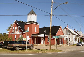
Renfrew County is a county in the Canadian province of Ontario. It straddles the west bank of the Ottawa River. There are 17 municipalities in the county.

The Petawawa River is a river in the Saint Lawrence River drainage basin in Nipissing District and Renfrew County in eastern and northeastern Ontario, Canada. The river flows from Algonquin Provincial Park to the Ottawa River at the town of Petawawa, and is only one of two major tributaries of the Ottawa River to flow completely freely. The river's name comes from the Algonquian for "where one hears a noise like this", which refers to its many rapids.

The Bonnechere River is a river in the Saint Lawrence River drainage basin in Nipissing District and Renfrew County in eastern and northeastern Ontario, Canada. The river flows from Algonquin Provincial Park to the Ottawa River east and north of the town of Renfrew. The river's name is thought to come from the French "bonne chère" meaning "plentiful good food".

The Barron River is a river in the Saint Lawrence River drainage basin in Nipissing District and Renfrew County, Ontario, Canada. It flows from Clemow Lake in northern Algonquin Provincial Park and joins the Petawawa River, whose southern branch it forms, in the municipality of Laurentian Hills, near the municipality of Petawawa.
The Snake River is a river in Renfrew County, Ontario, Canada.

Golden Lake is a body of water located in Renfrew County Ontario, located on the Bonnechere River approximately 25 km southwest of Pembroke, Ontario. It is bounded by the Township of North Algona-Wilberforce, the Township of Bonnechere Valley and Algonquins of Pikwàkanagàn First Nation.
King's Highway 41, commonly referred to as Highway 41, is a provincially maintained highway in the Canadian province of Ontario. The 159.6-kilometre (99.2 mi) highway travels in a predominantly north–south direction across eastern Ontario, from Highway 7 in Kaladar to Highway 148 in Pembroke. The majority of this distance crosses through a rugged forested region known as Mazinaw Country. However, the route enters the agricultural Ottawa Valley near Dacre. A significant portion of Highway 41 follows the historic Addington Colonization Road, built in 1854.

North Algona Wilberforce is a township municipality in Renfrew County, Ontario, Canada. It has a population of 3,111. The township was formed in 1999 when the North Algona and Wilberforce townships were amalgamated.

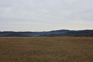
The Opeongo Hills are a range of hills in Southern Ontario, near Algonquin Provincial Park. The hills stretch from Opeongo Lake in Algonquin Park in the west, along the Madawaska and Opeongo Rivers, towards the Opeongo Colonization Road, and extending towards the Deacon Escarpment, Bonnechere, Ontario, and Dacre in the east. To the east of the Opeongo Hills lie the Madawaska River valley, the Mississippi River Valley, and the Ottawa-Bonnechere Graben along the Ottawa River. Its tallest peak is roughly 7 km northeast of Highway 60. At roughly 586 meters, it is the tallest point in Southern Ontario. The community of Foymount is one of the highest settlements in Southern Ontario.

Rib Lake is a long and narrow lake in the Town of Latchford and in the Municipality of Temagami in Northeastern Ontario, Canada, located about 9 kilometres (6 mi) southeast of the centre of the community of Latchford and 9 kilometres (6 mi) northeast of the community of Temagami North. The lake is in the Ottawa River drainage basin and is the main access for canoeists en route to Rib Mountain.
Kamaniskeg Lake is a lake in the municipalities of Hastings Highlands, Hastings County, and Madawaska Valley, Renfrew County, in Southern Ontario, Canada. It is part of the Ottawa River drainage basin and is located in the Madawaska River Valley, with nearby communities of Barry's Bay and Combermere. The lake is known for its simple beauty, with a mixture of forest, and rock and sand beaches.
Snowshoe Lake is a lake in the Madawaska River drainage basin in South Algonquin, Nipissing District, about 11.5 kilometres (7.1 mi) southeast of the community of Madawaska, and Madawaska Valley, Renfrew County, about 16 kilometres (10 mi) southwest of the community of Barry's Bay, in the province Ontario, Canada. It is about 650 metres (2,133 ft) long and 330 metres (1,083 ft) wide, and lies at an elevation of 334 metres (1,096 ft). The primary outflow is an unnamed creek to Sand Bay on the west side of Bark Lake on the Madawaska River, which flows into the Ottawa River. Only a small sliver of the lake at the northwest tip lies in South Algonquin, Nipissing District.
Partridge Creek is a creek in the Moira River and Lake Ontario drainage basins in Hastings and Lennox and Addington Counties, Ontario, Canada.
Rainy Lake is a small lake in the Ottawa River and St. Lawrence River drainage basins in Addington Highlands, Lennox and Addington County, Ontario, Canada.
Crawford Lake is a lake in geographic Haultain Township in the Montreal River and Ottawa River drainage basins in Timiskaming District, Ontario, Canada. It is about 0.63 kilometres (0.4 mi) long and 0.2 kilometres (0.1 mi) wide, and lies at an elevation of 348 metres (1,142 ft) about 8 kilometres (5 mi) northeast of the community of Gowganda. A short unnamed creek flows in at the north. The primary outflow, at the south, is an unnamed creek towards Lost Lake, which flows via Calcite Creek, Sydney Creek and the Montreal River to Lake Timiskaming on the Ottawa River.
Daisy Lake is a lake in the geographic townships of Butt and McCraney in the Unorganized South Part of Nipissing District, Ontario, Canada. The lake is in the Ottawa River drainage basin and is entirely within Algonquin Provincial Park.
Peterson Creek is a river in the Ottawa River drainage basin in Lanark Highlands, Lanark County and North Frontenac, Frontenac County in eastern Ontario, Canada. It flows 9.5 kilometres (5.9 mi) from and unnamed lake to its mouth at the South Branch Clyde River.
Brule Lake is a lake in North Frontenac, Frontenac County in Eastern Ontario, Canada, located near the community of Plevna. It is part of the Saint Lawrence River drainage basin, and is in geographic Miller Township.
Bobs Lake is a lake in Frontenac County and Lanark County in Eastern Ontario, Canada. It is in the St. Lawrence River drainage basin and is the source of the Tay River.
Meyers Lake is a lake in Cochrane District and Timiskaming District, in northeastern Ontario, Canada. The lake is in the James Bay drainage basin and the nearest community is Bourkes, 4.6 kilometres (2.9 mi) to the northeast.


