
Oregon City is the county seat of Clackamas County, Oregon, United States, located on the Willamette River near the southern limits of the Portland metropolitan area. Established in 1829 by the Hudson's Bay Company, in 1844 it became the first U.S. city west of the Rocky Mountains to be incorporated.

Clackamas County is a county in the U.S. state of Oregon. As of the 2010 United States Census, the population was 375,992, making it Oregon's third-most populous county. Its county seat is Oregon City. The county was named after the Native Americans living in the area, the Clackamas Indians, who are part of the Chinookan people.

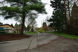
Oak Grove is an unincorporated community in Clackamas County, Oregon, United States, in the Portland metropolitan area. For statistical purposes, the United States Census Bureau has defined Oak Grove as a census-designated place (CDP). The census definition of the area may not precisely correspond to local understanding of the area with the same name. The population was 16,629 at the 2010 census.

The Clackamas River is an approximately 83-mile (134 km) tributary of the Willamette River in northwestern Oregon, in the United States. Draining an area of about 940 square miles (2,435 km2), the Clackamas flows through mostly forested and rugged mountainous terrain in its upper reaches, and passes agricultural and urban areas in its lower third. The river rises in eastern Marion County, about 55 miles (89 km) east-southeast of Salem. The headwaters are on the slopes of Olallie Butte in the Mount Hood National Forest, about 10 miles (16 km) north of Mount Jefferson, at an elevation of 4,909 feet (1,496 m) in the Cascade Range. The Clackamas flows briefly north and then flows northwest through the mountains, passing through North Fork Reservoir and Estacada. It then emerges from the mountains southeast of Portland. It joins the Willamette near Oregon City and forms the boundary between Oregon City and Gladstone.

The Mount Hood National Forest is 62 miles (100 km) east of the city of Portland, Oregon, and the northern Willamette River valley. The Forest extends south from the Columbia River Gorge across more than 60 miles (97 km) of forested mountains, lakes and streams to the Olallie Scenic Area, a high lake basin under the slopes of Mount Jefferson. The Forest includes and is named after Mount Hood, a stratovolcano. The Forest encompasses some 1,067,043 acres (4,318.17 km2). Forest headquarters are located in Sandy, Oregon. A 1993 Forest Service study estimated that the extent of old growth in the Forest was 345,300 acres (139,700 ha). The Forest is divided into four separate districts - Barlow, Clackamas River (Estacada), Hood River, and Zigzag (Zigzag).

Timothy Lake is a lake about 50 miles (80 km) southeast of Portland, Oregon, United States. It is in proximity to Clear Lake and an impoundment of the Oak Grove Fork Clackamas River.

Marylhurst, Oregon is an unincorporated community in Clackamas County, Oregon, United States. It is located approximately eight miles south of Portland, between Lake Oswego and West Linn on Oregon Route 43 near the Willamette River. Marylhurst was the home of Marylhurst University.
The Oak Grove Hydroelectric Project is a 44 megawatt hydroelectric plant operated by Portland General Electric (PGE) on the Oak Grove Fork Clackamas River. Water for this project is held by three lakes, built between 1923 and 1956. The dam creates the impoundment Lake Harriet.

Oak Grove Fork Clackamas River is a 21-mile (34 km) tributary of the Clackamas River in the U.S. state of Oregon. From its headwaters in the Warm Springs Indian Reservation near Abbot Pass in the Cascade Range, the river flows generally west through Mount Hood National Forest in Clackamas County to the unincorporated community of Ripplebrook. Here it enters the main stem of the Clackamas River. Oak Grove Fork feeds Timothy Lake and Lake Harriet, two artificial impoundments built along its course to control water flows to hydroelectric plants.

Mirror Lake is a mountain lake in Clackamas County of the U.S. state of Oregon. It is located at the foot of Tom Dick and Harry Mountain in a natural catchment formed by a toe of the mountain, 11.4 kilometres (7.1 mi) southwest of Mount Hood, and 3.1 kilometres (1.9 mi) WSW of Government Camp within Mount Hood National Forest.

The Clackamas Lake Ranger Station Historic District is a Forest Service compound consisting of eleven historic buildings located in the Mount Hood National Forest in the Cascade Mountains of northern Oregon. It was originally built as a district ranger station for the Clackamas Lake Ranger District. It was later converted to a summer guard station. Today, the Forest Service rents the historic ranger's residence to recreational visitors. The Clackamas Lake Ranger Station is listed as a historic district on the National Register of Historic Places.
Libraries in Clackamas County (LINCC) is a consortium of the public libraries of Clackamas County, Oregon. It was established in 1977 when the first county-wide funding levy was approved by county voters. LINCC is a resource and revenue sharing network with a single library computer system.
Roaring River Wilderness is a wilderness area in the Mount Hood National Forest in Clackamas County, Oregon, United States. Southwest of Mount Hood, Oregon's tallest mountain, the 36,500-acre (14,800 ha) area was created in 2009. The wilderness area is named after the Roaring River that flows through the area and is a tributary of the Clackamas River.
Shadowood is an unincorporated community in Clackamas County, Oregon, United States, about four miles south of Lake Oswego on the Tualatin River east of Shipley Bridge. Its elevation is 190 feet. Shadowood has a West Linn ZIP code.
Ripplebrook is an unincorporated community in Clackamas County, Oregon, United States. It is located at the eastern terminus of Oregon Route 224, at an intersection with forest highways 46 and 57, in the Mount Hood National Forest. It is near the confluence of the Clackamas River with the Oak Grove Fork Clackamas River, and is the only community on the route between Estacada and Detroit. Ripplebrook Ranger Station is located there. Bathrooms and information are available, but no other services.

The Clackamas Wilderness is a wilderness area located in the Mount Hood National Forest in the northwestern Cascades of Oregon, United States. Created by the Omnibus Public Land Management Act of 2009, it consists of 9,470 acres (3,830 ha). The wilderness is made up of five different tracts of lands with no roads on a 50-mile (80 km) stretch on both sides of the Clackamas River. These areas include Big Bottom, Memaloose Lake, Clackamas Canyon, Sisi Butte and South Fork Clackamas. It has some of the biggest trees in northwest Oregon. Memaloose Lake is a very popular hiking trail that leads through a forest to the lake, and then continues a mile up to a viewpoint on to up South Fork Mountain.

At the outbreak of the American Civil War in 1861, regular U.S. Army troops in the District of Oregon were withdrawn from posts in Oregon and Washington Territory and sent east. Volunteer cavalry and infantry were recruited in California and sent north to Oregon to replace the Federal troops and keep the peace and protect the populace. Oregon also raised the 1st Oregon Cavalry that was activated in 1862 and served until June 1865. During the Civil War, emigrants to the newfound gold fields in Idaho and Oregon continued to clash with the Paiute, Shoshone and Bannock tribes of Oregon, Idaho and Nevada until relations degenerated into the bloody 1864 - 1868 Snake War. The 1st Oregon Volunteer Infantry Regiment was formed in 1864 and its last company was mustered out of service in July 1867. Both units were used to guard travel routes and Indian reservations, escort emigrant wagon trains, and protect settlers from Indian raiders. Several infantry detachments also accompanied survey parties and built roads in central and southern Oregon.
An education service district (ESD) is a regional education unit in the U.S. state of Oregon. ESDs work to provide the various counties' school districts with a wide array of educational programs and services, many of which are too costly or limited in demand for a single location. By coordinating a program or service among multiple districts, Oregon ESDs are able to moderate costs.
Ann Lininger is a judge on the circuit court in Clackamas County in the U.S. state of Oregon. Prior to being appointed as judge, she served as a Democratic state representative representing District 38, which includes most of Lake Oswego and portions of southwestern Portland.
Clackamas Education Service District is an education service district that coordinates school events and activities throughout the school districts in Clackamas County, Oregon. Clackamas ESD serves the educational needs of students and families in Clackamas County – a geographic area of 1,879 square miles.

