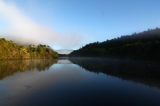
The River Derwent is a river located in Tasmania, Australia. It is also known by the palawa kani name timtumili minanya. The river rises in the state's Central Highlands at Lake St Clair, and descends more than 700 metres (2,300 ft) over a distance of more than 200 kilometres (120 mi), flowing through Hobart, the state's capital city, before emptying into Storm Bay and flowing into the Tasman Sea. The banks of the Derwent were once covered by forests and occupied by Tasmanian Aborigines. European settlers farmed the area and during the 20th century many dams were built on its tributaries for the generation of hydro-electricity.

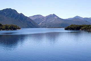
Lake Pedder, once a glacial outwash lake, is a man-made impoundment and diversion lake located in the southwest of Tasmania, Australia. In addition to its natural catchment from the Frankland Range, the lake is formed by the 1972 damming of the Serpentine and Huon rivers by the Hydro Electric Commission of Tasmania for the purposes of hydroelectric power generation.

Lake Gordon is a man-made reservoir created by the Gordon Dam, located on the upper reaches of the Gordon River in the south-west region of Tasmania, Australia.

The Gordon River is a major perennial river located in the central highlands, south-west, and western regions of Tasmania, Australia.

The Pieman River is a major perennial river located in the west coast region of Tasmania, Australia.

Castaic Dam is an embankment dam in northwestern Los Angeles County, California, in the unincorporated area of Castaic. Although located on Castaic Creek, a major tributary of the Santa Clara River, Castaic Creek provides little of its water. The lake is the terminus of the West Branch of the California Aqueduct, part of the State Water Project. The dam was built by the California Department of Water Resources and construction was completed in 1973. The lake has a capacity of 325,000 acre feet (401,000,000 m3) and stores drinking water for the western portion of the Greater Los Angeles Area.

Lake Burbury is a man-made water reservoir created by the Crotty Dam inundating the upper King River valley that lies east of the West Coast Range. Discharge from the reservoir feeds the John Butters Hydroelectric Power Station, owned and operated by Hydro Tasmania.

The Crotty Dam, also known during construction as the King Dam, or the King River Dam on initial approval, is a rockfill embankment dam with a controlled and uncontrolled spillway across the King River, between Mount Jukes and Mount Huxley, located in Western Tasmania, Australia.
The Central Highlands is a region in Tasmania, Australia where geographical and administrative boundaries closely coincide. It is also known as The Lake Country of Tasmania.

Crystal Springs Reservoir is a pair of artificial lakes located in the northern Santa Cruz Mountains of San Mateo County, California situated in the rift valley created by the San Andreas Fault just to the west of the cities of San Mateo and Hillsborough, and I-280. The lakes are part of the San Mateo Creek watershed.

The Butlers Gorge Power Station is a conventional hydroelectric power station located in the Central Highlands region of Tasmania, Australia.

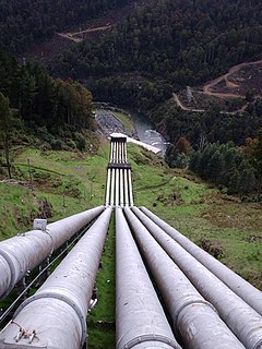
The Tarraleah Power Station is a hydroelectric power station located in the Central Highlands region of Tasmania, Australia. The power station is part of the Upper Derwent hydro scheme and is operated by Hydro Tasmania.

The Catagunya Power Station is a run-of-the-river hydroelectric power station located in the Central Highlands region of Tasmania, Australia. The power station is situated on the Lower River Derwent catchment and is owned and operated by Hydro Tasmania.

The Liapootah Power Station is a run-of-the-river hydroelectric power station located in the Central Highlands region of Tasmania, Australia. The power station is situated on the Lower River Derwent catchment and is owned and operated by Hydro Tasmania.

The Repulse Power Station is a conventional hydroelectric power station located in the Central Highlands region of Tasmania, Australia. The power station is situated on the Lower River Derwent catchment and is owned and operated by Hydro Tasmania.

The Tungatinah Power Station is a conventional hydroelectric power station located in the Central Highlands region of Tasmania, Australia. The power station is situated on the Upper River Derwent catchment and is owned and operated by Hydro Tasmania.

The Lake Echo Power Station is a conventional hydroelectric power station located in the Central Highlands region of Tasmania, Australia. The power station is situated on the Upper River Derwent catchment and is owned and operated by Hydro Tasmania.

Tarraleah is a rural locality in the local government area (LGA) of Central Highlands in the Central LGA region of Tasmania. The locality is about 53 kilometres (33 mi) north-west of the town of Hamilton. The 2016 census has a population of nil for the state suburb of Tarraleah.

The Scotts Peak Dam is a rockfill embankment dam without a spillway across the Huon River, located in the South West region of Tasmania, Australia.

The Nieterana Power Station is a small hydroelectric power station located in the Central Highlands region of Tasmania, Australia.


