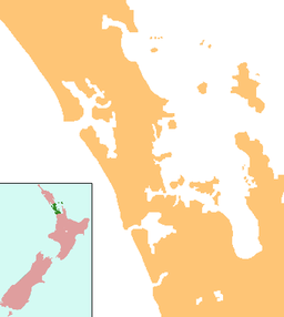
The Kaipara District is located in the Northland Region in northern New Zealand.

Kaipara Harbour is a large enclosed harbour estuary complex on the north western side of the North Island of New Zealand. The northern part of the harbour is administered by the Kaipara District and the southern part is administered by the Auckland Council. The local Māori tribe is Ngāti Whātua.

The Northland Peninsula, called the North Auckland Peninsula in earlier times, is in the far north of the North Island of New Zealand. It is joined to the rest of the island by the Auckland isthmus, a narrow piece of land between the Waitematā Harbour and the Manukau Harbour in the middle of the Auckland metropolitan area. The peninsula is not conterminous with the local government area of Northland Region, which occupies the northern 80% of the peninsula. The southern section of the peninsula is administratively part of the Auckland Region.

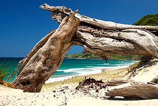
Muriwai, also called Muriwai Beach, is a coastal community on the west coast of the Auckland Region in the North Island of New Zealand. The black-sand surf beach and surrounding area is a popular recreational area for Aucklanders. The Muriwai Regional Park includes a nesting site for a large colony of gannets.
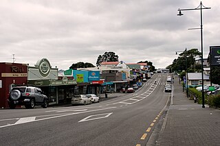
Helensville is a town in the North Island of New Zealand. It is sited 40 kilometres northwest of Auckland, close to the southern extremity of the Kaipara Harbour. State Highway 16 passes through the town, connecting it to Waimauku 16 km to the south, and Kaukapakapa about 12 km to the north-east. Parakai is 2 km to the north-west.

Wellsford is a town on the Northland Peninsula in the northern North Island of New Zealand. It is the northernmost major settlement in the Auckland Region, and is 77 kilometres northwest of the Auckland CBD.
The Kumeu-Riverhead section was a short-lived railway line north-west of Auckland, New Zealand. It was built as part of the Kaipara-Riverhead Railway, which was isolated from the national railway network until 1881, just before closure of this section.

Kaukapakapa is a town in the North Island of New Zealand. It is situated in the Rodney ward of the Auckland Region and is around 50 kilometres northwest of Auckland city. State Highway 16 passes through the town, connecting it to Helensville about 12 km to the south-west, and Araparera about 14 km to the north. The North Auckland Line also passes through Kaukapakapa. The Kaukapakapa River flows from the town to the Kaipara Harbour to the west.
Pakiri is a locality in Auckland, in the former Rodney District of New Zealand. Leigh is about 9 kilometres (6 mi) to the south-east. The Pakiri River flows through the area and into the Hauraki Gulf to the north-east.

The Pouto Peninsula is a landform on the northern Kaipara Harbour in Northland, New Zealand. The Peninsula runs in the north west to south east direction and is approximately 55 km long. The width varies from about 5.4 km to about 14 km, with the widest part of the peninsula near its southern end. The Tasman Sea is to the west, and the Kaipara Harbour is to the south. The Wairoa River and Kaipara Harbour are to the east. Dargaville and State Highway 12 lie directly to the north east of the peninsula. The mouth of the Kaipara Harbour separates the peninsula from the smaller Te Korowai-o-Te-Tonga Peninsula to the south.

Kaipara Flats is a locality in the Rodney District of New Zealand. Warkworth is 12 km to the east, Ahuroa to the south, and Tauhoa to the north-west. The North Auckland railway line passes through the area.

Waioneke is a locality on the Te Korowai-o-Te-Tonga Peninsula of the Kaipara Harbour, in the Rodney District of New Zealand. Parakai is 22 km to the south-east, and the road continues another 14 km to the north-west. Rangitira Beach and Woodhill Forest are to the west, and Omokoiti Flats and the southern Kaipara Harbour are to the east.

New Zealand has large ocean energy resources but does not yet generate any power from them. TVNZ reported in 2007 that over 20 wave and tidal power projects are currently under development. However, not a lot of public information is available about these projects. The Aotearoa Wave and Tidal Energy Association was established in 2006 to "promote the uptake of marine energy in New Zealand". According to their 10 February 2008 newsletter, they have 59 members. However, the association doesn't list its members.
The Topuni River is a river of the Northland Region of New Zealand's North Island. It flows generally south, with most of its length being through a drowned valley in the northeast of the Kaipara Harbour system. The Topuni River reaches the Oruawharo River — an arm of the Kaipara — 10 kilometres northwest of Wellsford.
The Auckland Region of New Zealand is built on a basement of greywacke rocks that form many of the islands in the Hauraki Gulf, the Hunua Ranges, and land south of Port Waikato. The Waitākere Ranges in the west are the remains of a large andesitic volcano, and Great Barrier Island was formed by the northern end of the Coromandel Volcanic Zone. The Auckland isthmus and North Shore are composed of Waitemata sandstone and mudstone, and portions of the Northland Allochthon extend as far south as Albany. Little Barrier Island was formed by a relatively isolated andesitic volcano, active around 1 to 3 million years ago.

Lake Rototoa is located at the northern end of the south head of the Kaipara Harbour in the Rodney ward of the Auckland Region, New Zealand. With a surface area of 1.39 km2 and a maximum depth of 26 m, it is the largest and deepest of a series of sand-dune lakes found along the western coastline of the North Island.

Lake Kereta lies at the South Head peninsula of the Kaipara Harbour, in the Rodney District, along the west coast of the North Island of New Zealand. The surface area of the lake is about 32 hectares with a maximum depth of 1.5 metres and water temperature of about 21.1 °C (70.0 °F).
The Kaipara tidal power station is a proposed tidal power project to be located in the Kaipara Harbour. The project is being developed by Crest Energy, with an ultimate size of 200MW at a cost of $600 million.

Te Korowai-o-Te-Tonga Peninsula, also known as South Head and by its former name of the South Kaipara Peninsula, is a long peninsula in the North Island of New Zealand, extending north along the western edge of the Kaipara Harbour for some 35 kilometres (22 mi) from near Helensville to the harbour's mouth. The peninsula was officially renamed in 2013 as part of a Treaty of Waitangi settlement. The name, which is Māori for "The cloak of the south", reflects the peninsula's geographical role in guarding the southern half of the Kaipara Harbour from the Tasman Sea and prevailing westerly winds. The mouth of the Kaipara Harbour separates the peninsula from the larger Pouto Peninsula to the north.

Ātiu Creek Regional Park is a regional park located south of Oruawharo River in the Kaipara Harbour in New Zealand's North Island. It is located west of Wellsford and east of Tapora on the Okahukura Peninsula, in Rodney in the Auckland Region and is run by Auckland Council.