
Waikato is a region of the upper North Island of New Zealand. It covers the Waikato District, Waipa District, Matamata-Piako District, South Waikato District and Hamilton City, as well as Hauraki, Coromandel Peninsula, the northern King Country, much of the Taupō District, and parts of the Rotorua Lakes District. It is governed by the Waikato Regional Council.
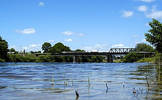
Ngāruawāhia is a town in the Waikato region of the North Island of New Zealand. It is located 20 kilometres (12 mi) north-west of Hamilton at the confluence of the Waikato and Waipā Rivers, adjacent to the Hakarimata Range. Ngāruawāhia is in the Hamilton Urban Area, the fourth largest urban area in New Zealand. The location was once considered as a potential capital of New Zealand.

Te Awamutu is a town in the Waikato region in the North Island of New Zealand. It is the council seat of the Waipa District and serves as a service town for the farming communities which surround it. Te Awamutu is located some 30 kilometres (19 mi) south of Hamilton on State Highway 3, one of the two main routes south from Auckland and Hamilton.

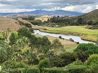
The Waipā River is in the Waikato region of the North Island of New Zealand. The headwaters are in the Rangitoto Range east of Te Kūiti. It flows north for 115 kilometres (71 mi), passing through Ōtorohanga and Pirongia, before flowing into the Waikato River at Ngāruawāhia. It is the Waikato's largest tributary. The Waipā's main tributary is the Puniu River.

Waipa District is a municipality in the Waikato region of New Zealand that is administered by the Waipa District Council. Its most populous town is Cambridge. The seat of the council is at the second most populous town, Te Awamutu. The district is south and south-east of the city of Hamilton. It has five wards: Te Awamutu, Cambridge, Pirongia, Maungatautari and Kakepuku.

Paterangi is a settlement in the Waikato region of New Zealand's North Island. It is located 10 km northwest of Te Awamutu. It is close to the site of one of the most strongly fortified pā built during the New Zealand wars of the late 19th century.
The Ōpārau River is a river of the Waikato Region of New Zealand's North Island in the area occupied by Ngāti Hikairo. It flows southwest from its sources in the Pirongia Forest Park, the highest being The Cone, and flows into the Kawhia Harbour, 5 kilometres (3 mi) east of Kawhia. The river has about 171 km (106 mi) of tributaries.
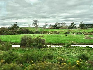
The Puniu River is a river of the Waikato region of New Zealand's North Island. As a tributary of the Waipā River, and at a length of 57 kilometres (35 mi), it is one of the longest secondary tributaries in New Zealand.

Te Pahu is a rural community in the Waipa District and Waikato region of New Zealand's North Island, located just north of Cambridge across State Highway 1.

Te Mawhai railway station was a flag station on the North Island Main Trunk in New Zealand. Its primary traffic was supplies to the nearby Tokanui Psychiatric Hospital. The hospital was situated to be convenient for freight and passengers by rail and a light railway connection to the hospital was considered.

Ngaroto railway station was a station on the North Island Main Trunk in New Zealand, 3.42 km (2.13 mi) south of Lake Rd, 2 mi (3.2 km) north of Te Awamutu, beside the entrance to Yarndley's Bush. Lake Ngaroto is visible from the railway to the north of the station.

Lake Road railway station was a flag station in the Waikato Region and on the North Island Main Trunk in New Zealand.

State Highway 31 (SH 31) is a New Zealand state highway in the Waikato region. It provides a link to the harbour town of Kawhia on the west coast of the North Island.
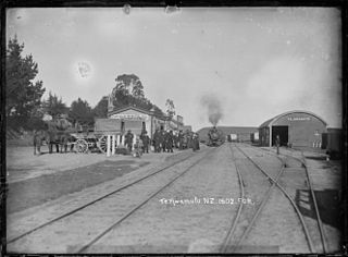
Te Awamutu was a temporary terminus, serving the border town of Te Awamutu, on the North Island Main Trunk (NIMT) in New Zealand from 1880, when the line was extended from Ōhaupō, until 1887, when the line was extended south to Ōtorohanga.

Rangiaowhia was, for over 20 years, a thriving village on a ridge between two streams in the Waikato region, about 4 km (2.5 mi) east of Te Awamutu. From 1841 it was the site of a very productive Māori mission station until the Invasion of the Waikato in 1864. The station served Ngāti Hinetu and Ngāti Apakura. Only a church remains from those days, the second oldest Waikato building.
Horotiu is a small township on the west bank of the Waikato River in the Waikato District of New Zealand. It is on the Waikato Plains 13 km (8.1 mi) north of Hamilton and 5 km (3.1 mi) south of Ngāruawāhia. From early in the 20th century it developed around a freezing works and other industries.
Lake Whangape is shallow, supertrophic, lateral and the second largest lake in the lower Waikato River basin in New Zealand. One source said the name translated to 'a large sheet of water', another that it was a chief's name.
Lake Opuatia is a small lake in the much larger Opuatia wetland, which drains from the west into the Waikato River. It lies near the foot of a long valley drained by the Opuatia Stream.

Whitikahu is a settlement scattered along Whitikahu Rd in the Waikato District and Waikato region of New Zealand's North Island.

Te Rore was in the 1850s an important transhipment point on New Zealand's Waipā River, between the agriculture of the Waikato basin and its Auckland market. That was ended in 1864 by the Invasion of the Waikato, when Te Rore was, for a few months, part of the supply route to four redoubts set up nearby. It is now a rural community in the Waipa District, 6 km (3.7 mi) north of Pirongia and roughly the same distance south of Ngāhinapōuri on State Highway 39.


